|
|
|
|
|
|
|
|
|
|
Climbing Volcanoes in Guatemala
Photos from a trip from Nov. 26 to Dec. 13, 2016
|
|
| This trip was organized by KE Adventure Company based in Keswick, England. The local guide in Antigua was Old Town Outfitters. The trip was run very well and we enjoyed great food both in restaurants and during the four nights we were camping on the various volcanoes. I can give a strong recommendation to both companies. Here is some website information: www.keadventures.com Our trip was called Guatemala's Magnificent Seven. Holiday Code: GVO
Old Town Outfitters is at: www.adventureguatemala.com Tele: 502-5819-1757 They are based in Antigua.
A special thank you goes to our guides: Wilbur, Emmy and Pepian. They are the greatest!
|
|
 |
|
 |
|
|
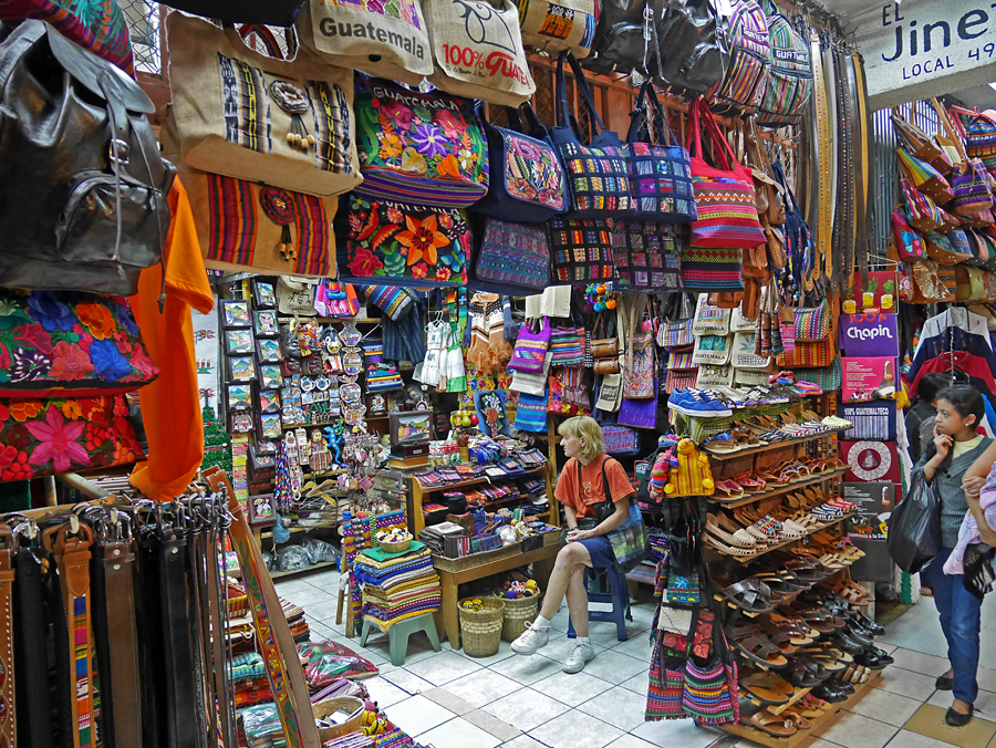
If you have a day or two in Guatemala City I suggest going to the market and bazaar about two blocks east of the main plaza in Zone 1. Every imaginable handicraft is available. |
|
|
|
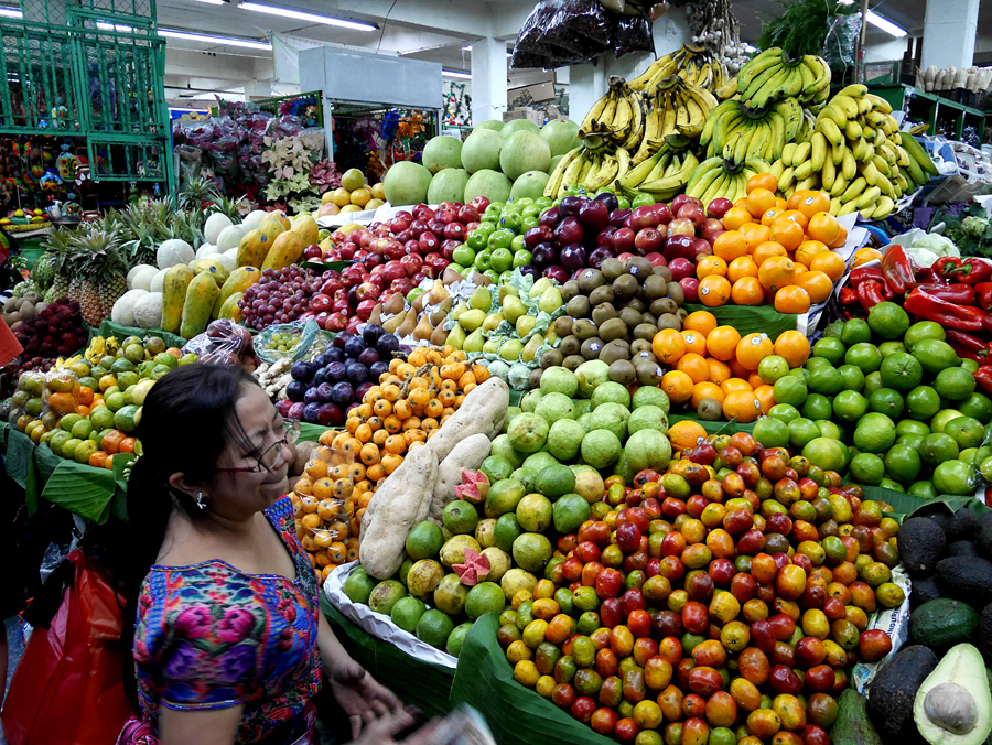
Abundant fruits and vegetables in one area of the market. Avocados are cheap and very good. |
|
|
 |
|
 |
|
|
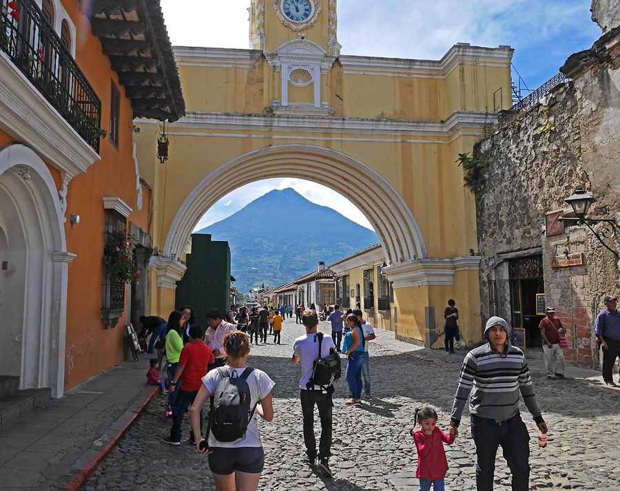
The old archway north of the central plaza in Antigua. It is often featured in postcards. Volcan de Agua in back looms over the town. |
|
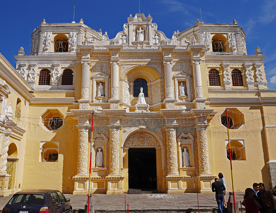
The church and convent called Santa Catalina also in Antigua. |
|
 |
|
|
 |
|
|
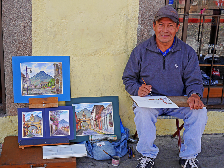
Local artist Victor Arias sells his paintings near the archway. He does really fine work and I bought two of his paintings. |
|
|
 |
|
|
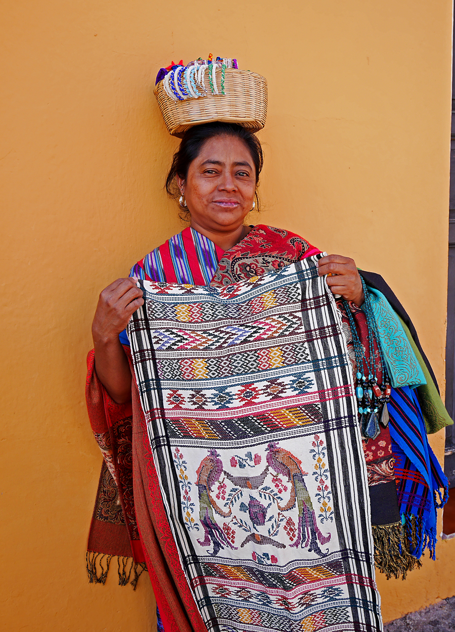
A woman selling scarfs also near the archway. |
|
|
| You never know what event you will see in Antigua. This is a video of a nighttime foot race along 4th Ave. South on Nov. 25, 2016. YouTube Video, Night Foot Race |
|
 |
|
|
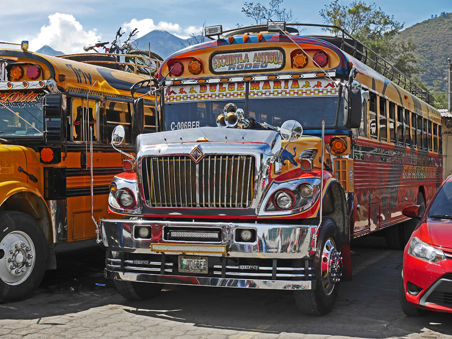
Buses in my home of San Diego are boring compared to this city bus in Antigua. |
|
|
 |
|
|
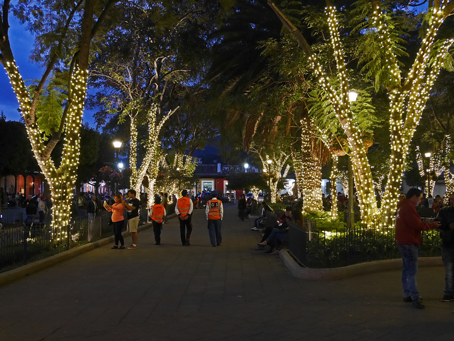
The central plaza in Antigua is especially pretty at night. |
|
|
 |
|
|
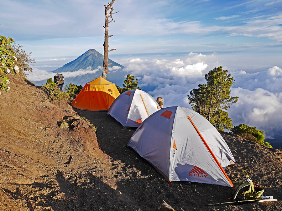
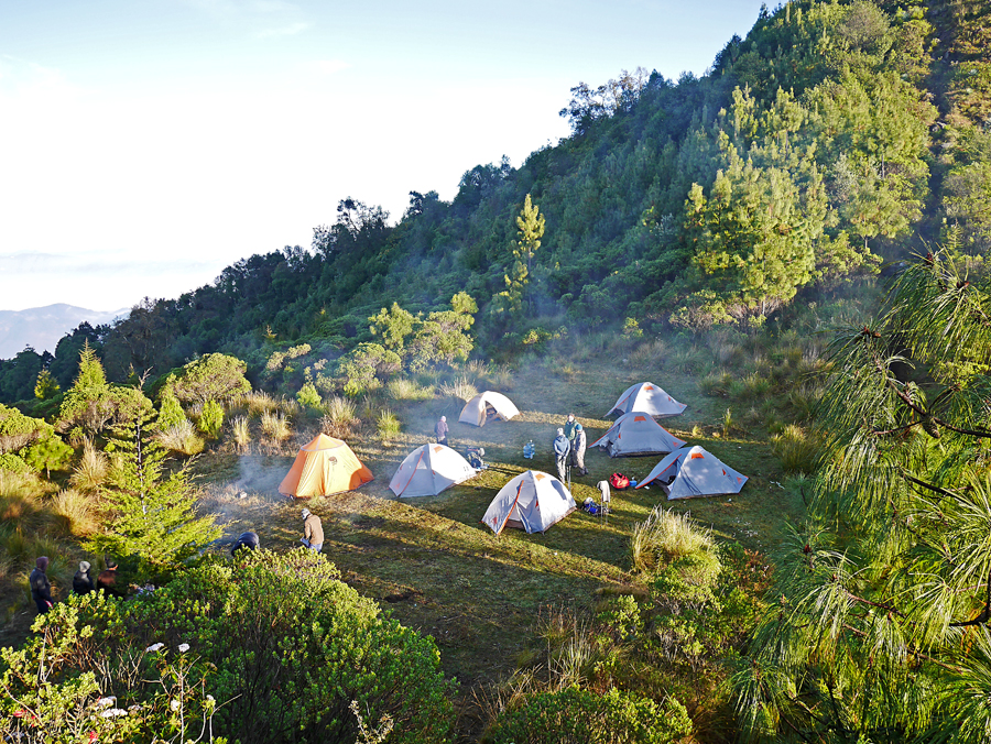
Now to the mountains. Our campsite on a carved-out ledge at 11,750 ft. on the slopes of Acatenango. That is Volcan de Agua in the distance. |
|
|
 |
|
|
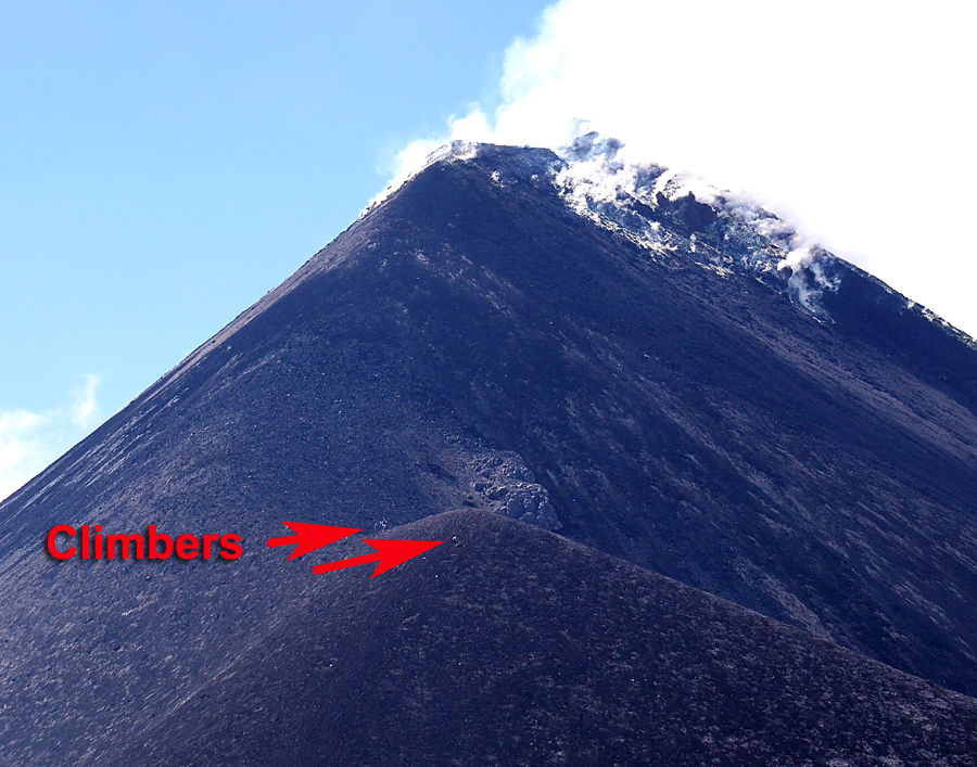
Volcan del Fuego was only about 1.7 miles west of our campsite. This is a view from the shoulder of the peak with some of our group climbing part way up the side. |
|
|
 |
|
|
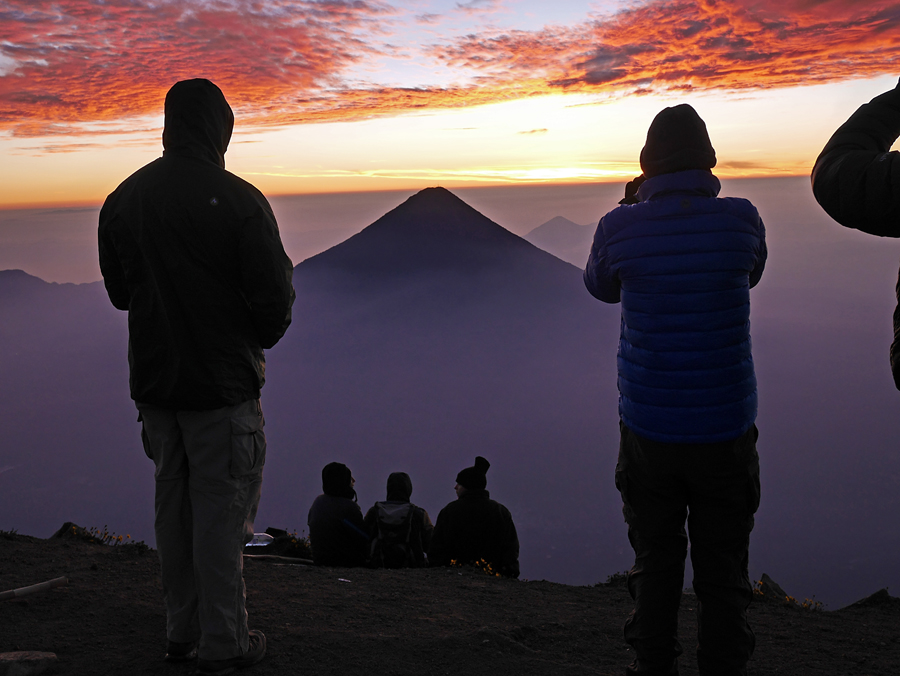
We make an early ascent of Acatenango to see the sunrise. That is Agua in view again. Acatenango is 13,044 ft. |
|
|
 |
|
|
|
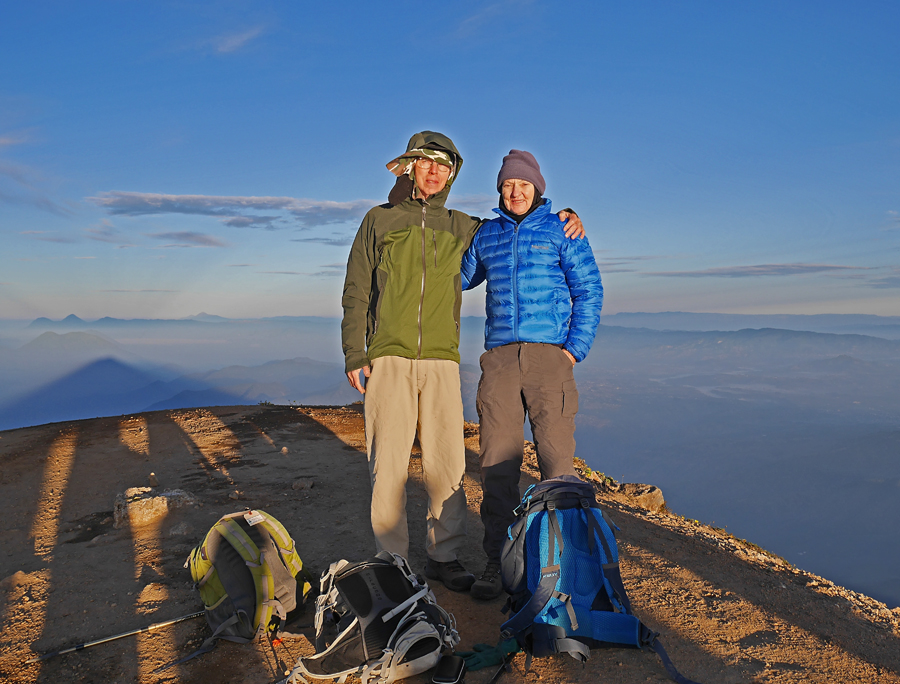
Me and Shelley on Acatenango, our first successful summit. Note the shadow of the mountain |
|
|
 |
|
|
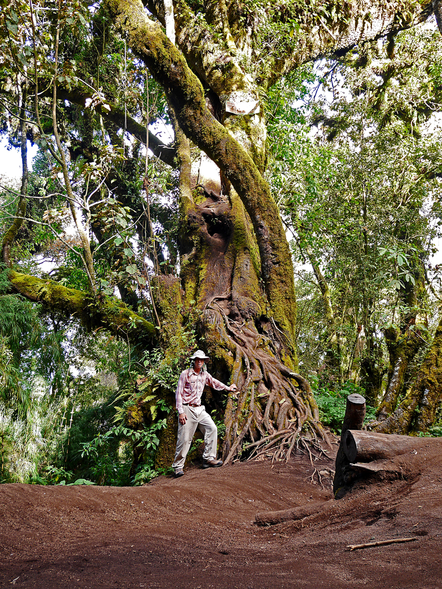
A huge old tree on the trail to Acatenango. |
|
|
 |
|
|
Our campsite on the ridge of Pico Zunil, our next summit. |
|
|
 |
|
|
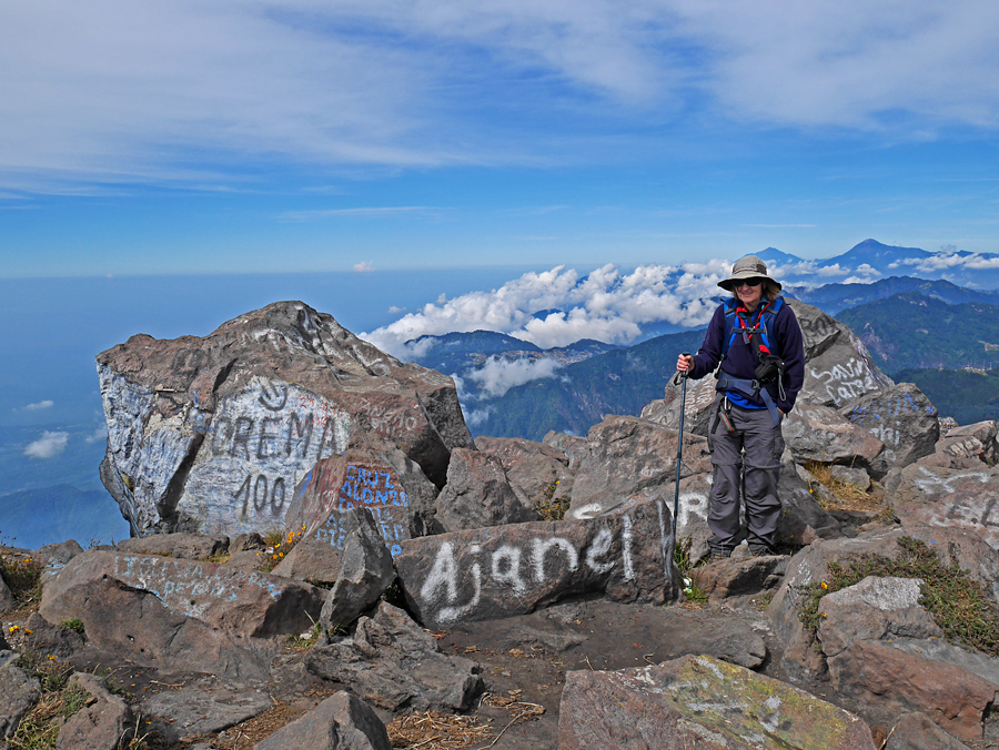
Our group less two guides on Pico Zunil summit. From the left that's Craig, Merik, Phil, Graham, Shelley, Richard and our guide and driver Pepian. The peak is 11,621 ft. |
|
|
 |
|
|
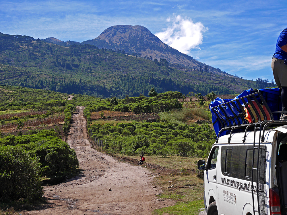
That is Tajumulco our highest summit on the trip. We started on this road at 10,250 ft. The summit is 13,845 ft. |
|
|
 |
|
|
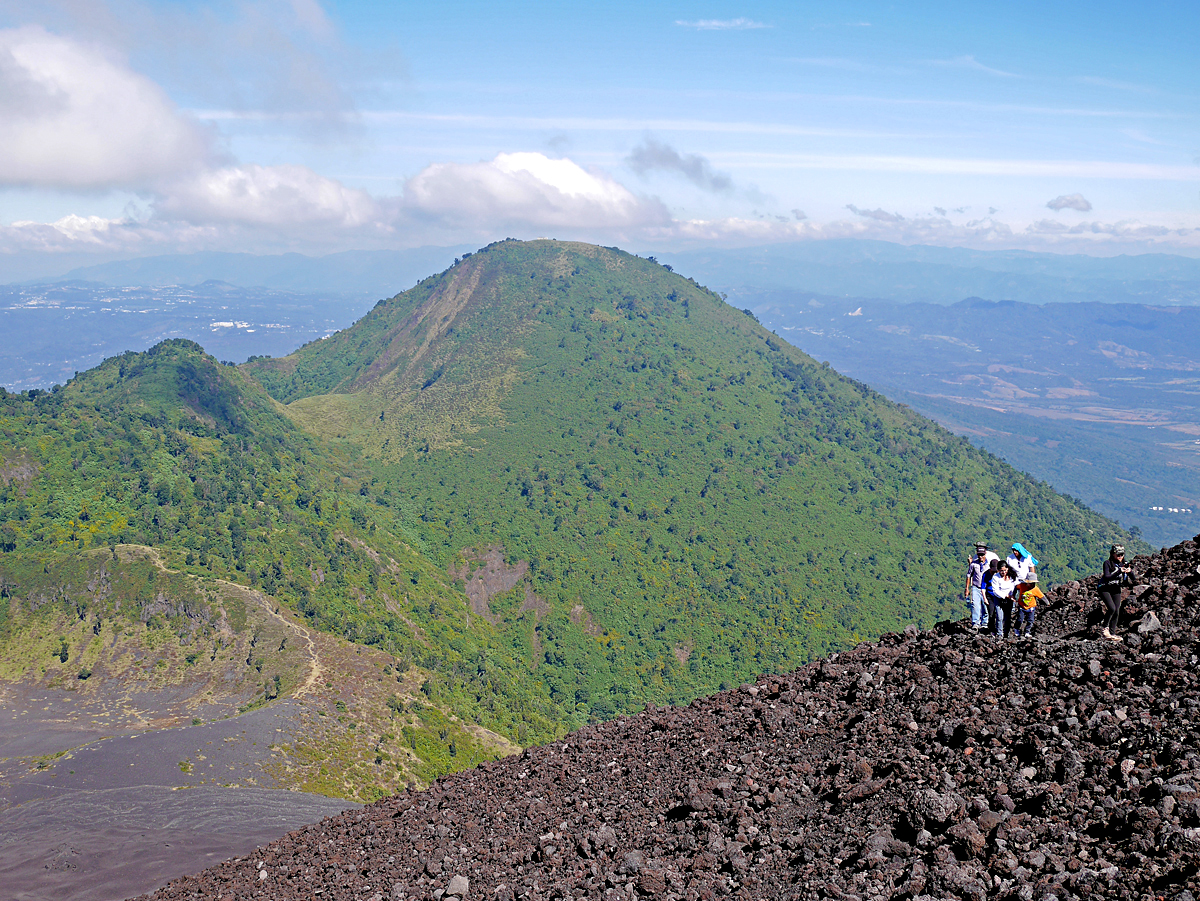
Shelley on Volcan Santa Maria. This was a tough hike with a rough trail going up steeply for 4300 ft. The summit is 12,375 ft. In back to the right of Shelley is Tajumulco and Volcan Tacana. |
|
|
 |
|
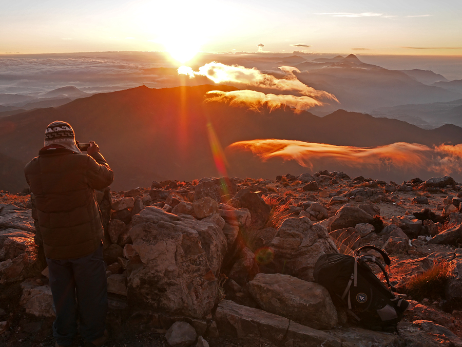
| Sunrise on Tajumulco. Santa Maria is the peak on the right at the horizon. About 60 miles away we could see an eruption from Fuego. It is the little cloud to the right of the sun. |
|
 |
|
|
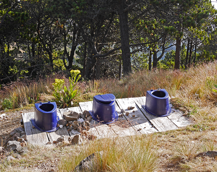
Toilet facilities at our camp on Tajumulco. Not much privacy, but a great view! |
|
|
| This a short video of the streaming clouds on Tajumulco. Video of streaming clouds on Tajumulco. |
|
|
|
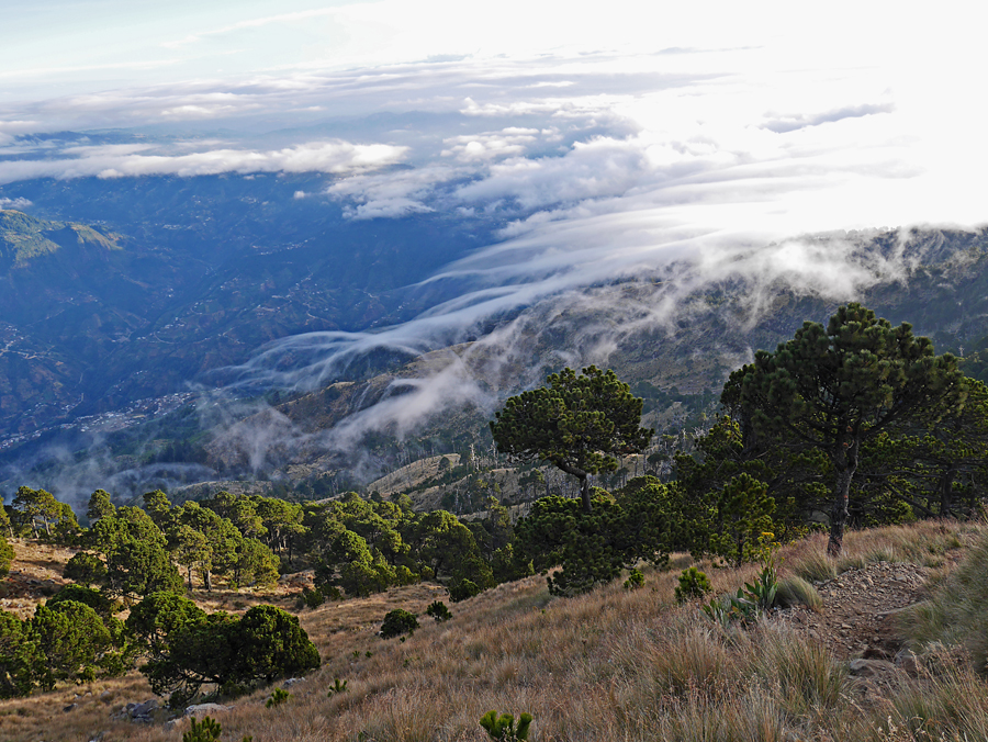
Fascinating streaming clouds on our descent from Tajumulco. |
|
|
|
 |
|
 |
|
|
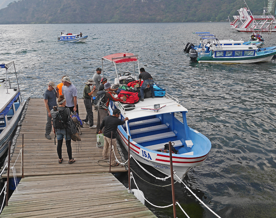
We drive to Lake Atitlan and make a seven mile crossing to the town of Laguna de San Pedro. |
|
|
|
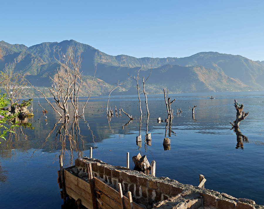
A view across Lake Atitlan from our hotel. The lake has no outlet and has risen since 2010 killing trees and flooding some buildings. |
|
| We climbed up to a viewpoint on Volcan San Pedro. Part way up is a swing on a tree and there is a Video of Phil on the swing. |
|
|
 |
|
|
 |
|
|
The wind was blowing strongly to the west that day making it safe to climb Pacaya. Whole groups were getting up there with kids and dogs. This is the highest point at 8373 ft. although my GPS showed 8475 ft. I didn't have my level-sighting device, but Pacaya seemed higher. The listing on Peakbagger.com shows both peaks. http://www.peakbagger.com/peak.aspx?pid=34899
A page with additional information on Volcan Pacaya. |
|
|
Shelley and I extended the trip about three days and went with Pepian to climb Cerro Grande which is next to Volcan Pacaya. This is a view of Grande from the slopes of Pacaya. The summit is 8402 ft. and my GPS showed 8397 ft. |
|
|
|
|
|
|
|
|
|
|
|
|
|
|
|
|
|
|
|
|
|
|
|
|