|
|
|
Volcan Pacaya, Guatemala
The Google Earth map shows an elevation of 2552 meters (8376 ft.)
|
|
|
|
 |
|
|
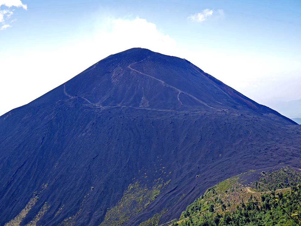
Looking west at Volcan Pacaya from the slope of nearby Cerro Grande, December 11, 2016. This was a particularly good day with a strong wind blowing the smoke from the crater to the west so the summit could be safely ascended. The upper more steeply-sloped trail is the one used to reach the top. |
|
|
|
 |
|
|
| A Google Earth image showing the hiking route we used. We first climbed Cerro Grande then descended to a saddle and up to Pacaya. A GPX file is available for this route. VolcanPacaya_CerroGrande.gpx
For more details see my report on Peakbagger.com. Volcan Pacaya on Peakbagger
|
|
|
 |
|
|
|
Shelley Rogers at what we thought was the highest point of Pacaya. We couldn't see west very well due to the smoke. The Google Earth image when zoomed in shows there could be a higher point to the west. Our GPS units showed about 8475 ft., about 100 ft. higher than the Google Earth elevation. The elevation on Cerro Grande is listed as 8402 ft. and our GPS showed 8397 ft. which is good agreement leading us to believe the Pacaya reading is correct. |
|
|
|
 |
|
|
A sign in the saddle warns of dangers and prohibits ascending to the crater. There were many people that day ignoring the sign and going to the top. As long as there is a good wind blowing west there doesn't seem to be much danger. There is a good website that will show current wind conditions and this can be looked at to see if the wind is blowing west across the mountain.
https://www.windytv.com/?14.404,-90.580,12 |
|
|
|
|
|
|
|
|
|
|
|
|
|
|