|
|
Mount Peale, San Juan County, Utah
Highpoint of San Juan County, Elevation = 12,721 ft. (3877 meters)
Located in the Manti-La Sal National Forest
|
|
|
 |
|
|
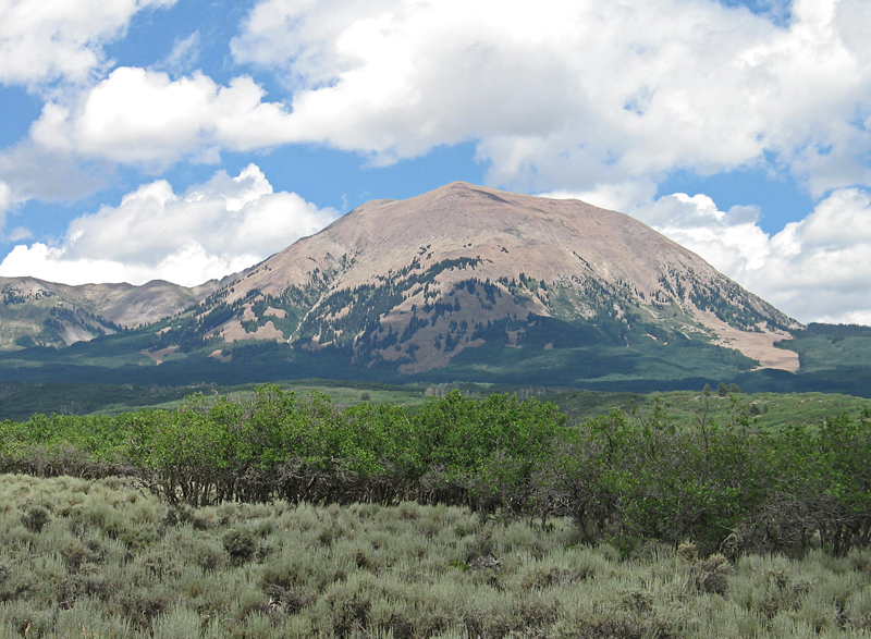
Mount Peale, the highpoint of the La Sal Mountains, lies southeast of Moab and is the highest peak in southeastern Utah. This view looking west was taken on the La Sal Pass Road on July 13, 2013. Since the peak is a county highpoint there are several detailed reports here. |
|
|
 |
|
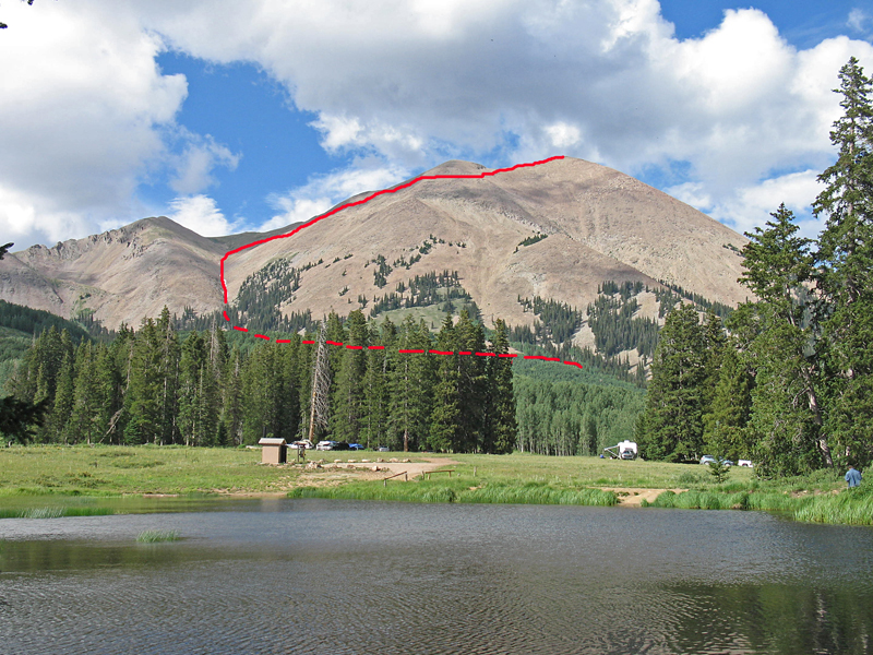
| Looking across Medicine Lakes at the south side of Mount Peale. The climbing route we used started at the end of a Jeep road and proceeded west through the forest to the drainage west of the summit. The USGS datasheet has the elevation as 12,726 feet. A benchmark disk was placed in 1934 at the summit, but we could not find it. |
|
|
 |
|
|
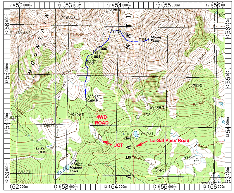
This topo map shows our climbing route from a campsite at the end of a four-wheel drive Jeep road. This is a bit shorter than the approach from La Sal Pass. The road is 0.7 miles long and moderately rough. Camping at the end is limited to two or three vehicles and is on stoney and sloping ground. Views are nice though! If you have a standard car park at the JCT point shown and walk the road. The route follows a use trail through the forest which has some fallen timber but which can be gotten through without too much difficulty. Once past the forest go up the drainage then onto talus slopes up to the ridge top. There is a use trail there over to the highpoint. The route is 3.6 miles round-trip with a gain of about 2600 feet, counting some small dips. It took us 2 1/2 hours for the ascent. This map has the UTM grid using NAD27 datum, zone 12.
Note: It is best to use the La Sal Pass Road (#123) from the east since the west side is listed as rough, four-wheel drive. The east side is reached via Two Mile Road from highway 46. The road is smooth and suitable for most passenger cars.
|
|
|
|
|
|
|
|
|
|