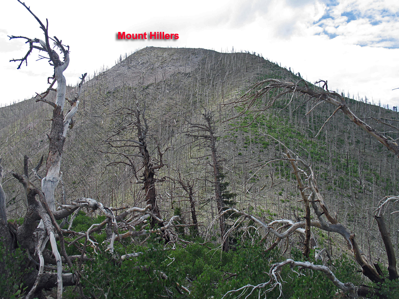
Elevation = 10,737 ft. (3273 meters)
On BLM land in the Henry Mountains
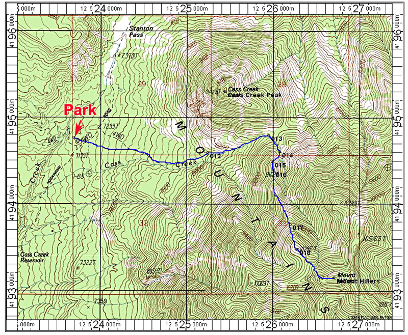
Driving Directions: From Hanksville go south on highway 95 then turn right onto 276. The road into the mountains is 31 miles total from Hanksville. The good, graded dirt road is the Bull Creek Pass Scenic Backway. From the intersection with 276 note the following mileages:
0.0 at highway 276
1.7 go left at a junction
3.6 go right at a junction
5.8 go left toward Stanton Pass at a signed junction.
11.9 note a sign on the left about 0.8 miles south of Stanton Pass marked 13530. This is an ATV track going south toward the mountain. Park on stoney ground. There is no good camping here or very nearby.
Hiking Directions: Walk up the ATV track which has been rerouted some from shown on the topo. You will go into the ravine that is Cass Creek. You can stay in the ravine most of the way and then come out near the saddle at point 013. From here follow a drainage south and leave it a short distance going up the talus slopes on your right. The footing is slippery and loose, but gets a bit easier as you gain the main ridge. Stay with the ridge all the way to the top. There are a couple of quite steep sections. This route is about 3.3 miles round-trip with a gain of 3700 feet. It tooks us 3 1/2 hours to reach the top. 7/13 RLC