In the Anza-Borrego Desert State Park

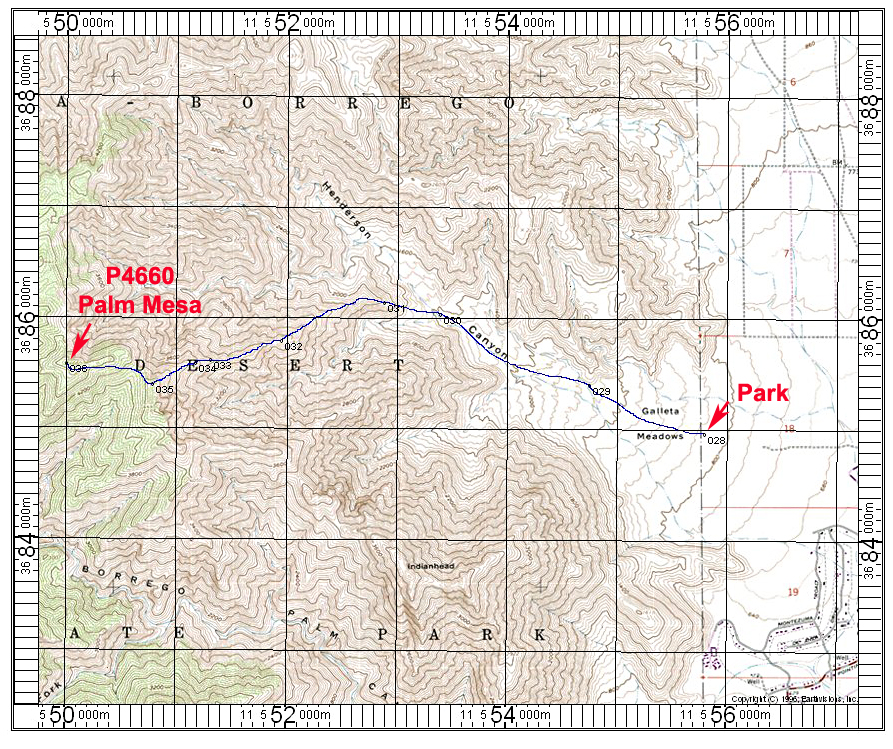
Driving Directions: From the Christmas Circle in Borrego Springs drive north on Borrego Springs Road for 3.6 miles. Go past the iron dragon sculpture to where the road makes a sharp bend to the right. Turn off to the left onto a fair dirt road. This road goes to Galleta Meadows and passes an iron sculpture of a Padre and then a saguaro cactus. The road has a number of pullouts for camping and is rocky in places. Drive for 0.9 miles and park at the end at point 028 on the map. The road goes further than shown on the old topo. High-clearance is advised. A sedan might make it OK with careful driving as the surface is firm and not sandy. Camping is OK here.
Hiking Directions: Get an early start and head west on a use trail into the canyon. Follow this all the way to a divide at point 030. Go left up the ridge to P3181 ft. which is 032 on the map. From there the ridge is more difficult with more jagged rock. We went below the ridge on the right (north) side to avoid tough sections. Up near the top it gets easier. You will have to drop about 200 ft. to a saddle and then go left up broad slopes to the top. This route is 9.2 miles round-trip with a gain of about 3900 ft. It took us five hours up and ten hours round-trip. Some younger hikers have reached the top in four hours. Go in the winter months and take plenty of water.