Mt. Apo, 2954 m (9691 ft.) Highest point in the Philippines
Located on the Island of Mindanao
|
Mt. Apo, 2954 m (9691 ft.) Highest point in the Philippines
Located on the Island of Mindanao |
||||||||||||||||
|
||||||||||||||||
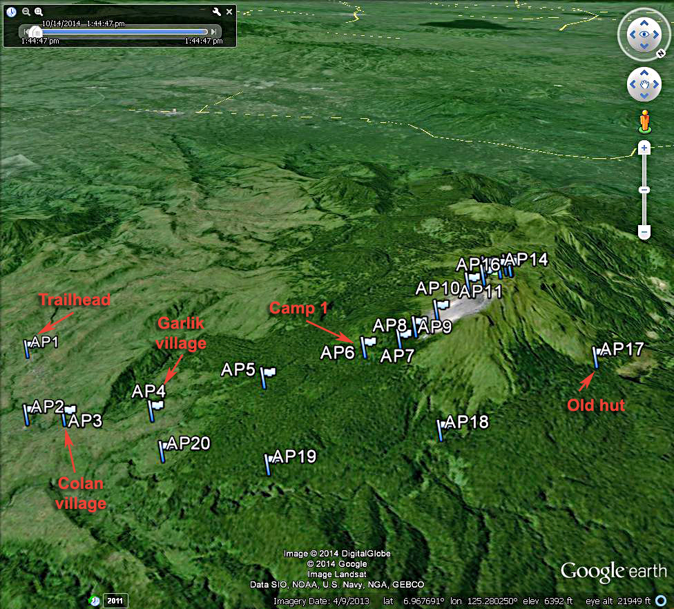
| A Google Earth image of the climbing route used on Mt. Apo. The route is a large loop starting east of the mountain and proceeding west via several camps to the summit. We then dropped down steeply on the north side to an old hut at point AP17. The trail then went east through some thick forest to point AP20 where we ended in a small village. | ||||||||||||||||
|
|
|||||||||||||||
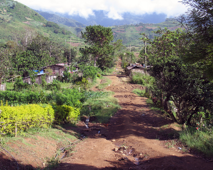
| This is the start of the route at an elevation of about 1146 m (3760 ft.). | ||||||||||||||||
|
||||||||||||||||
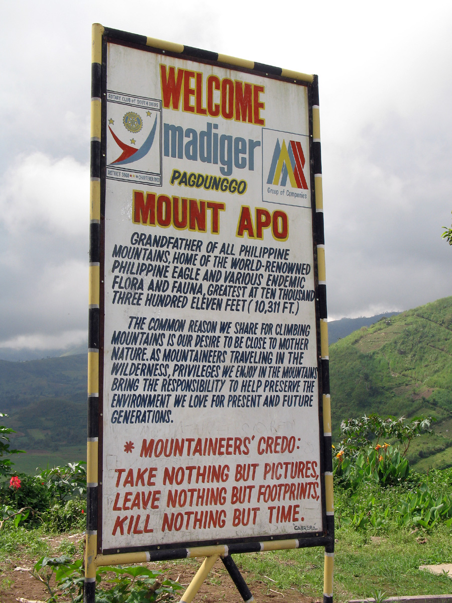
| A sign at the village of Colan. Note that the peak is listed as 10,311 ft. which is much too high! The elevation in the guidebooks is 9691 ft. | ||||||||||||||||
|
||||||||||||||||
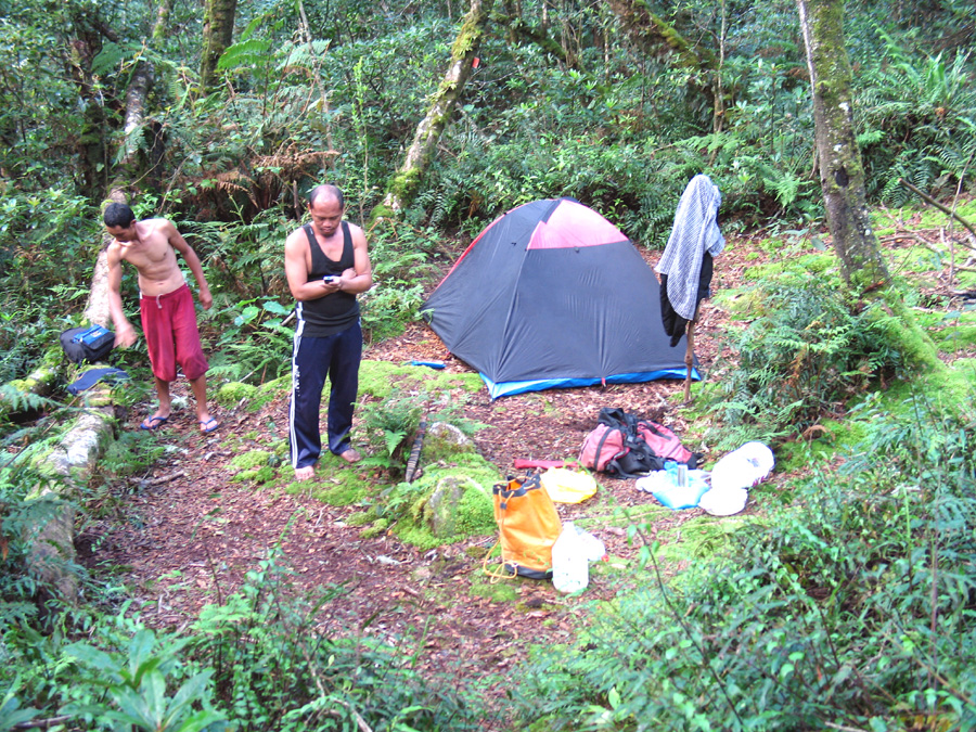
| Camp #1 Our first night's camp at about 2277 m (7470 ft.) | ||||||||||||||||
|
||||||||||||||||
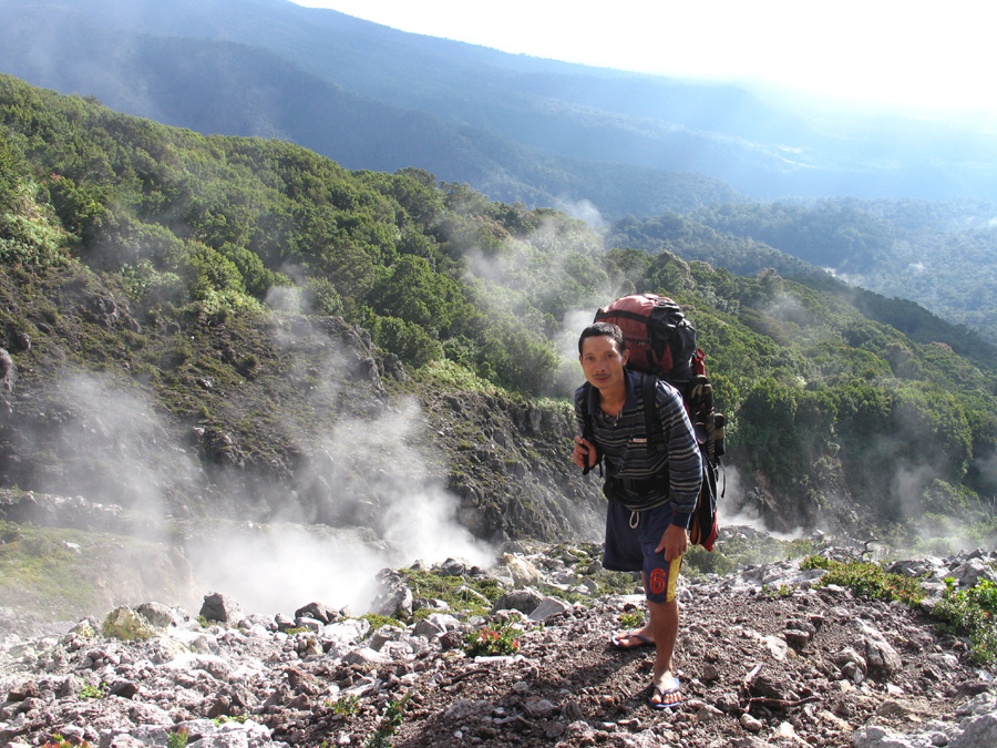
| Our porter above the sulphur vents. This is above the tree line at about 2520 m, (8270 ft.) | ||||||||||||||||
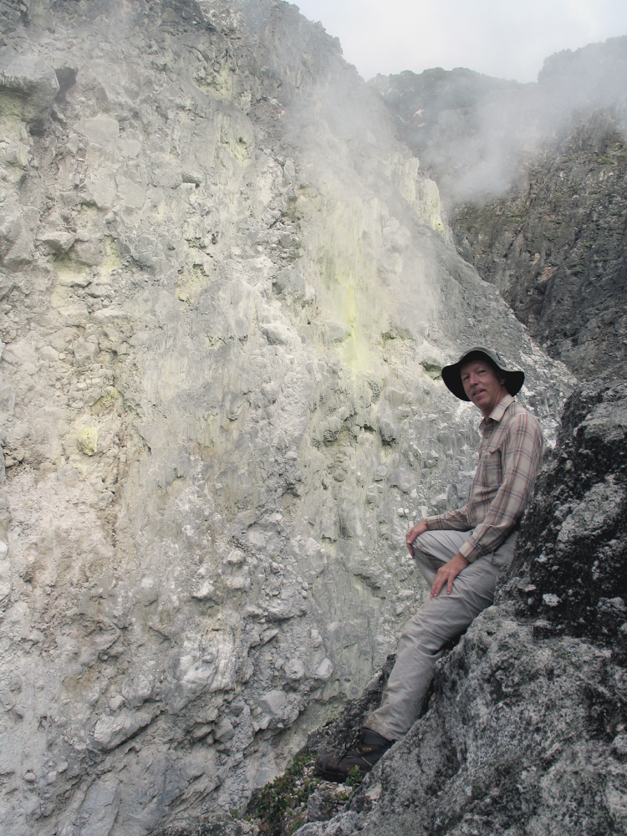
| At sulphur vents at about 2500 m, (8200 ft.) | ||||||||||||||||
|
||||||||||||||||
|
||||||||||||||||
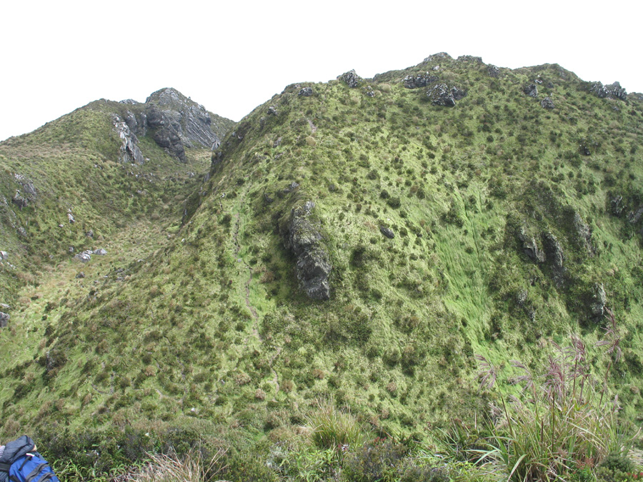
| The Mt. Apo summit is the peak on the upper right. | ||||||||||||||||
| At the summit area at about 2920 m, (9580 ft.). Some groups camp here using these pinnacles as a shelter. | ||||||||||||||||
|
||||||||||||||||
|
||||||||||||||||
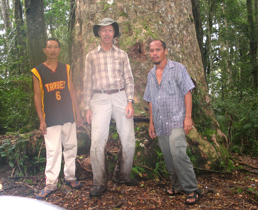
| Our porter Dong, Richard and guide Ruel at a mssive tree on the way down. Elevation here is about 1970 m, (6460 ft.) | ||||||||||||||||
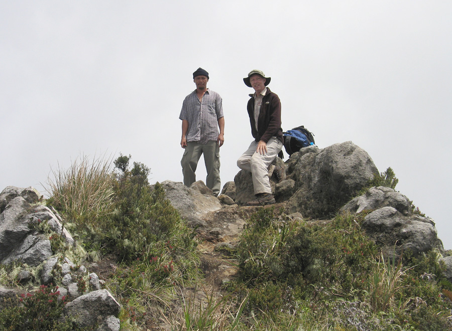
| Ruel and Richard at the Mt. Apo summit. I measured an elevation of 9770 to 9780 ft. which is 80 to 90 ft. higher than the guidebook elevation of 9691 ft. | ||||||||||||||||