Cambria County High Point, Pennsylvania
Elevation = 2862 feet (872 meters)
|
Cambria County High Point, Pennsylvania
Elevation = 2862 feet (872 meters) |
||||||
|
||||||
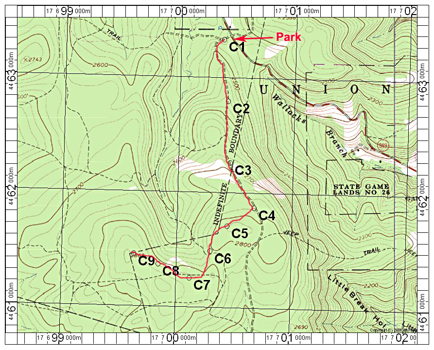
| My route is essentially the same as Ben Lostracco's. See his report. Park at C1 off highway 869 and walk the road to point C4 where you turn right along a deer fence on a cleared path. Follow this path to C8 where you will have to make your way west through somewhat open forest to the high point. I found the highest ground to be a partially cleared area a bit east of the point on the topo. The ground clearly went down to the west. 7/15 RLC A gpx file is available: Cambria.gpx The above map has a one-kilometer UTM grid using NAD27. | ||||||