Allegheny National Forest High Point, McKean County, Pennsylvania
Elevation = 2360+ feet
|
Allegheny National Forest High Point, McKean County, Pennsylvania
Elevation = 2360+ feet |
|||||||||
|
|||||||||
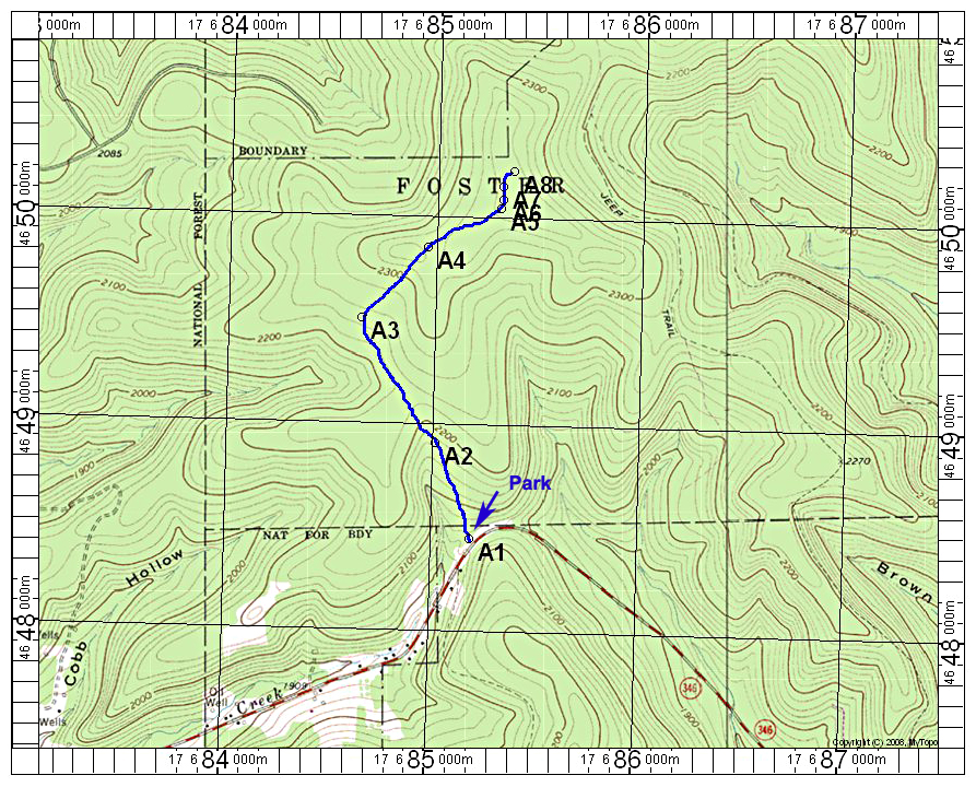
| I used the excellent trip report by Ben Lostracco for this forest high point. The above map shows my route on the Stickney topo which is essentially the same as Bens except possibly the very end. Park at point A1 on highway 346 about 7 miles west of Bradford. Walk north and then northeast on the road to point A5. Here I left the road and went north on a faint track that leads almost to the corner and the highpoint. I found the corner to be somewhat south of that shown on the topo. Point A8 is at the corner where the benchmark and signs are located. The route is 3.4 miles round-trip with a gain of about 350 feet. 7/15 RLC A gpx file is available for this route: AlleghenyNF.gpx The above map has a one-kilometer UTM grid using NAD27. | |||||||||
|
|||||||||
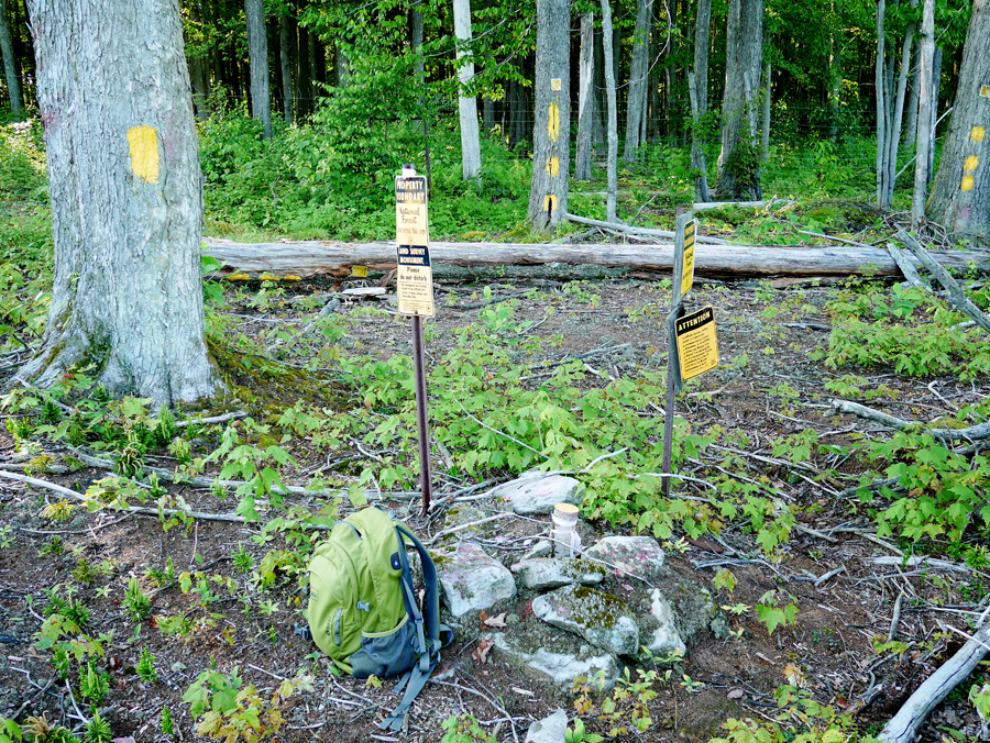
| The benchmark is in the center of the stones. A fence is back to the west about 20 feet. This is point A8 shown on the above map. | |||||||||
|
|||||||||
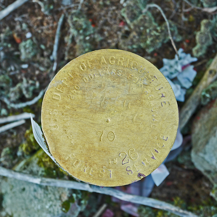
| This is the benchmark which might be from 1926. The number to the left of the 26 is difficult to make out. There is no datasheet for this. | |||||||||