On BLM land, Elevation = 8606 ft. (2623 meters)
Highest point in the Seaman Range
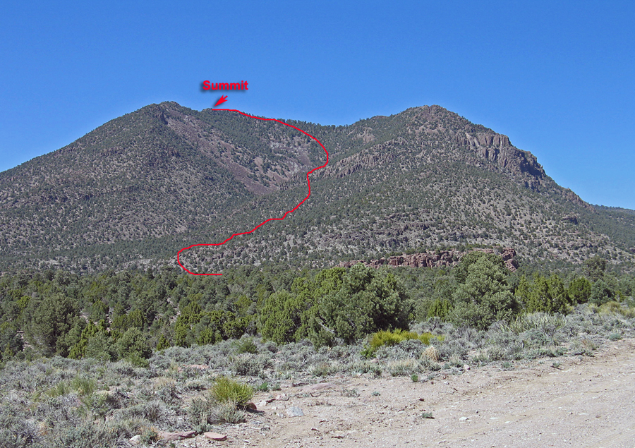
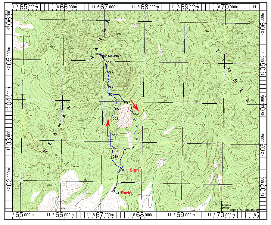
Climbing Route: We walked a short distance past the sign and turned west up a hill then had to drop down to the north across a valley to another hill. Topping out at point 050 we then had to sidehill some distance until we crossed a drainage. There is a band of rocks and we found a way through on the left side at point 054. Staying above the canyon bottom we eventually reached the final broad slope. We tried to avoid the larger talus by staying in or near the bigger pines. Reaching the ridge top we turned west and did a short scramble up a rock pile to the summit. The ascent took 3 1/2 hours. On the descent we went east crossing a ridge at point 059 and descended the east side. There was a long north-south cliff band that blocked our way, but moving along it we found a way through at point 060. We then dropped into the sandy canyon bottom and made our way back to the road. The descent took 2 1/2 hours. The elevation gain is about 2200 feet. 4/13 RLC.