Located on BLM Land

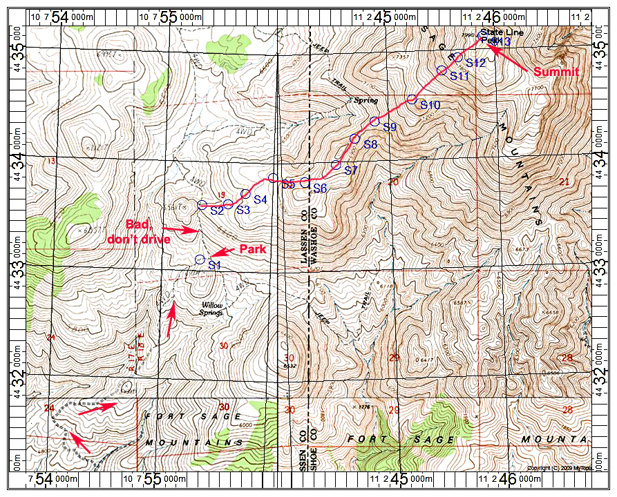
Driving Directions: On route 395 take the Doyle Loop Road which is about 45 miles northwest of Reno and 40 miles southeast of Susanville. On the south side of the town of Doyle find the loop road and turn right on Hackstaff Road. The road crosses a single-lane bridge and turns north and the pavement soon ends. Just after the pavement ends turn right on a good dirt road and reset your odometer here. This is Homestead Ranch Road, but it may not be signed. Follow this road southeast for 4.3 miles and turn left at a junction for a Jeep road. UTM here is: 753223E, 4430583N, NAD27, Zone 10. This is right at a spot elevation of 4352 ft. Reset odometer again. At one mile go left at a junction. The road goes up steeply to a crest then drops down and curves north in a short distance. The road is steep, but with little rock. 4WD low-range is needed. Continue on a shelf road portion and up more steep sections. I suggest parking at a junction at a saddle after 2.2 miles. The road goes left up a nasty hill with a lot of loose rock and I don't recommend driving this section.
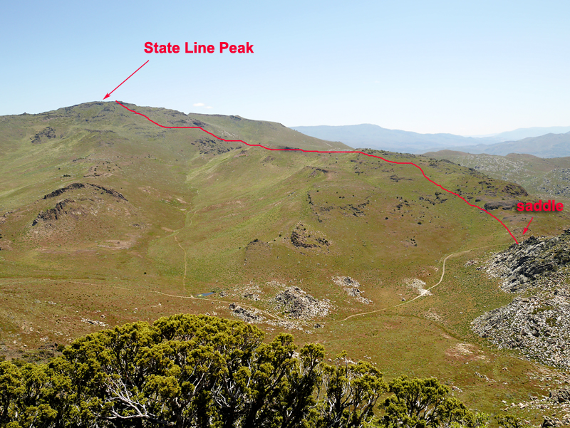
Hiking Route: Hike up the rough road to a high saddle. From here go right, cross-country following the track shown on the map below. There is a small dip at point S8 and stay to the left of rocks at point S10. The route is 5.2 miles round-trip with a gain of about 2000 ft. It took me about 2 hours and 20 minute to ascend. A gpx file is available for this route: StateLine.gpx

