On BLM land, Elevation = 8169 ft. (2490 meters)
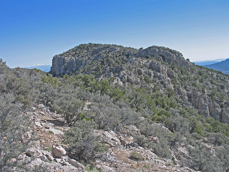
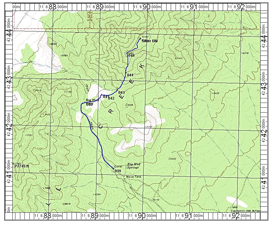
Climbing Directions: Hike northwest up the old road which turns into an ATV track to Big Mud Pass. From there take the track that goes east up a bare patch to high ground at point 042. At this point the track ends and you will want to head northeast up along the ridge toward point 8082. The photo shows the summit from this point. Head toward the ridge, at first stay on the south side of the limestone pinnacles and then it is easier to cross over through a gap to the north side. Near the end of the ridge there is a cliff and it is best to go left to get around it. Then in a short distance you can get up on the ridge top through the limestone band. The climb up took about 2 1/2 hours and allow 2 hours for the descent. The distance is 5.6 miles round-trip with a gain of about 1800 feet. 4/13 RLC
