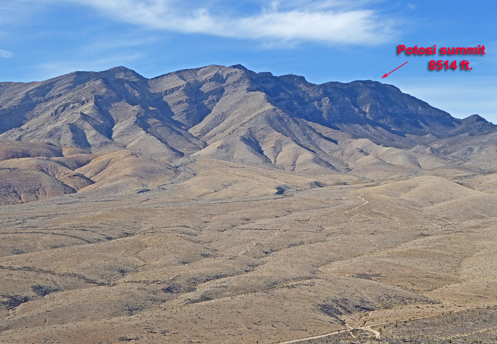
On BLM land, Elevation = 8514 ft. (2595 meters)
In the Spring Mountains

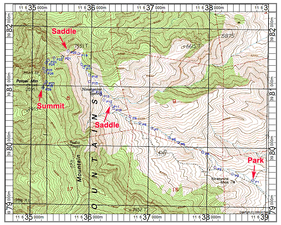
Driving Directions: From exit 12 on Interstate 15 take Nevada 161 north to Goodsprings. Just before the town go right on the paved truck bypass. After a mile or two go right at stop sign onto a fair dirt road heading north to Cottonwood Pass. Follow this road for about 6.8 miles to a signed road 800C on your left. This road gets really bad with a lot of rock and high-clearance four-wheel drive is needed. For some of the route take a newer parallel road on the left that is much less rocky. We parked across a short dip at point P1.
Hiking Directions: Follow the old road past the mine area and go right across a small canyon passing a concrete tank at P3. Stay on the road as it turns into a sandy wash. At P6 continue in the narrow wash to P8 where you will intersect an ATV track. Follow this up to a minor saddle at P11. Drop down some and cross brushy slopes and eventually go into a route in the canyon bottom at P16. The canyon appears to have been cleared as a trail a long time ago. The canyon fades out so head up brushy slopes to a saddle at P20. From here head up to the cliffs, staying close to them until P27 where there is a canyon going up to the summit. This route is 7.4 miles round-trip with a gain of about 3300 ft. It took us about 4 hours to reach the top and 2 1/2 hours down. There is an ammo box register at the top. We could not find benchmark disk Olcott. There is a USGS datasheet: FS1016 3/16 RLC