On BLM land, Elevation = 8999 ft. (2743 meters)
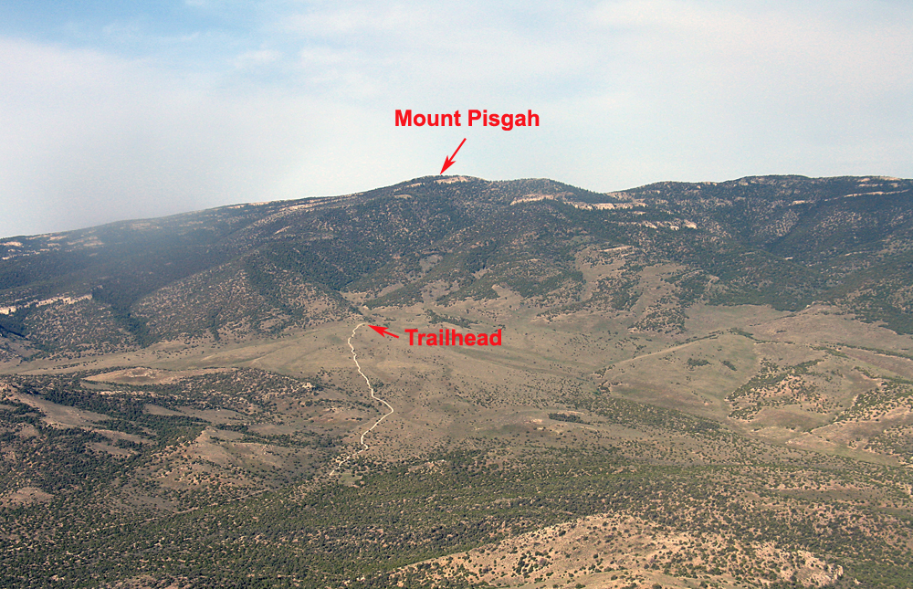
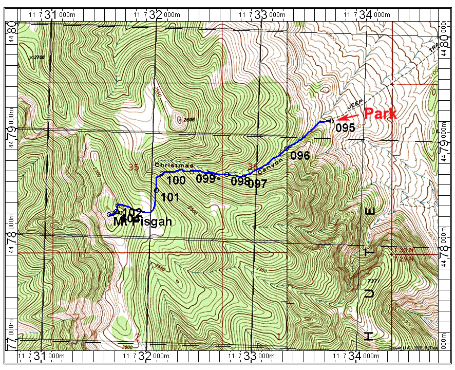
Driving Route: The trailhead can be reached by taking the dirt road west from the abandoned highway maintenance station on highway Alt 93. There is a sign here identifying the mountain as a raptor study area. The dirt road is fairly good for 2.9 miles to a junction with a sign "Goshute Peak Trailhead 2 miles". Go left here. This road is rough with a lot of rock and requires high-clearance. The road ends in 1.4 miles, not 2, at a wide parking area and wilderness boundary. This is point 095 on the above map. There is plenty of room to camp here on the somewhat sloping ground at 7000 feet elevation.
Hiking Route: The trail follows an old road in Christmas Canyon and you will find a trail register box at point 098. Continue on the good trail all the way up. It makes a lot of swtichbacks from 099 to point 102 as it climbs up the slopes. At point 103 there is a junction and metal post. Go left here and walk past some big black plastic storage boxes to the south side where a trail goes right to the summit. I am estimating the distance at 4 miles round-trip with a gain of 2000 ft. The ascent takes about 1 1/2 to 1 3/4 hours. 5/14 RLC A GPX file is available.