Morey Peak, Nye County, Nevada
On BLM land, Elevation = 10,260 ft. (3127 meters)
Highpoint of the Hot Creek Range
|
Morey Peak, Nye County, Nevada
On BLM land, Elevation = 10,260 ft. (3127 meters) Highpoint of the Hot Creek Range |
||||||||||
|
||||||||||
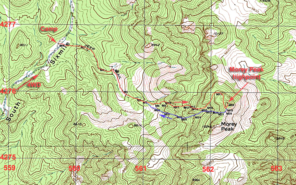
| This topo shows our climbing route to Morey peak from a camping spot in Sixmile Canyon west of the peak. The camping spot at point M1 was 8.4 miles north in the canyon on a fair to poor four-wheel drive road. The road is overgrown at stream crossings so a high-profile camper will have problems (see photo below). The climbing route starts out on an old road that eventually fades out at about point M5 to M6. From there we went on a ridge that had some tough, slippery spots and a talus field up near points M15 to M16. We made it up to a high ridge top at M17 and then went south along the west side of the northern peak which is the highpoint. It is best to scramble up the rock on the south side to reach the summit. Going down we went to a saddle between the two summits and then down the canyon shown by the blue line. This is a better route and I suggest following this line. At point M7 head southeast to point M28 and stay in the canyon. It is a bit brushy, but better than the slippery slopes and talus we found on our ascending route. The climb is about 2.3 miles one-way with a gain of about 2500 ft. It is not a simple climb and it took us four hours to reach the top. A GPS waypoint file is available for this route: MoreyPeak.gpx The above map has the UTM grid using NAD27 in Zone 11. | ||||||||||
|
||||||||||
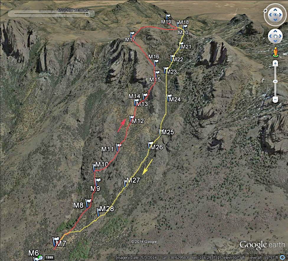
| A Google Earth image looking east at the route up Morey Peak. This shows mostly the upper parts since the lower part follows an old road and is easy to follow. As mentioned above I suggest following our down route shown in yellow. From M12 to M13 there was a steep, slippery slope. Higher up was an extensive talus field from M15 to M16. | ||||||||||
|
||||||||||
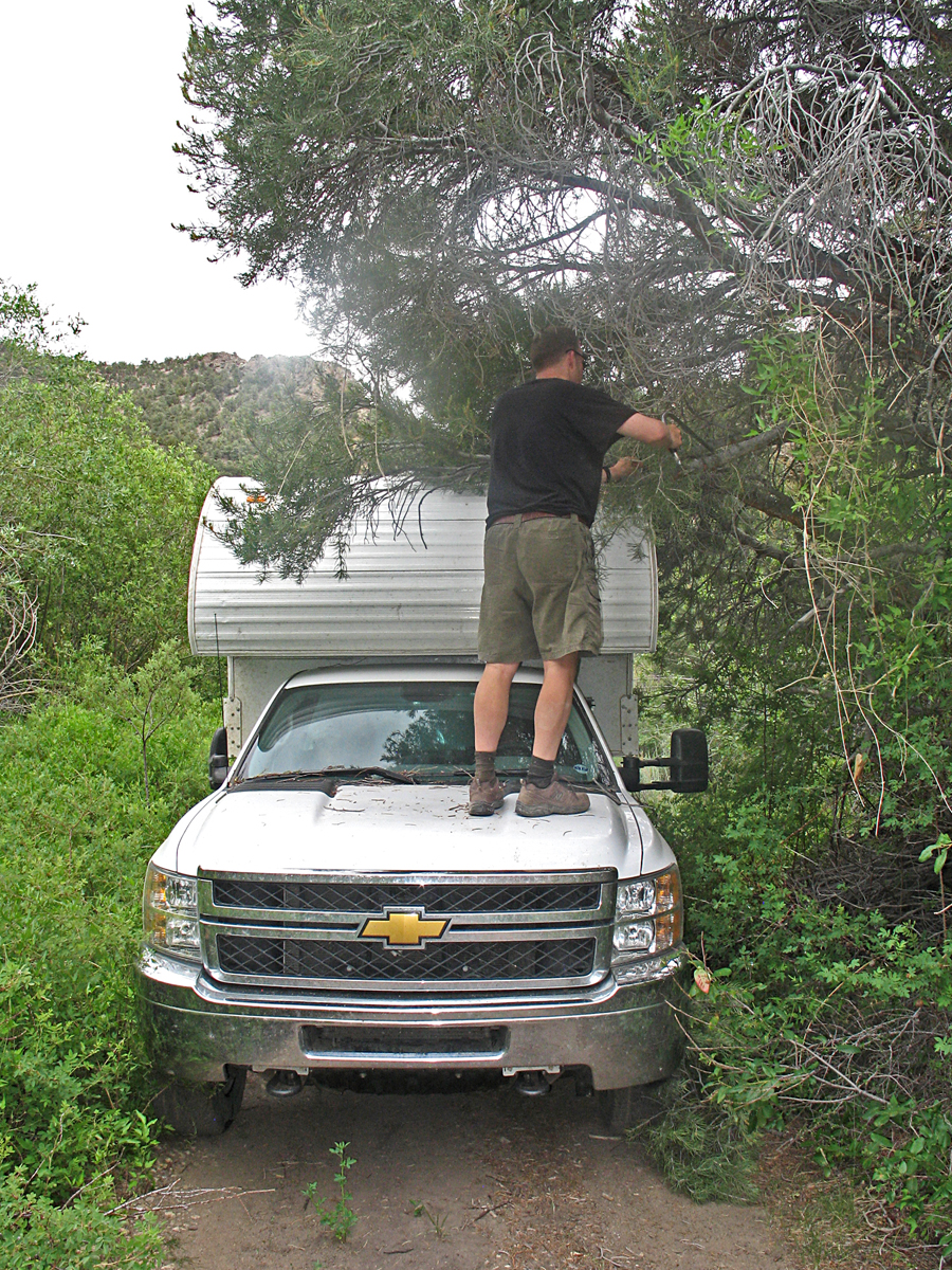
| John Hamman is trimming the low-hanging branches in Sixmile Canyon so Bob Packard can get his camper through. Good thing that Bob has a saw in his tool kit! A cab-high camper will have no problems on the road. | ||||||||||