Kumiva Peak, Pershing County, Nevada
On BLM land, Elevation = 8241 ft. (2512 meters)
Highpoint of the Selenite Range

|
Kumiva Peak, Pershing County, Nevada
On BLM land, Elevation = 8241 ft. (2512 meters) Highpoint of the Selenite Range |
|||||||||||
|
|||||||||||
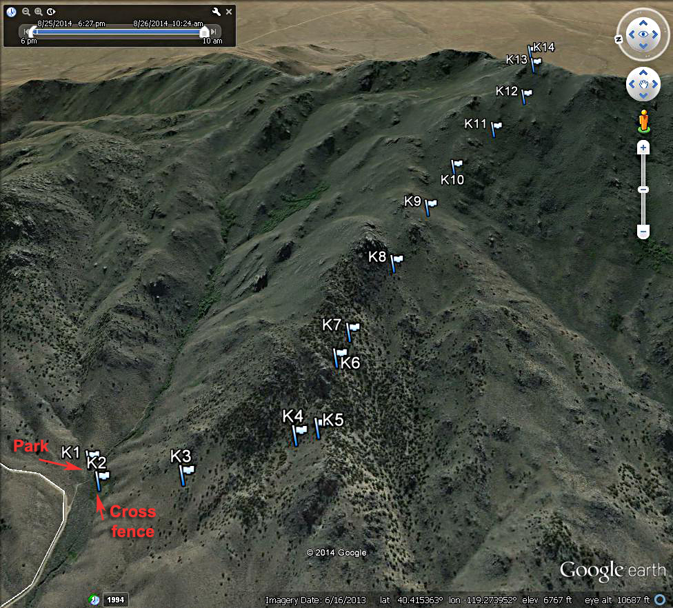
| This topo shows our climbing route to Kumiva Peak from a spur road off the good road to Cowles Ranch. This road is about 9.8 miles south of Empire on route 447. Drive east on this graded road for 3.4 miles and turn off to the right on a road that makes its way into a canyon. There is limited parking along there. Start the hike by going west along a stream until you can find a way across it in the sometimes heavy sagebrush. At point K2 we had to cross a tight barb wire fence. It is easy going then up the slopes through scattered trees to a ridge at point K5. Head southeast gaining ground along the slopes under large boulder piles to your left. There is a way through to more open slopes at point K8. Cross a drainage and go up brushy slopes all the way to the top. This route is 4.0 miles round-trip. The gain is about 2900 feet including a small drop along the way. It took us 3 hours and 50 minutes for the ascent. The above map has a UTM grid using NAD27 in zone 11. A GPS waypoint file is available for the above route: KumivaPeak.gpx | |||||||||||
|
|||||||||||
| Here is a Google Earth image looking to the east at the route up Kumiva Peak. | |||||||||||
|
|||||||||||
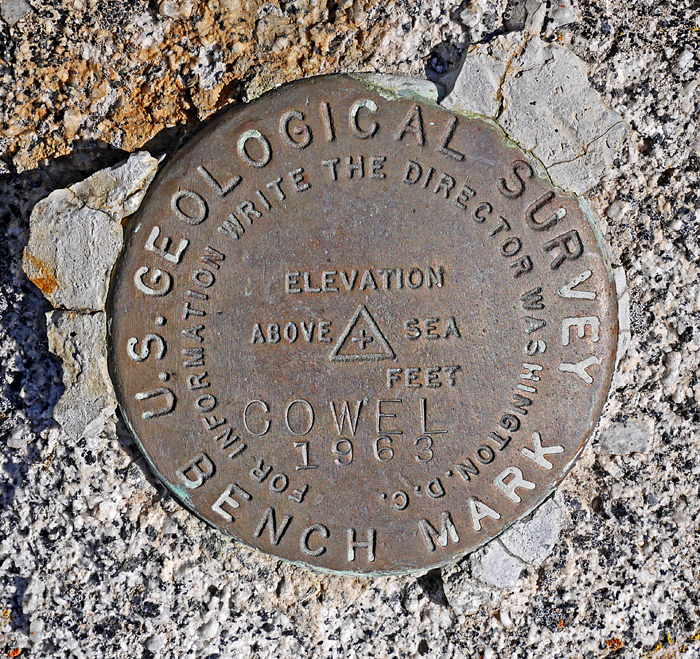
| The benchmark disk at the summit which appears to be named for the nearby Cowles Ranch, however the spelling is wrong. Placed in 1963. Datasheet | |||||||||||