Kawich Peak, Nye County, Nevada
On BLM land, Elevation = 9401 ft. (2865 meters)
Highpoint of the Kawich Range

|
Kawich Peak, Nye County, Nevada
On BLM land, Elevation = 9401 ft. (2865 meters) Highpoint of the Kawich Range |
|||||||||||
|
|||||||||||
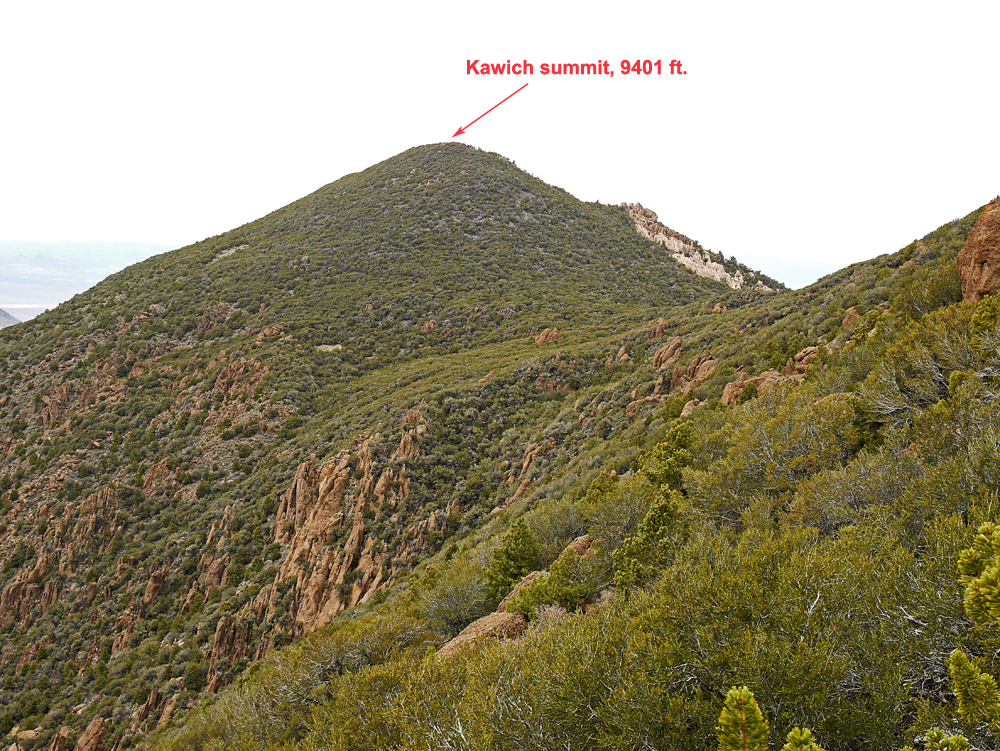
| Looking north at Kawich summit from the ridge top at point K17 shown on the map below. We went over Peak 9380 then down to the saddle at K22 and up the final slopes which were very brushy. | |||||||||||
|
|||||||||||
| The map shows our route which is different from most shown on Peakbagger.com. We saw the relatively open slopes up to the ridge and decided to go up that way then north along the ridge to the summit. We hoped the brush wouldn't be too bad, but it was slow going. From K17 to K19 there are large boulders with a tangle of brush among them and the going is difficult. Going over the ridge top, which is Peak 9380, isn't quite so bad. We found some open areas descending to the saddle at K22. The summit is well guarded with quite a tangle of brush until the top is reached which is open. This route is 6.4 miles round-trip with a gain of about 2500 ft. due to a drop along along the ridge. There will be an extra 320 ft. of gain on the return hike for about 2800 ft. total. The climb took us 4 1/2 hours to the top and 8 1/2 hours total. The above map has a UTM grid using NAD27. 5/20/15 RLC A gpx waypoint file is available for the route: KawichPk.gpx | |||||||||||
|
|||||||||||
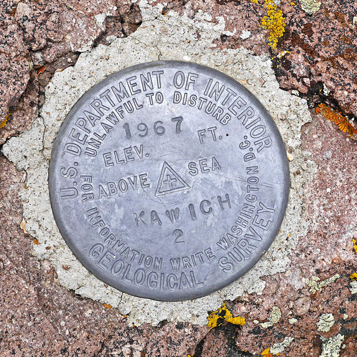
| The benchmark disk was in good shape, placed in 1967. | |||||||||||