Hole in the Mountain Peak, Elko County, Nevada
In the Humboldt National Forest, Elevation = 11,306 ft. (3446 meters)


|
Hole in the Mountain Peak, Elko County, Nevada
In the Humboldt National Forest, Elevation = 11,306 ft. (3446 meters) |
|||||||||
|
|||||||||
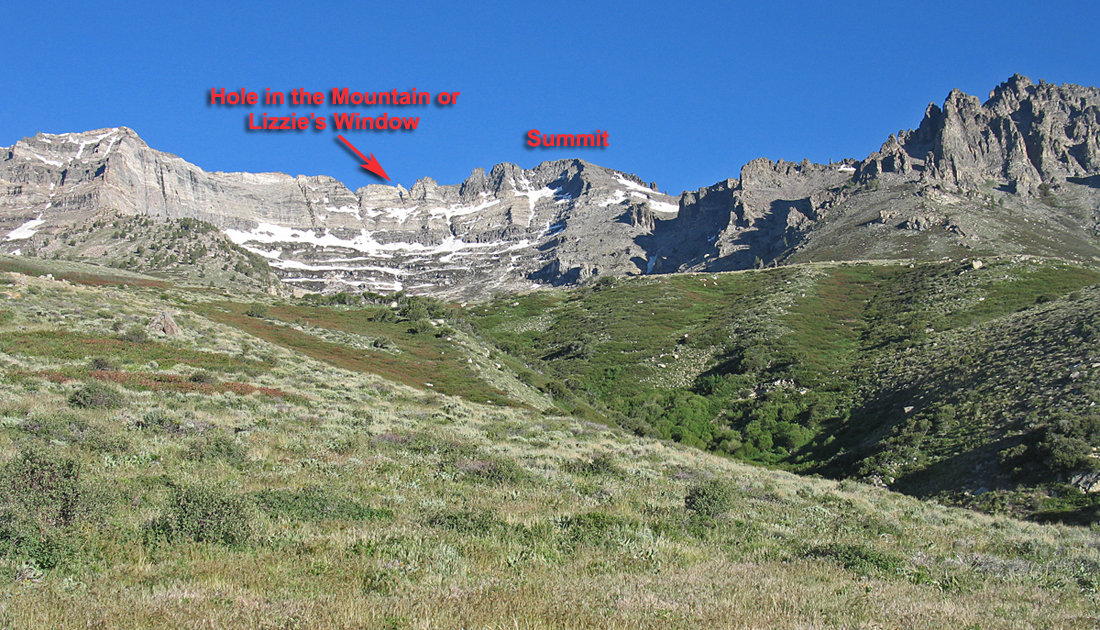
| Hole in the Mountain Peak, located southwest of Wells, is the highpoint of the East Humboldt Range that runs north-south for about 30 miles on the west side of Clover Valley. The peak is named for the hole, called Lizzies Window, which is south of the highest point and is barely visible in this picture. | |||||||||
|
|||||||||
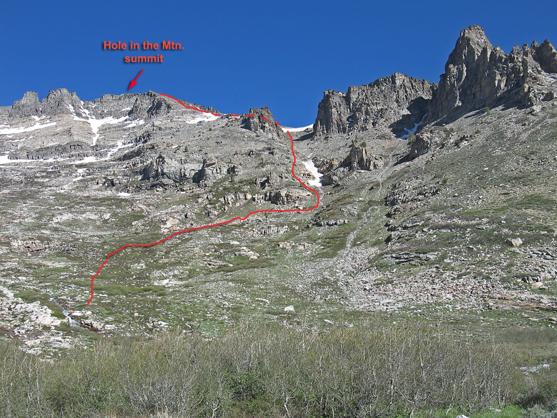
| A closer view of the summit and a climbing route. In mid-June, 2012 the snow was melted off enough so that it was not a problem getting past it on the upper slopes. There was a small section of 3rd class scrambling near the top since we had to stay close to the ridge edge to avoid the snow bank. This is a rewarding climb with nice views and there is a good chance you will see mountain goats in the cliffs near the summit. | |||||||||
|
|||||||||
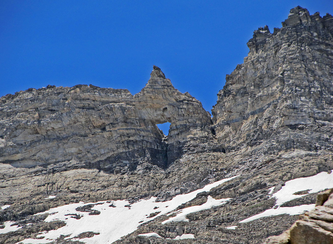
| A good view of Lizzies Window by Mark Adrian on June 16, 2012. It was named for Lizzie Wiseman an early pioneer of Clover Valley. | |||||||||
|
|||||||||
| Mark Adrian at the summit. This view is looking west with Ruby Dome in the back. There are wood poles and wire indicating surveyors were there some time ago, but no benchmark disk could be found. | |||||||||
|
|||||||||
| Map showing our climbing route. The road is rough, four-wheel drive getting to the parking spot where we camped. There is limited space for a couple vehicles by a rock outcrop. Hike up the road and turn off on a spur at point 047 to a gaging station by the lake. Follow a barely visible route through the brush west and stay close to the lake. At the west side cross the stream and head up the open slopes. Go up a drainage right of a rock pinnacle (see photo). Go left (west) up the talus slopes to the top. In Mid-June it was possible to stay off the snow. There are good driving directions on summitpost.org. Adam Helman describes a route staying higher around the lake avoiding the brush . This is a longer report. Look for Hole in the Mountain after July 4th. The UTM grid lines on the above map are using NAD27 datum in Zone 11. There is a GPS file available with the above waypoints. HoleinMtn.gpx | |||||||||