Grassy Mountain, Lincoln County, Nevada
On BLM land, Elevation = 8613 ft. (2625 meters)
|
Grassy Mountain, Lincoln County, Nevada
On BLM land, Elevation = 8613 ft. (2625 meters) |
||||||||
|
||||||||
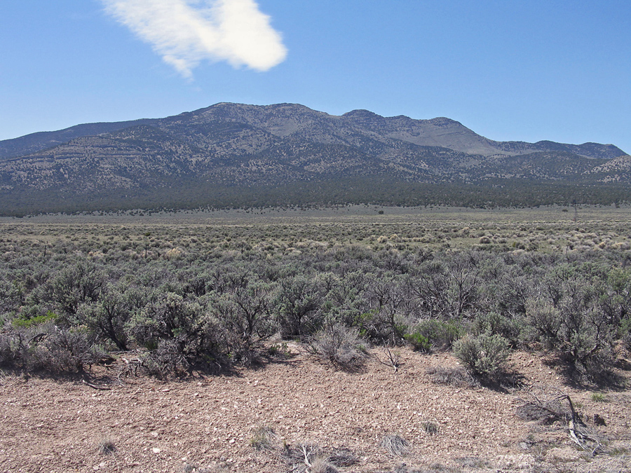
| A view of the west side of Grassy Mountain. The peak is an easy climb and has a prominence of 1993 feet. | ||||||||
|
||||||||
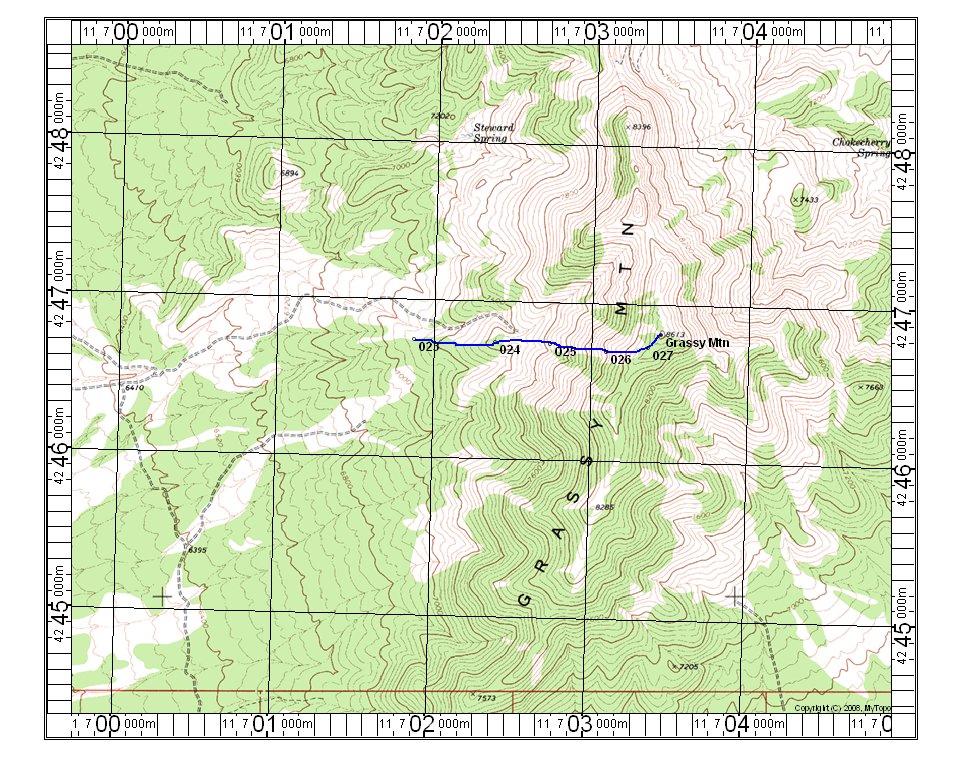
| This topo shows the climbing route for Grassy Mountain. The UTM grid is shown using NAD27 in Zone 11. A GPS waypoint file for this route is available: GrassyMtn.gpx To reach the starting point turn off highway 93 onto Sidehill Pass Road which is not signed. It is a very short distance north of the BLM Fire Station. Drive west on the good graded road for 6.1 miles and turn right onto a fair road going north. UTM there is: 700345E, 4242506 N. Go 2.0 miles north and turn right onto a poor road at spot elevation 6395. This road gets overgrown and rough and four-wheel drive is needed. Continue for another 1.4 miles to a high, bare hill and park. This is point 023 on the map. The road goes downhill and connects with another road coming in from the west. This might have been a better road. Start the hike east and go straight up the slopes to the summit. There is a bit of loose and rough area near the top. The route is 2 miles round-trip with a gain of 1500 feet. I took 1 hour 15 minutes up and only 35 minutes down. The summit is bare and open with nice views. 4/13 RLC | ||||||||