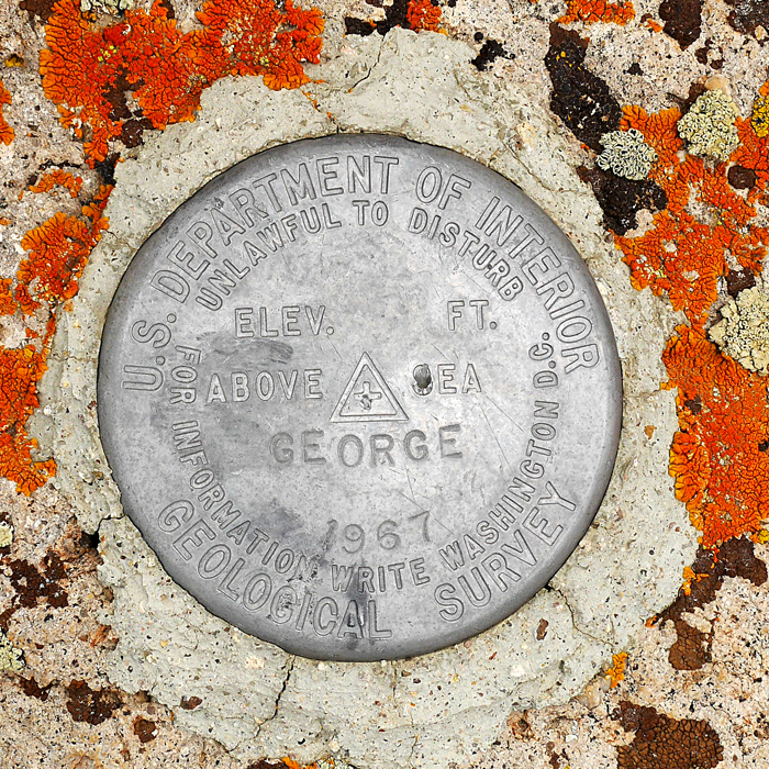
In Toiyabe National Forest, Elevation = 9324 ft. (2842 meters)
Highpoint of the McKinney Mountains
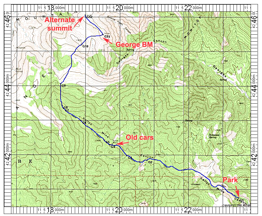
Driving Directions: From Tonopah drive east on route 6 about 30 miles to a junction on your left about 2.5 miles past Saulsbury Summit. The road north is marked "Stone Cabin Ranch" and is good graded dirt. Note the following mileages from route 6:
At 1.5 miles go left at a junction.
At 6.6 miles reach an east-west crossroad and turn left. This is route 44164.
At 8.2 miles turn right onto a worse condition road where four-wheel drive may be needed.
At 9.4 miles stay right at a junction.
At 9.5 miles go straight at a triangle intersection.
Follow this road into Georges Canyon and eventually Kellys Mine Canyon.
At 14.9 miles reach the end of a narrow section.
At 15.2 miles is run down Fancher Cabin on the right.
We parked after 15.6 miles, but if you don't mind some vehicle scrapes on brush you can go further possibly to point G3.
Hiking Directions: The hike starts at point G1 following the road. At G3 go right to some old car bodies at G4. Past the cars the trail is overgrown and hard to follow. We got to point G8 and gave up on the road and went straight up the slopes which were less brushy than staying in the canyon bottom. At G9 we could see the summit to the northeast. It was easy going with some gain and loss over a hill to the top. There was a cairn, but no register so we left one. A competing summit with the same spot elevation lies 1/2 mile northwest. There was a register from 2000 there and Gordon McLeod says that with his sighting level he thought that peak was higher. With my level it was too close to call. Anyway, it is best to do both peaks. This route is 6.8 miles one-way to George BM. With the other summit included the total round-trip distance is about 15 miles. There is a gain of about 3600 feet due to some ridges to go over. The hike took us 9 1/4 hours. 5/15 RLC A gpx waypoint file is available for this hike: GeorgeBM.gpx