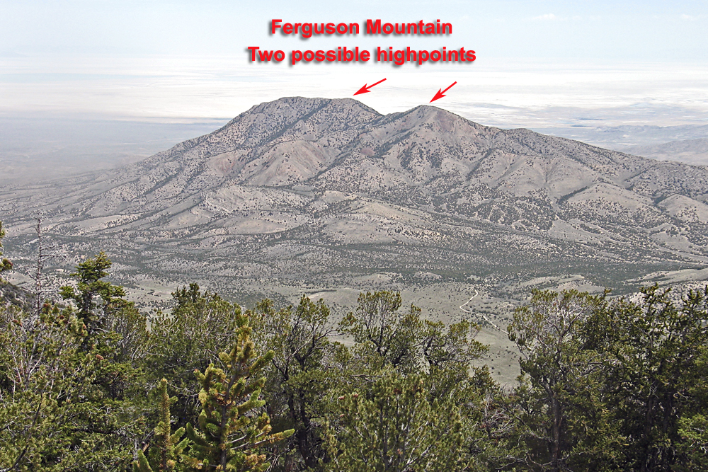
On BLM land, Elevation = 7729 ft. (2356 meters)
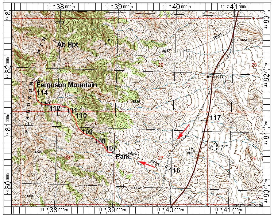
Driving Route: A good trailhead and camping area can be reached from highway Alt 93. The obscure road at point 117 is 1.7 miles north of the abandoned highway maintenance station. Drive west a tenth of a mile or less and reach the old highway which has a broken, paved surface. Drive south on this for 0.7 miles to point 116 and turn west up a slope onto an old track. This is not too rough, but high-clearance if not four-wheel drive is advised. Drive west for 0.6 miles to the road end at the base of a hill. This is fairly flat and makes for reasonable camping for several vehicles. The only drawback was the mosquitoes.
Hiking Route: Go northwest straight up the slope. You can easily go around some rock outcrops. The route goes west at points 110 to 113 then follow along the base of a cliff which angles up to the summit. The route is 3.0 miles round-trip with a gain of about 1500 feet. Allow about 1 1/2 hours for the ascent. I did not visit the alternate highpoint which is about 0.6 miles north. With my Kuker-Ranken hand level the northern summit looked to be very close to the same height. 5/14 RLC A GPX file is available.