Duffer Peak, Humboldt County, Nevada
On BLM land, Elevation = 9428 ft. (2874 meters)
Highpoint of the Pine Forest Range
|
Duffer Peak, Humboldt County, Nevada
On BLM land, Elevation = 9428 ft. (2874 meters) Highpoint of the Pine Forest Range |
|||||||
|
|||||||
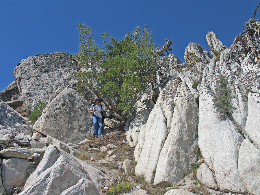
| Andy Martin coming down from the summit through a narrow passage by a pine tree. This is a good way to the top with easy climbing. Duffer Peak has a prominence of 4139 feet. | |||||||
|
|||||||
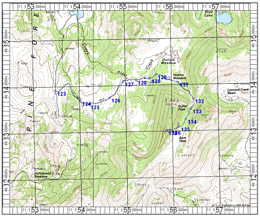
| The above map shows the hiking route for Duffer Peak. We parked at point 123 which is 2.3 miles south from the Onion Valley Reservoir. The road is rough past the meadow and tin cabin by Little Onion Lake and four-wheel drive is needed. From point 123 go east on a trail to the east end of a meadow at point 129. Stay to the left here through some thick aspens to reach a higher meadow. Go around the east side of the ridge and climb south up an easy drainage to a high saddle. Go west up through steep, rocky slopes toward the summit staying a bit to the right side of the highest point. Look for the pine tree close to the top as shown in the picture. This hiking route is about 3.5 miles one-way with a gain of about 1800 feet. It took us 2 hours and 40 minutes to reach the top. UTM coordinates for this map are in NAD27 datum. | |||||||