Currant Mountain, White Pine County, Nevada
In the Humboldt National Forest, Elevation = 11,518 ft. (3511 meters)
|
Currant Mountain, White Pine County, Nevada
In the Humboldt National Forest, Elevation = 11,518 ft. (3511 meters) |
|||||||||||||
|
|||||||||||||
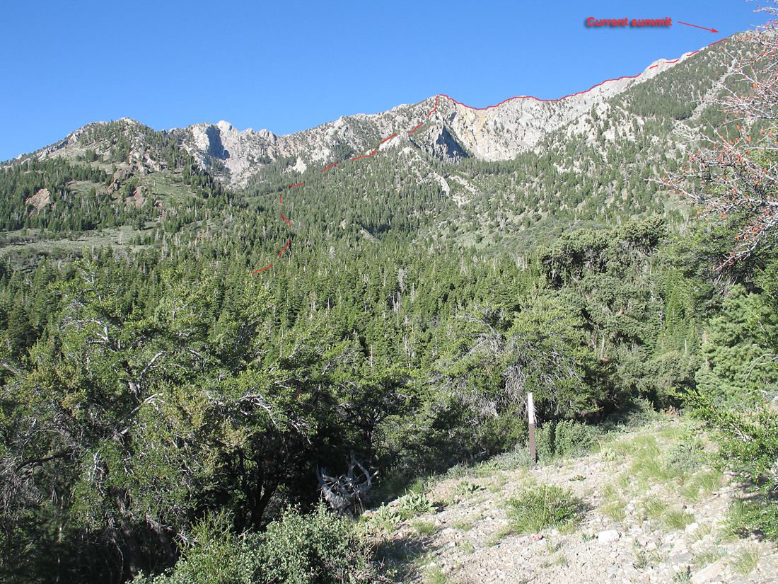
| Currant Mountain is just out of view in the photo looking southwest from the fifth switchback on the jeep road. The peak is in the Currant Wilderness and no permits are needed to climb it. A good route starts from the first switchback and proceeds through the forest to the red line route shown here. (see map below) The forest is not very thick and it is usually easy to find a way around brushy areas and fallen logs. | |||||||||||||
|
|||||||||||||
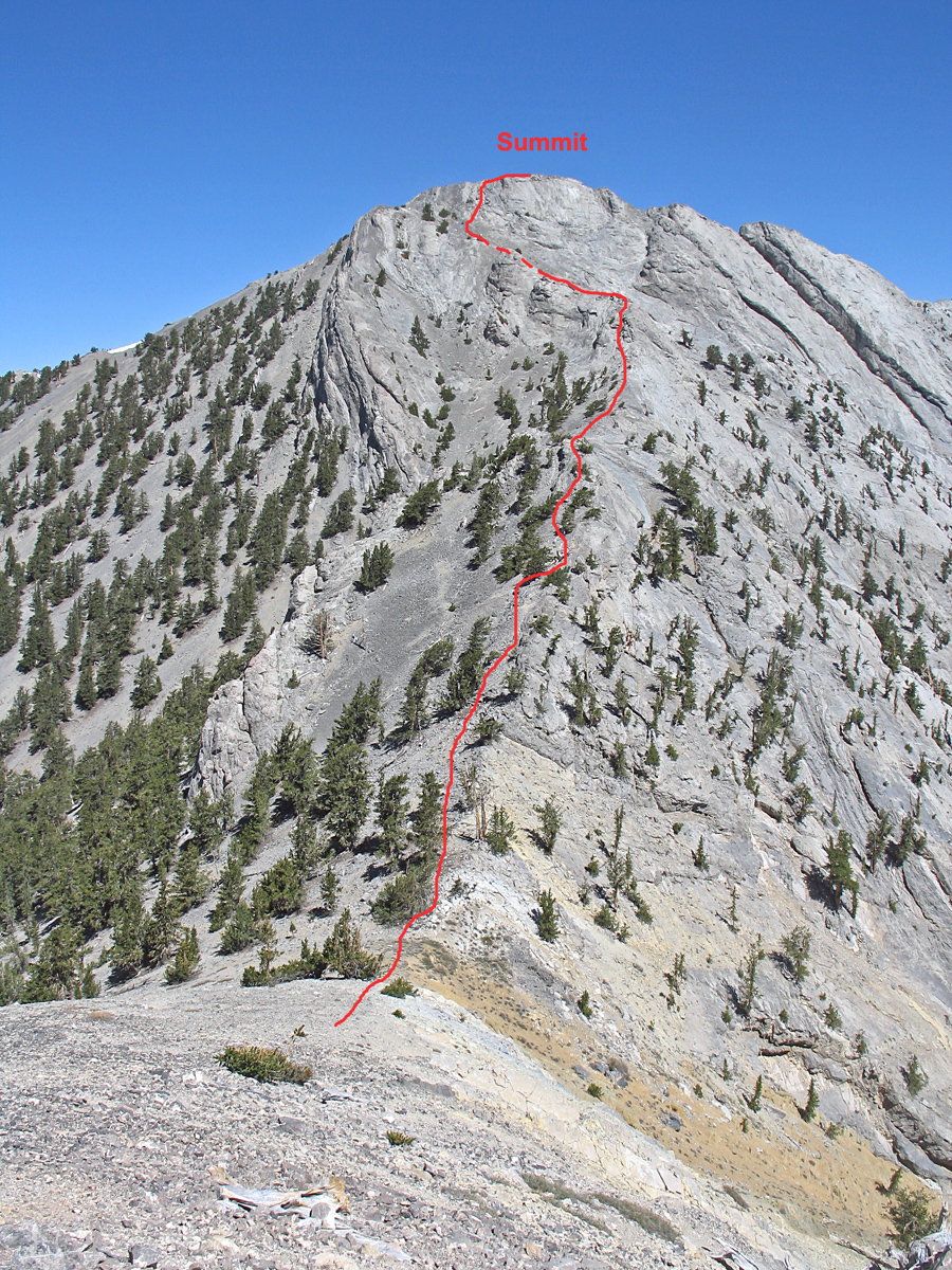
| A view looking north from about point 040 on the ridge top. (see map below) It looks intimidating, but goes easier than expected following the ridge as shown. This is a fun peak and is highly recommended. | |||||||||||||
|
|||||||||||||
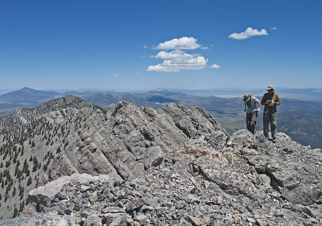
| Shelley Rogers and Mark Adrian at the summit in this view looking north. Duckwater Peak further along the ridge. | |||||||||||||
|
|||||||||||||
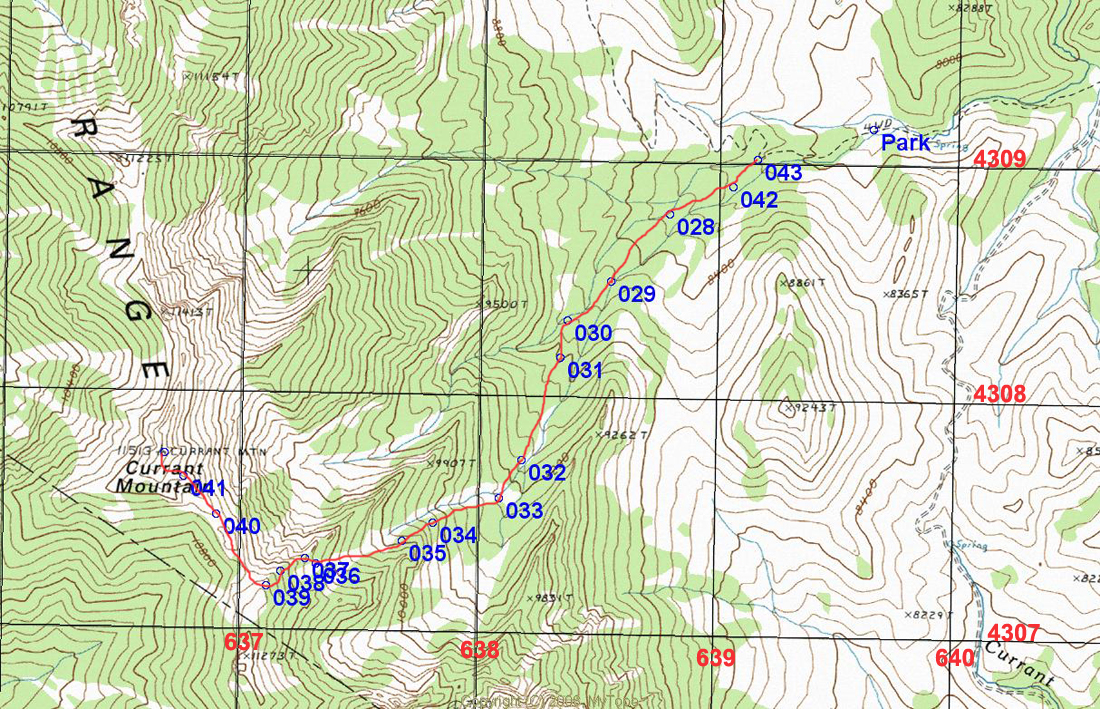
| Map showing our climbing route. A four-wheel drive vehicle is needed to get to Park where we camped at the junction of a spur road not shown on this map. Leave the jeep road at 043 and pick up an old path through the forest. Stay along the drainage heading southwest then turn right up steeper slopes along a ridge from 033 to its top at 039. You'll descend and go over a small hill to 040 where the one photo was taken. The ridge is not difficult, but has some exposure. I would not advise doing it in wet conditions or with strong winds. The UTM grid lines are using NAD27 datum in Zone 11. A waypoint file with the above points is available: Currant.gpx | |||||||||||||
|
|||||||||||||
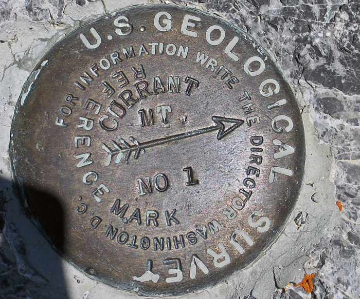
| Reference Mark #1 is near the top. The primary benchmark which was placed in 1947 could not be found. Datasheet. | |||||||||||||