Bare Mountain, Nye County, Nevada
On BLM land, Elevation = 6317 ft. (1925 meters)
Highpoint of the Bare Mountains


|
Bare Mountain, Nye County, Nevada
On BLM land, Elevation = 6317 ft. (1925 meters) Highpoint of the Bare Mountains |
|||||||||
|
|||||||||
| Near the summit of Bare Mountain we surprised about 28 sheep grazing on the slopes. At the start of our hike we spotted eight burros in the lower canyon. | |||||||||
|
|||||||||
| From the parking spot in Tarantula Canyon this is the view looking south up to Bare Mountain summit. The red line shows the hiking route. On the way down we went around the east side of the rock pyramid which was a bit less steep. This would work OK for the ascent. | |||||||||
|
|||||||||
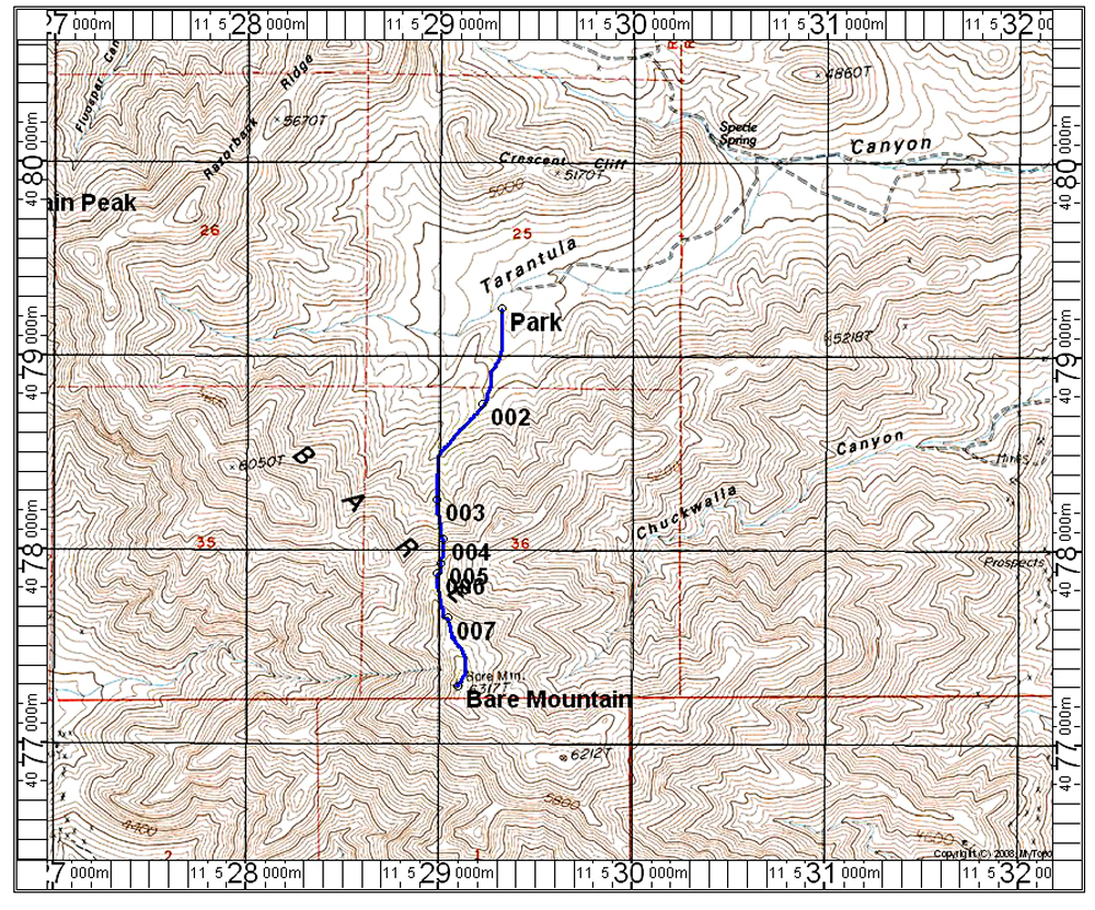
| The climbing route is shown here on this topo which has a UTM grid using NAD27. The parking area was 7.7 miles from highway 95. There is a good driving and hiking description on this peak by Dennis Poulin at the Peakbagger website. Bare Mountain route. Our route follows his description except that we parked at the circular spot he mentions which made a good campsite. The route is 3.0 miles round-trip with a gain of about 1700 feet. It took us 2 hours up and an hour and 20 minutes down with some stops for sheep and burro viewing. 4/14 RLC A GPX file of our ascent route. | |||||||||
|
|||||||||
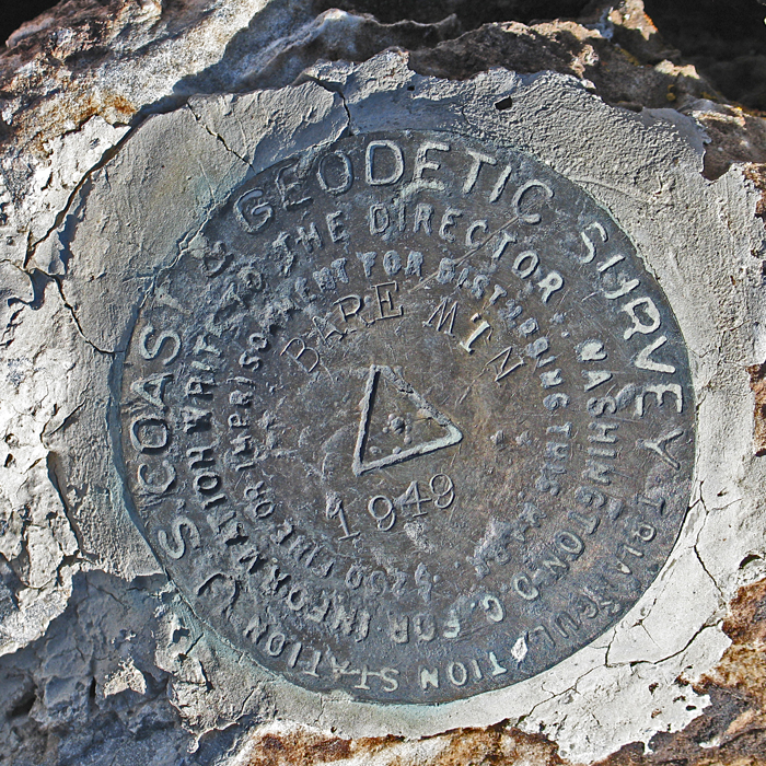
| The benchmark disk was in good shape, placed in 1949. | |||||||||