On BLM land, Elevation = 8163 ft. (2488 meters)
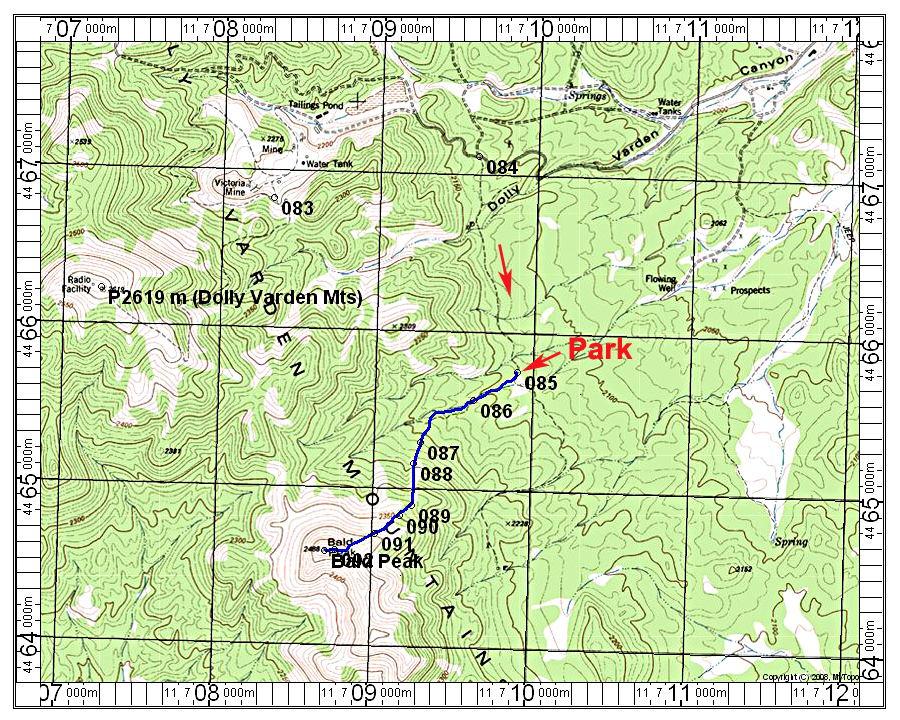
Driving Route: The drive in from the east is the same as for the highpoint of the Dolly Varden Mountains. From Alt 93 take the good dirt road going west. Along the highway it is signed "Dolly Varden" and is close to milepost 15. Set your odometer and note the following points:
0.0 at Alt 93
2.8 cross a cattle guard
4.1 another cattle guard
11.2 go left onto narrow dirt road. This is waypoint 084. There is another dirt road on the right going north. The road going south is quite good in spite of being a single dashed line. There are a few steep spots but no rock and not too badly overgrown with trees.
12.1 reach a drop off at point 085 where I recommend parking. There is no advantage to going down the hill since the Jeep track going west is overgrown and not driveable. The road does continue on south, but I didn't follow it.
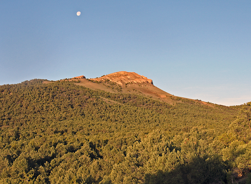
Hiking Route: Go down the hill and follow the Jeep track and horse trails west then turn up the slopes to a bare area starting at point 088. Angle across and go under a rock outcrop up to the ridge just east of the summit. It is an easy walk up the rock to the top. The route is 2.8 miles round-trip with a gain of about 1130 ft. Allow about one hour for the ascent. 5/14 RLC A GPX file is available.
Note: The start of the steep Jeep track up to Dolly Varden summit is point 083 on the map. There are no gates and in low range one can drive to the top. It is 1.9 miles to the top from 083.