Ute Mountain, 10,093 feet, (3076 meters) Taos County, New Mexico

Located on BLM Land (proposed Wilderness)

Ute Mountain is an isolated high mountain in northern New Mexico close to the Colorado border. There are no trails, but the climb is straightforward using the route shown on the above map. I recommend the driving directions in Ken Jones' report at this site: Ute Mtn. We followed them in July 2014 and found them to be very accurate. The old road from waypoints 012 to 013 is badly eroded and is not driveable.

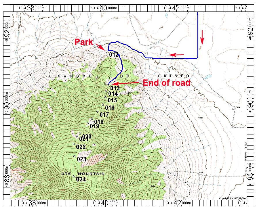
The waypoints on the above map show our climbing route which is mostly the same as what Ken Jones did. The map has the UTM grid in the margins using NAD 27. The climb took us one hour and 25 minutes to the top and is about 5.6 miles round-trip with a gain of 2400 feet. A GPS file is available for this route. UteMtn.gpx

The boulder and cairn at the highest point of Ute Mountain.