Notes on use of the California Mid section List - January 17, 2013
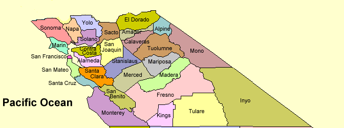
This peak list contains a comprehensive list of mountain peaks in the middle 27 counties of California shown on the map below. There are 1761 peaks with elevation and prominence values shown. All peaks down to 1000 feet of prominence are listed along with many below that value.
Elevations are from the 7.5 minute topo maps. If there is a benchmark with a data sheet then I have used the corrected VERTCON elevation provided by the USGS. Generally this will be a few feet higher than that shown on the topo map.
Prominence values are from Lists of John which I feel is an accurate and definitive source. Check out the site at: http://www.listsofjohn.com/. Some minor peaks and benchmarks do not have a prominence value and in that case they are probably below a hundred feet.
Terrain Navigator notes:
1. When imported into the program the names will show on the maps in six colors according to their prominence. This table shows the color scheme:
>5K prominence = Red
>4K prominence = Violet
>3K prominence = Green
>2K prominence = Brown
>1K prominence = Blue
<1K prominence = Black
2. If you click on the name and select "EDIT" you will see the elevation and prominence in feet. Also shown are details on how the elvation is found. Spot means a fixed number is shown on the map. BM means a small triangle is on the map and the peak has a survey disk or benchmark. Inter. means there is no value on the map and the convention is to add one-half the contour interval to the last and highest closed contour shown at the summit. This represents a good approximation.
3. If you have a newer GPS you can load the entire 1761 peaks into the unit. Older units accept only 500 or maybe 1000 waypoints. The list is generally arranged by descending prominence so you can edit the text file by deleting peaks below a certain value to shorten the list.
4. When loaded into a newer Garmin GPS such as the GPSMap 62S the notes will show up in the waypoint list. You will be able to see the elevation, prominence, elevation status and whether the peak is a Range, Hills or County high point. County high point is abbreviated: CHPT.
5. Sometimes the waypoint or marker names are too small. On the toolbar at the upper left click on VIEW and then LAYER SIZE/VISIBILITY. On that page you will see a horizontal slider bar. Move this to the right and the size of all the markers will increase.