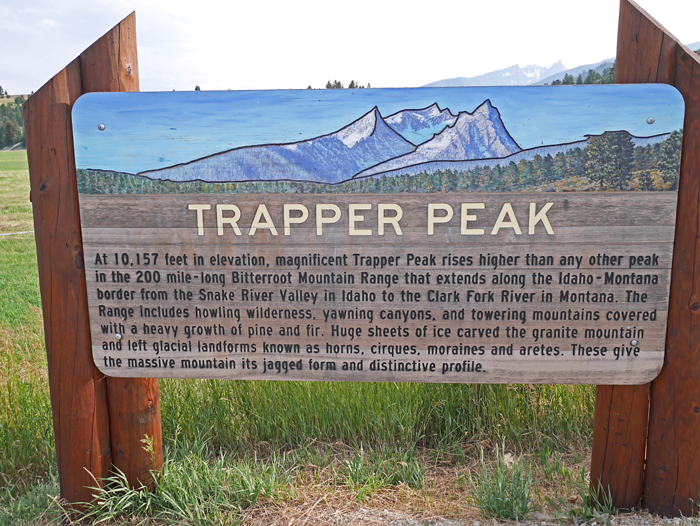
In the Bitterroot National Forest, Selway-Bitterroot Wilderness
The prominence is 3570 ft., highpoint of the Bitterroot Mountain Range
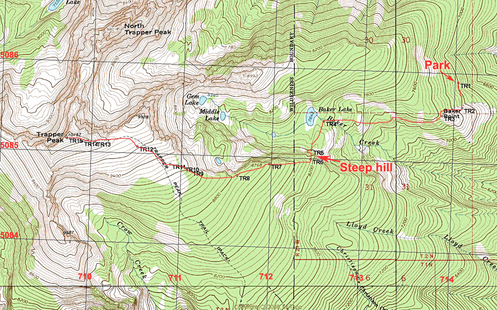
Driving Directions: From Darby go south on route 93 about 4.5 miles and turn right on West Fork Road. Follow this paved road for 7.5 miles to a road on your right at Pierce Creek. This is also 1.4 miles south of the Trapper Creek Conservation Center. UTM here is: 718080E, 5085285N, NAD27, Zone 11. If coming from the south on route 93, turn left at Conner and go 1.2 miles west to West Fork Road and turn left (south). From there it is 4.3 miles to the Pierce Creek Road. Drive up the road, number 5634, to Baker Lake trailhead. It is a good-graded dirt road with a moderate grade that most cars car make. It is about 9 miles up to the trailhead parking area.
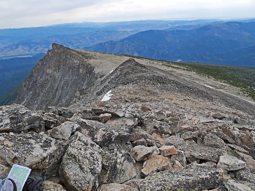
Hiking Directions: The well-used trail goes south up the ridge to a viewpoint at Baker Point then heads west up through the forest to Baker Lake, a popular destination. Just before the lake turn left near point TR4 and cross the creek. Head over to the base of the ridge to point TR5. There is a steep use trail up the slopes to the ridgetop. From there go west, mostly cross-country in a failrly open forest, all the way to point TR11 where you will reach the trail coming up from the south on a barren slope. The trail goes past a small peak of 9928 ft. then crosses talus slopes to the top. This route is 7.2 miles round-trip with a gain of about 3100 ft. It took us 3 1/2 hours to reach the top and 2 hours 20 minutes to go down. 8/14 RLC A GPS waypoint file is available for this route: TrapperPk.gpx