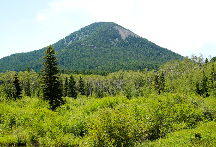
On the Rocky Boys Indian Reservation
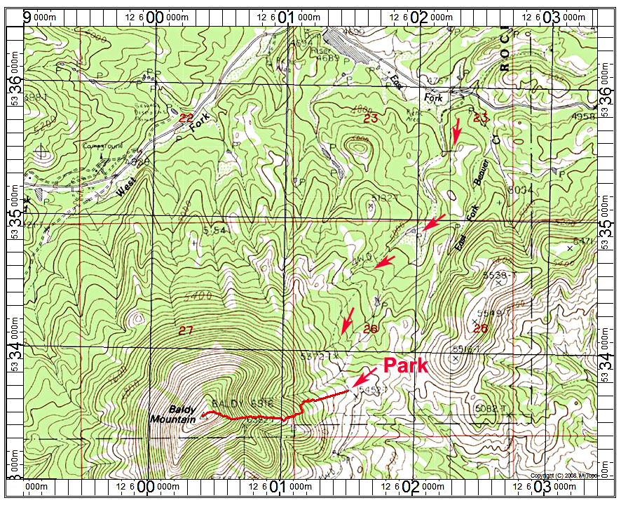
Driving Directions: From the town of Havre take route 234 south which becomes Beaver Creek Road. After about 30 miles turn left onto Warrick Road which becomes dirt in a short distance. Drive past a reservoir on your right and after 0.9 miles turn right onto a dirt track that goes by a picnic table. If it hasn't been raining you can drive this for 2.0 miles to a saddle. Park there which is near spot elevation 5452 ft. This road can be really bad if it has rained recently and we had to stop about a third of the way due to thick mud. If the surface is dry it should be drivable in a high-clearance vehicle.
Hiking Route: Go west up a track in a meadow for a 100 yards or so until the forest is reached. Look for a track heading through the woods which may be hard to follow. We went somewhat south and came to a new fence line and section corner marker. From there the trail went up steeply. We passed a number of prayer cloths tied to the trees. The summit is broad and treeless. If you can drive to the saddle as shown the route is about 0.9 miles with a gain of 1560 ft. We had to park down the road and this added at least another mile. It took us 2 hours and 10 minutes to reach the summit. We did not find a benchmark disk. Datasheet
Special Notes: You should stop at the tribal office and buy a recreation permit. The tribal elder we talked to told us about this route and did not say we couldn't climb the peak. At times in early summer there are fasting ceremonies on the summit. If there are tribal members up there I would advise not climbing the peak at that time.