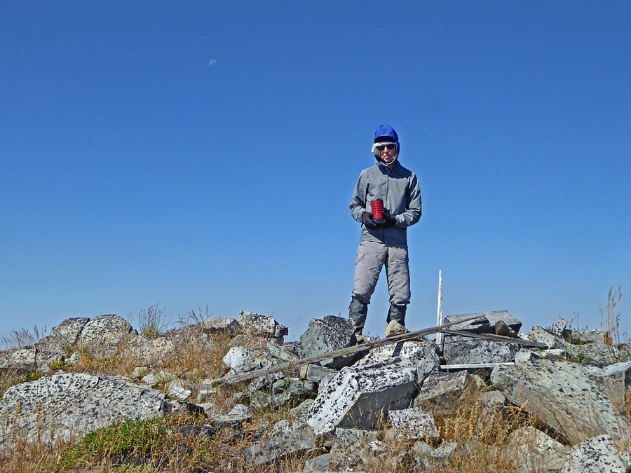
Roderick Mountain, Lincoln County, Montana, Elevation = 6635 ft.
Located in the Kootenai National Forest
|
Roderick Mountain, Lincoln County, Montana, Elevation = 6635 ft.
Located in the Kootenai National Forest |
||||||||
|
||||||||
| This is the highest point of Roderick Mountain which has the benchmark. The lookout was on a small hill 700 ft. to the southwest. A 10 ft. wood pole tower with L-4 cab was constructed in 1942. This was destroyed in about 1975. Photo on August 10, 2020. | ||||||||
|
||||||||
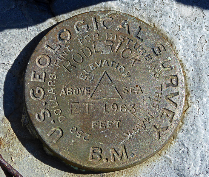
| Roderick ET benchmark was placed in 1963. Datasheet: TN0949 | ||||||||