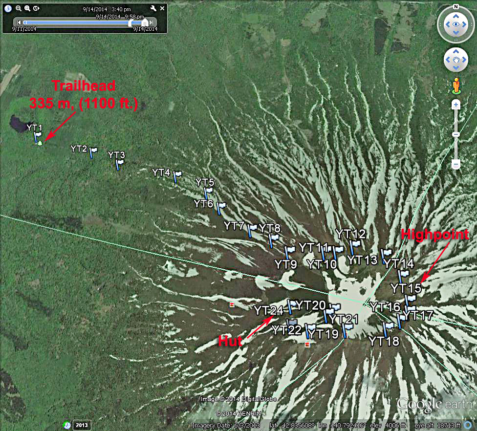
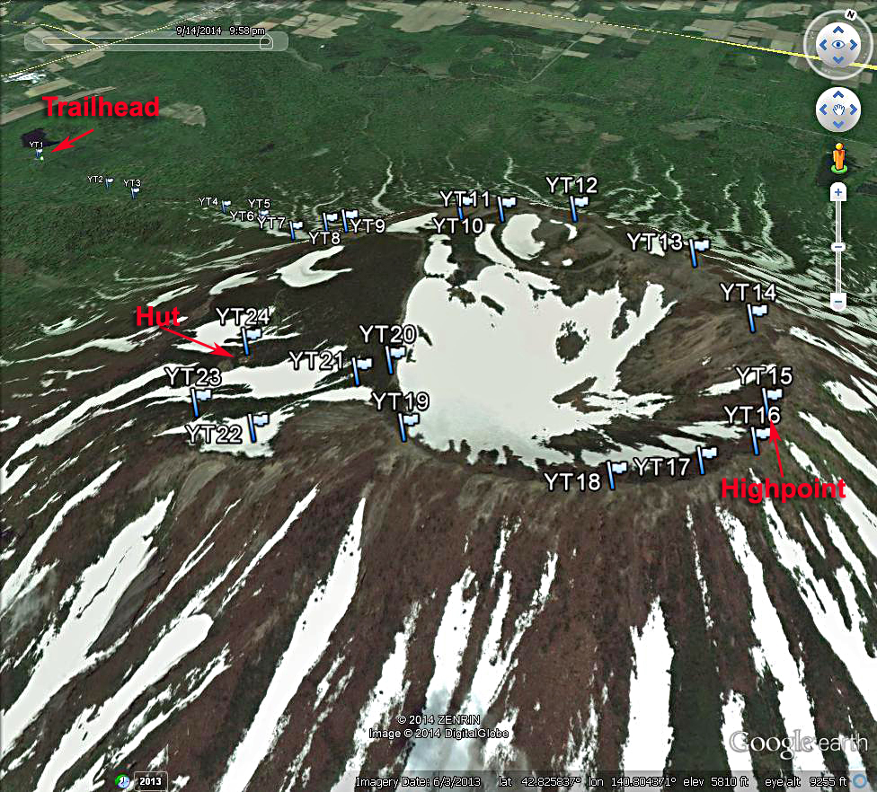
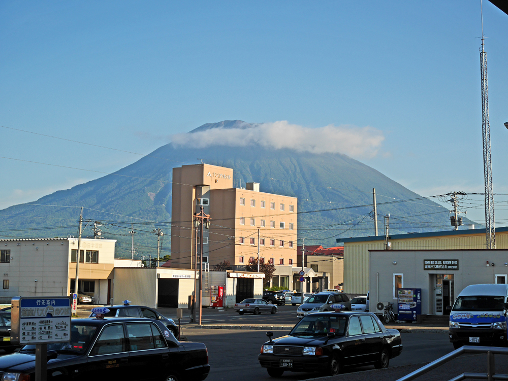
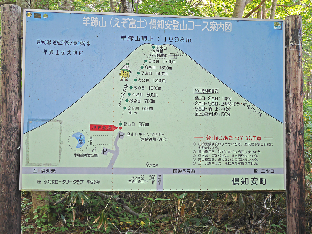
Yotei-zan, in Hokkaido, Japan

Located in Shikotsu-Toya National Park

Elevation = 6227 ft., 1898 meters

A Google Earth image of the popular Kutchan climbing route on the west side of the mountain.The waypoints shown are available as a .gpx file which can be loaded into a GPS receiver. Yotei-zan.gpx Yotei-zan_route.gpx There is a well-used trail all the way with station markers at various intervals shown on the photo below. It is steep in places with a lot of elevation gain. The total to the highpoint is 1550 m (5100 ft.). At point YT9 go left for the summit. The crater rim is reached at YT11. Continue clockwise around the rim to the highest point at YT15. We continued around the rim which is more difficult with hands-on scrambling over rocks. The route is marked with white paint. At YT20 turn left to go to the hut. Going to the right would work with some elevation gain back to point YT10. At YT23 go right to the hut at YT24. You can continue along a trail that will go back to the ascent route joining at YT9. The ascent took us 4 1/4 hours to the top. Starting at 8:00 we were back at the trailhead at 4:30PM. The ascent and loop route around the crater as shown is 12.8 km (7.7 mi.).
A closer Google Earth view of the crater. We did a clockwise loop going past the hut.
Yotei-san looms over the town of Kutchan. View looking southeast from the train station. Climbers at the summit post. It was a busy day with a lot of Japanese doing the peak. We didn't see any westerners all day.
A sign at the trailhead showing the station markers on the trail and their elevation. The trailhead is reached by a paved road which goes to the main highway, route 5, coming south from Kutchan. There is water, restrooms, and a camping area at the trailhead.
Other sources of information about the mountain. The report by Rob Woodall on Peakbagger.com was very helpful. Yotei-zan by Rob Woodall.

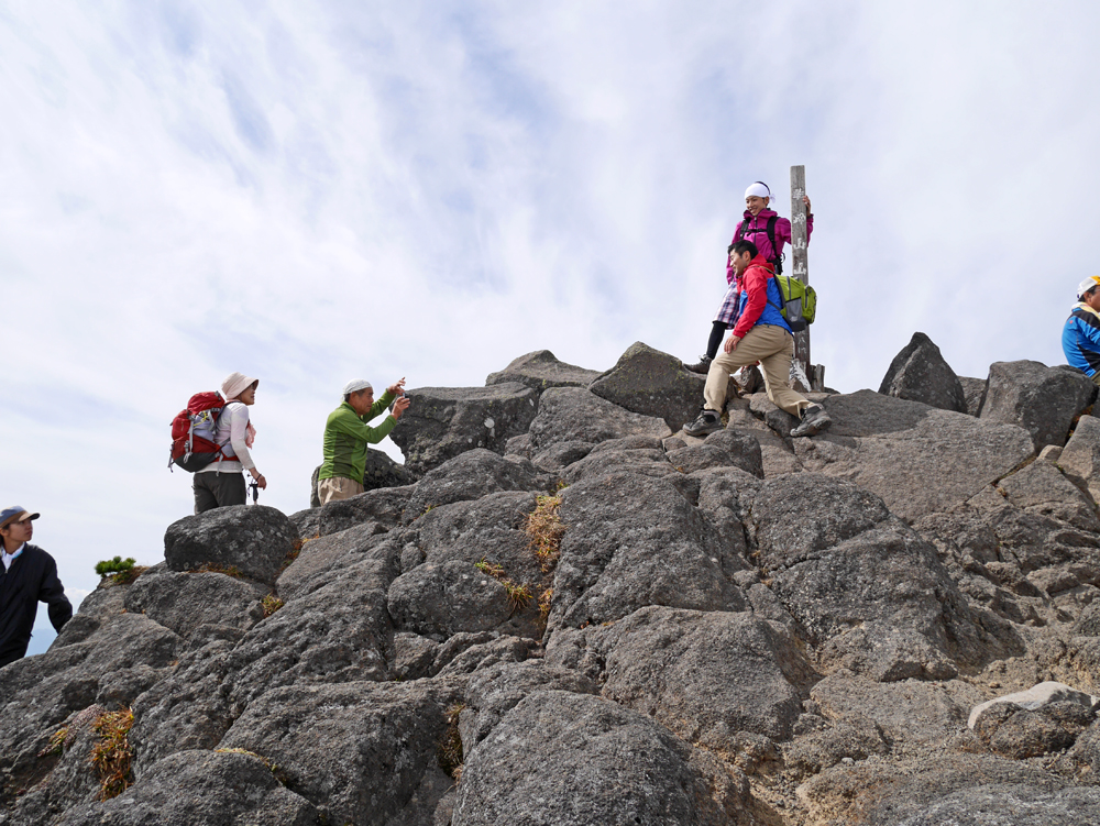
Yotei-zan is one of Japan's top 100 peaks called The Hyakumeizan. There is a good website with reports on most all of the 100. Yotei-zan at Japanhike.

Transportation to the Mountain - There are buses about every half hour going south from the Kutchan train station to the Hirafu intersection where you get off and walk the road about 1.6 km (1 mi.) to the trailhead. The first one is at 8:00. There are return buses up to 7:00PM and later so there is plenty of time to do the climb and return to Kutchan. We stayed at the Owashi Lodge in nearby Niseko village at the base of the ski area. We wanted to get an early start so hired a taxi which cost 2150 Yen to the trailhead. At the end of the day we called the lodge using our rented cell phone and they called the taxi. The same driver came and took us back to the lodge. The Owashi Lodge is a good place to stay and the rate was reasonable at 2500 Yen per person per night. Owashi Lodge There are buses to Niseko from the train station for 360 yen.