Mt. Fuji, highest mountain in Japan
Yamanashi Prefecture, Fuji-Hakone-izu National Park
Elevation = 12,387 ft. (3775.63 meters)

|
Mt. Fuji, highest mountain in Japan
Yamanashi Prefecture, Fuji-Hakone-izu National Park Elevation = 12,387 ft. (3775.63 meters) |
||||||||||||||
|
||||||||||||||
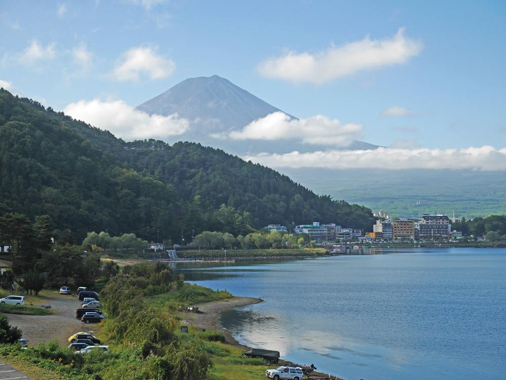
| Looking south at Mt. Fuji across Lake Kawaguchiko. It was a fine, clear day in late September 2014 when this view was taken. My friend Shelley Rogers climbed the mountain that day on the Yoshida Trail from the end of the paved road at Stage 5. Elevation there is 7562 ft. (2305 meters) which means there is a 4826 ft. (1471 meters) gain up to the summit. The route is 3.9 miles (6.3 KM). It took Shelley 4 hours and 20 minutes to reach the top. At this time of year all the shops are closed and there were very few climbers doing the peak. | ||||||||||||||
|
||||||||||||||
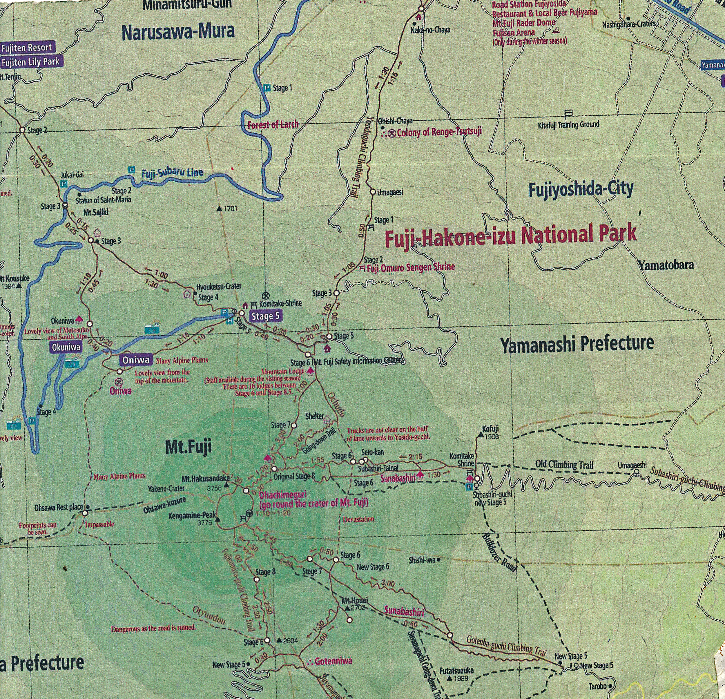
| A portion of a map available at the Kawaguchiko train station which shows the routes up the mountain. The paved road to Stage 5 is shown as the thick blue line. There is a regular bus service from the train station, but in order to get an early start Shelley had a taxi take her up there at 6:00AM at a cost of about $60 USD from our hotel on Lake Kawaguchiko. Going down she was able to take the regular bus which was only 1540 Y or about $14.00 USD. There are several other routes to the top including the Fujinomiya trail on the south side and the Sunabashiri trail which goes east from the summit. The Gotemba trail goes mostly southeast from the top. Each trail has a stage 5 at the starting point. | ||||||||||||||
|
||||||||||||||
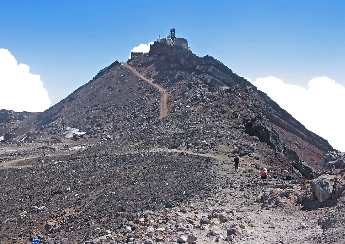
| The highest point is around the crater rim on the west side. On top is an old abandoned radar station. The map shows that this small peak is called Kengamine Peak. This photo and the next two were taken on a climb of the mountain on August 14, 2007. | ||||||||||||||
|
||||||||||||||
| That is Ed Herrman on the right and me on the left at the monument at the highest point. | ||||||||||||||
|
||||||||||||||
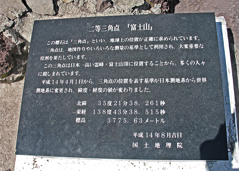
| I can't read Japanese, but I think the stone monument shows the latitude and longitude and the elevation of 3775.63 meters or 12,387 ft. | ||||||||||||||