Smoky Mountain, Cassia County, Idaho
Elevation = 7580 ft. (2310 meters)
Most of the mountain is BLM land
The route is about the same as that described in a trip report by Rick Baugher on Lists of John.
|
Smoky Mountain, Cassia County, Idaho
Elevation = 7580 ft. (2310 meters) Most of the mountain is BLM land |
||||||
|
||||||
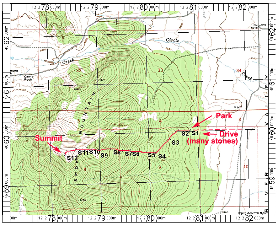
| Smoky Mountain is a fairly easy off-trail hike near the City of Rocks Reserve. On a clear day when there isn't smoke from forest fires the views north over the City of Rocks is outstanding. To start the hike go south on Almo Road to the junction with the road going west into the City of Rocks. From here go south on Lynn Road. Stay right at a junction after 1.0 miles. On the south side of fenced-in private property at 1.6 miles there is a dirt road going west. Turn right (west) and follow this road which gets quite rocky for about 0.6 miles to its end in the forest. High-clearance is needed on this road. Look for an open path at S1 heading west and follow this to a fence line at point S2. Go along the fence heading southwest to point S4. From here you want to go due west through the forest. There is no trail here although some topo maps show one. The forest is not difficult to get through. At about S9 there is a more open area to the summit. The route is 3.8 miles round-trip with a gain of close to 2000 ft. 8/15 RLC A gpx file is available with the points shown in it. SmokyMtn.gpx The above map has a one-kilometer UTM grid using NAD27.
The route is about the same as that described in a trip report by Rick Baugher on Lists of John. |
||||||