Scott Peak, Lemhi County, Idaho
In the Targhee National Forest, Elevation = 11,393 ft. (3472 meters)

|
Scott Peak, Lemhi County, Idaho
In the Targhee National Forest, Elevation = 11,393 ft. (3472 meters) |
|||||||||
|
|||||||||
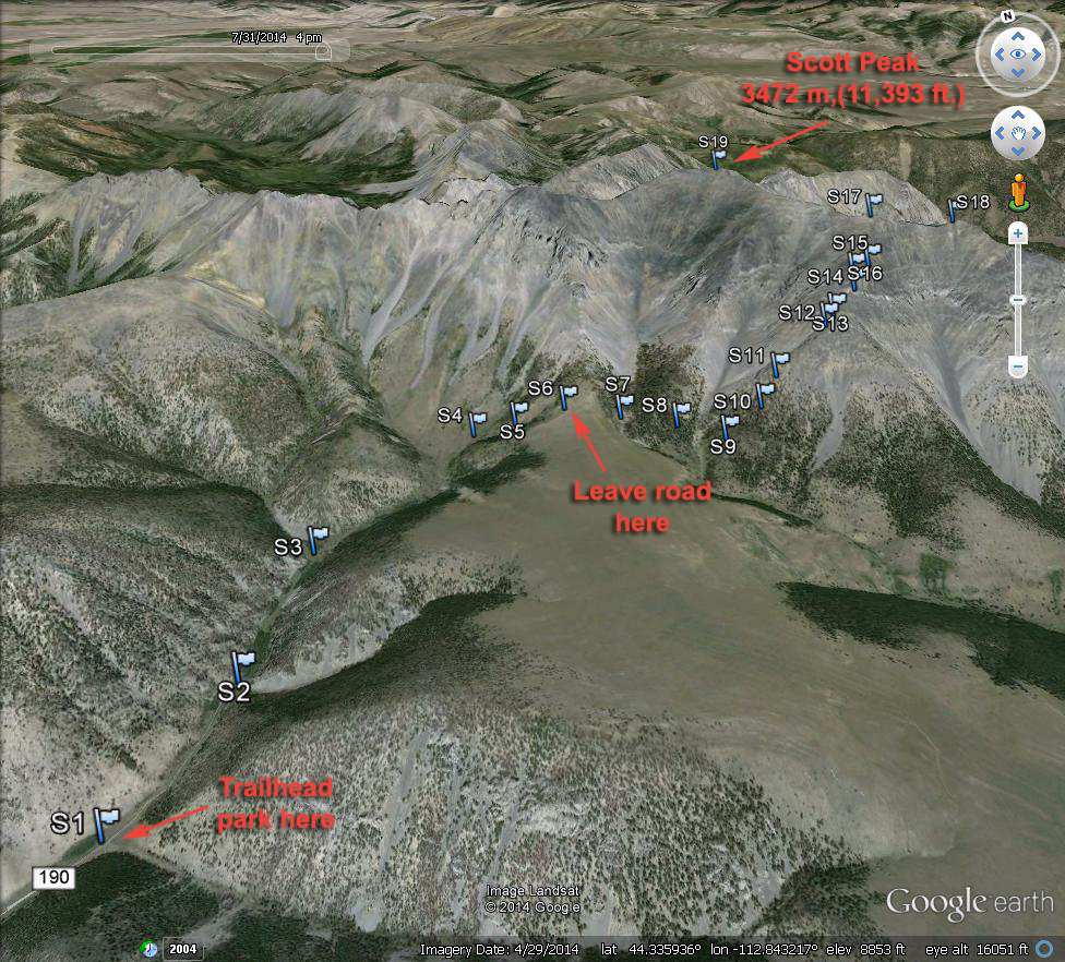
| A Google Earth view looking north of the route to Scott Peak. You can drive to point S1 at spot elevation 7698 ft. The road to here is reasonable and four-wheel drive is not needed, but high-clearance is advised. There is a wide, flat area at S1 good for camping. I recommend trip reports by Edward Earl and Ken Jones on Peakbagger for a description of the drive in. Edward's report. Ken's report. From point S1 start hiking on a road up the canyon. At S3 go right where the canyon divides. You will probably find cattle along the way. The road turns into a trail further on. Go right up a steeper canyon to a higher plateau. At S6 Leave the trail and head south going up and down across two canyons until you reach the ridge at S9. From here go left up the slopes. When the forest runs out you will encounter loose talus which is very tiring to go up as you slip and slide. It is like that most of the way to Webber Peak at S17. The next image gives a closer view of the top. | |||||||||
|
|||||||||
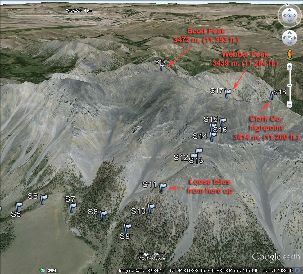
| A closer Google earth view of the upper part of the route. From Webber Peak it is an easy stroll north along the ridge about 0.8 mile to Scott Peak. While you are at Webber Peak you might want to go to the highpoint of Clark County which is 0.3 mile southeast of Webber. There is a bit of rough ridge on this section. | |||||||||
|
|||||||||
| This is a topo map of the route. A UTM grid is shown using NAD27. A waypoint file is available for loading into a GPS receiver. ScottPeak.gpx The route to Scott Peak is 5.0 miles one-way with a gain of about 3700 ft. We needed five hours to get to Webber Peak. It was slow and exhausting due to the loose footing on the upper ridge. | |||||||||