Volcan Santa Maria, Guatemala
The elevation is 3772 meters (12,375 ft.)
|
Volcan Santa Maria, Guatemala
The elevation is 3772 meters (12,375 ft.) |
|||||||||||
|
|||||||||||
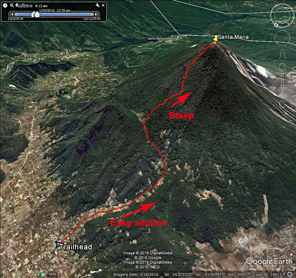
| A Google Earth image of Santa Maria showing our hiking track. The route is about 3.5 miles with an elevation gain of 4135 ft. A GPX track file for this route is available. Volcan Santa Maria.gpx | |||||||||||
|
|||||||||||
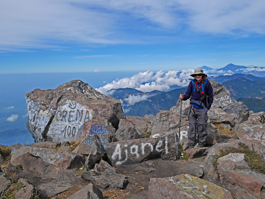
| Shelley Rogers at the summit. The view is looking north and Tajumulco can be seen. It is the bigger peak on the right. | |||||||||||
|
|||||||||||
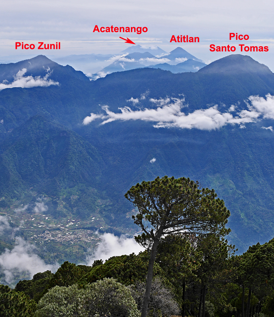
| Looking south from the summit one can see several of the big volcanoes in Guatemala. | |||||||||||