 |
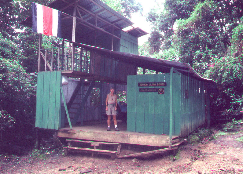 |
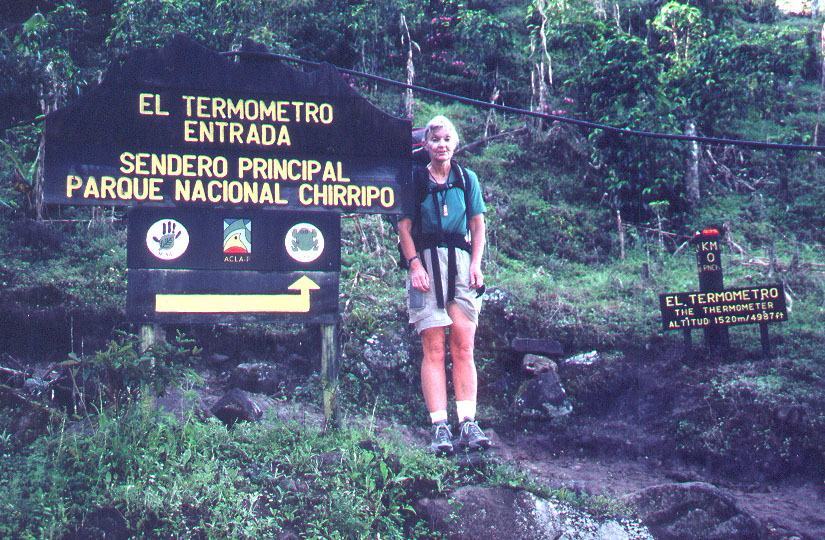
| Shelley at the start of the trail. Note km 0 sign on right. There are signs like this every kilometer to the hut. | The Llano Bonito shelter at about 7.5 km. There is potable water here and two pit toilets. |
 |
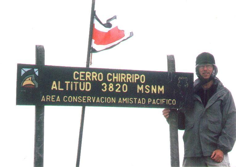 |
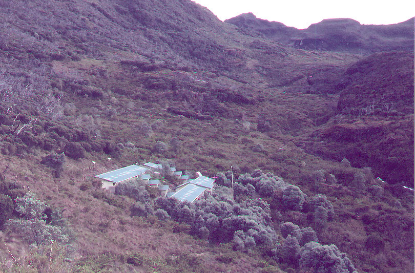
| The large mountain hut at 3390 meters (11,130 ft.) The summit is behind the ridge in the back and is not visible from here. | Richard at the summit. Cold and windy that day! The elevation as shown is 3820 meters (12,533 ft.) |