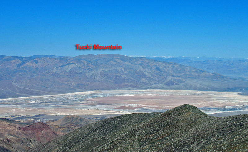
At the north end of the Panamint Range in Death Valley National Park
In Death Valley National Park. No permit is required for day hikes in the park. Information on back country camping and regulations is available from the Park Superintendant, Death Valley, Ca. 92328. (760) 786-2331
The mountain is usually climbed from the south and the starting point is reached by driving in on a 4WD road that goes by Telephone Canyon. At Emigrant Junction, on route 190 about 9 miles south of Stovepipe Wells, take the Emigrant Canyon road heading south for 1.5 miles. On the left just before the road turns to the left there is a dirt track that can be difficult to see. Reset your odometer and follow this track for about 100 ft. across a rough wash and then the road turns a sharp left (N) at a bluff. After a few hundred feet you'll climb out of the wash the road improves. At 1.6 miles it turns SE into a canyon and at 2.45 miles there is a sign on the right "Road Closed" marking the entrance to Telephone Canyon. Stay left and follow the road until a fork is reached at 9.4 miles. There is parking here for those not wanting to take the left fork and drive up the steep, rocky hill to get closer to the mountain. Use 4WD low range to climb the hill and after 0.7 miles there is parking on top. The road continues down a really steep slope into a valley, but I recommend starting the hike from this point. Hike across the valley and head NW up over three ridges before the cairn on the summit comes into view. The hike is 6 miles roundtrip and takes 2 3/4 hours to reach the top and 2 1/4 hours to return with an elevation gain of about 2200 ft. counting the ridges. The "Road and Peaks Guide" of the Desert Peaks Section has more information about the mines and cabins in the area. 9/94 RLC