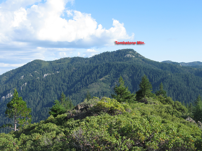
Tombstone Mountain, Shasta County, California
Located in the Shasta-Trinity National Forest
Elevation = 5613 ft. and the prominence of the peak is 2153 ft.
Revised after a successful climb September 28, 2013
|
Tombstone Mountain, Shasta County, California
Located in the Shasta-Trinity National Forest Elevation = 5613 ft. and the prominence of the peak is 2153 ft. Revised after a successful climb September 28, 2013 |
|||||||||
|
|||||||||
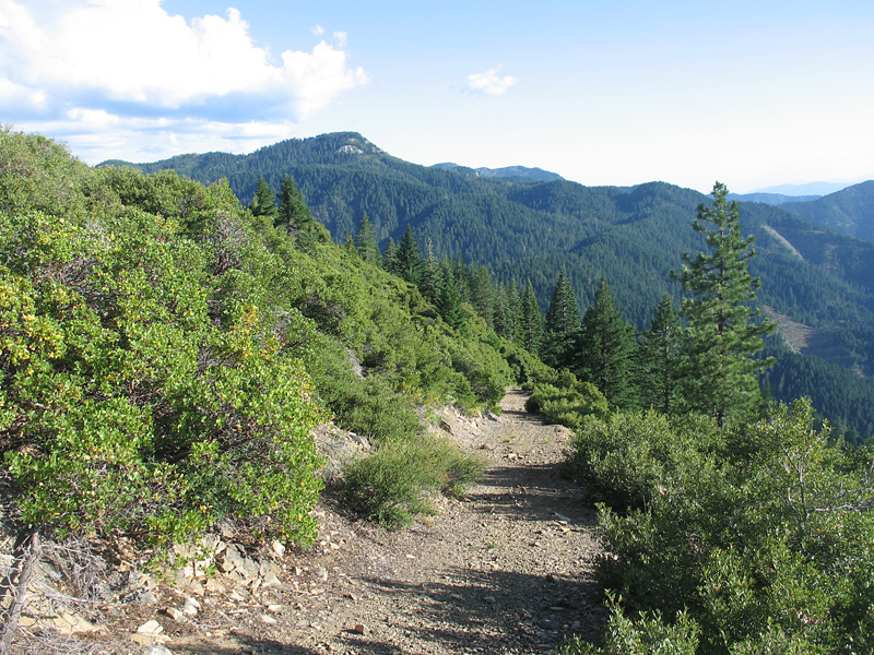
| Looking south at Tombstone from the Jeep road near peak 4881 ft. It was a 2.1 mile drive with several steep sections to get here. Four-wheel drive low-range needed. To get to the Jeep road take exit 726 on I-5 and go east crossing the river and go south on Riverside Road for about 1.1 mile to 38N23, Girard Ridge Road. Drive up this good dirt for for 5.3 miles to a junction at the ridge top and turn right. After 0.9 miles there is a junction with a locked gate on the right, point 039 on map. On the left is a borrow pit where one could camp. In the center is the narrow Jeep road going up a steep grade. This is the start and there were no gates on this route. | |||||||||
|
|||||||||
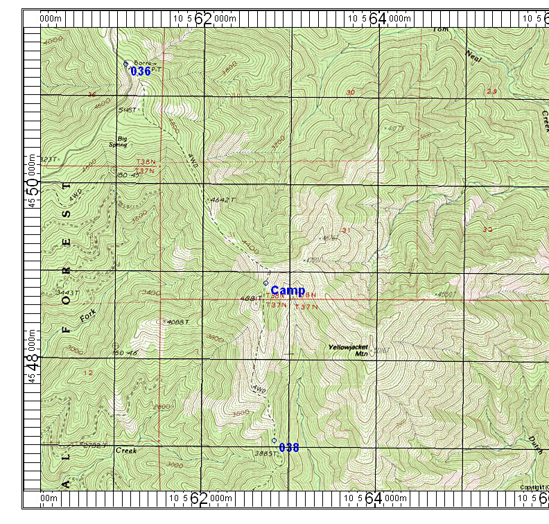
| The Jeep road descending from the point where the first photo was taken. There is a 1000 foot drop to the low point, however the road is blocked by a large fallen tree at point 038 shown on the map below. This is just before the low point. I didn't like the looks of this road so I camped at the point shown at 4772 feet. | |||||||||
|
|||||||||
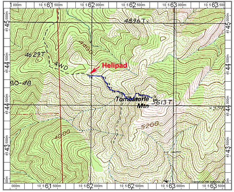
| The map below shows the Jeep road from the blockage at point 038 to the summit. The hike from CAMP to the helipad at point 039 is 3.8 miles with a drop of 1000 feet and a gain of 900 feet. It is another 0.8 miles with 1000 feet of gain to the summit. Point 041 is as far as I got when I was stopped by heavy brush. The hike from CAMP to the helipad at 039 took me two hours. | |||||||||
|
|||||||||
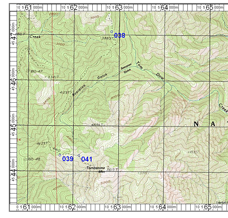
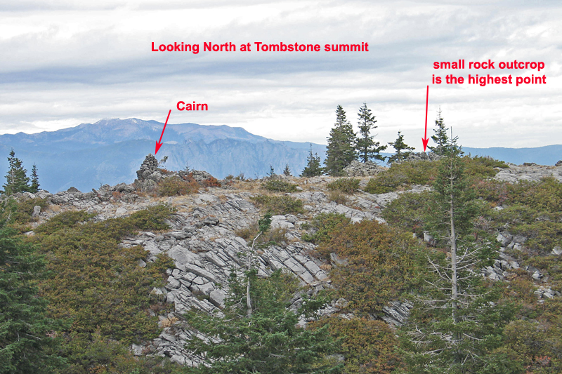
| In late September 2013 I returned to try again, this time with helpful advice and waypoints from Adam Helman who had done the peak a few days before. Since I was driving a rental car I could not do the Jeep road so I started hiking from the borrow pit, point 036 on the first map. I started at 8:05 and made good time in cool weather. I reached the camp spot in one hour and made it to the Helipad at 10:45. There were two ATV's there and I had noted their tracks on the way in. They were able to go under and around the many fallen trees which would stop a regular vehicle. The map below shows waypoints I took on the climb from T4 at the Helipad to T18 at the top. The old trail is heavily overgrown from T5 to T6 and it is necessary to just push on through. Eventually parts of the trail begin to appear at T6. At T9 I left the trail and headed up the steep slope staying on scree as much as possible to avoid the brush. It took 1 1/2 hours from the Helipad to the summit. I stayed about one-half hour on top and left a better register in the rocks at the highpoint which is about 20 feet east of the cairn. I agree with Andy Martin who noted in the old register that the mound to the south is about one to two feet lower. I left the top and hiked with only a few bearks all the way back to the car, arriving at 4:45. It had been almost 9 hours and I was really tired and camped there. I suggest loading in the GPX file to your GPS to help in finding the route through the brush and up the slope. Tombstone GPX file. In this file the borrow pit is T1, CAMP is T2, the big fallen tree is T3 (old 038). P.S. I did meet a father and son with their friend on ATV's on the way back. They live in Dunsmuir and use the road for hunting and endevour to keep it cleared for ATV's. They were quite suprised to see a solo hiker in there. | |||||||||
|
|||||||||
|
|||||||||