Thunder Mountain, 13,550 feet, (4130 m) Tulare County, California

Located on the Kings Canyon and Sequoia National Park boundaries

A view looking north at Thunder summit from a gap in the ridge. From here the route is usually a roped class 4 climb up to the summit block. A climber is shown in a slot getting close to the top. The peak is a Mountaineer's Peak on the Sierra Club, Sierra Peaks Section List. Photo taken August 1996. There are a number of reports available on the peak: Summitpost article on Thunder Mountain

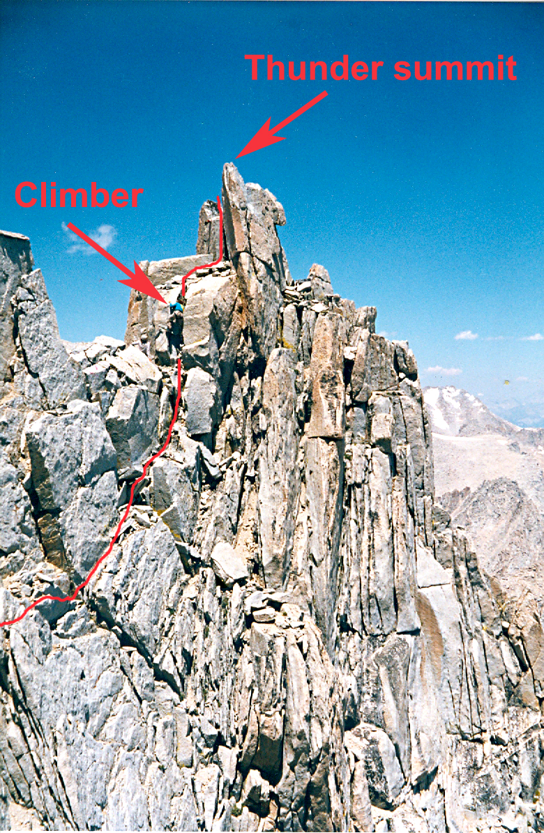
Bob Burd has quite extensive reports of two climbs that are worth reading.

Bob Burd's report from 2008

Bob Burd's report from 1999

The peak was named by George R. Davis, USGS, in August 1905 when he made the first ascent and placed a benchmark on the summit. I didn't make the summit, but there are no reports of a benchmark disk on top. There is usually a register.