Pyramid Peak, 6707 ft. (2044 m), Inyo County, California
Highpoint of the Amargosa Range, Funeral Mountains in Death Valley National Park

|
Pyramid Peak, 6707 ft. (2044 m), Inyo County, California
Highpoint of the Amargosa Range, Funeral Mountains in Death Valley National Park |
|||||||||||
|
|||||||||||
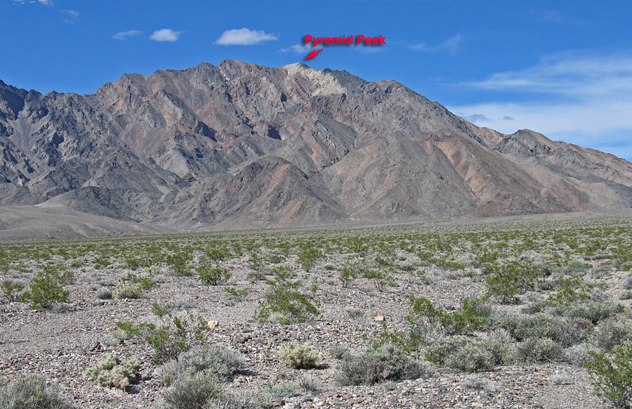
| A view of the south side of Pyramid Peak from highway 190 at the start of the climb. The peak has a prominence value of 3723 ft. Photo taken April 2, 2013. | |||||||||||
|
|||||||||||
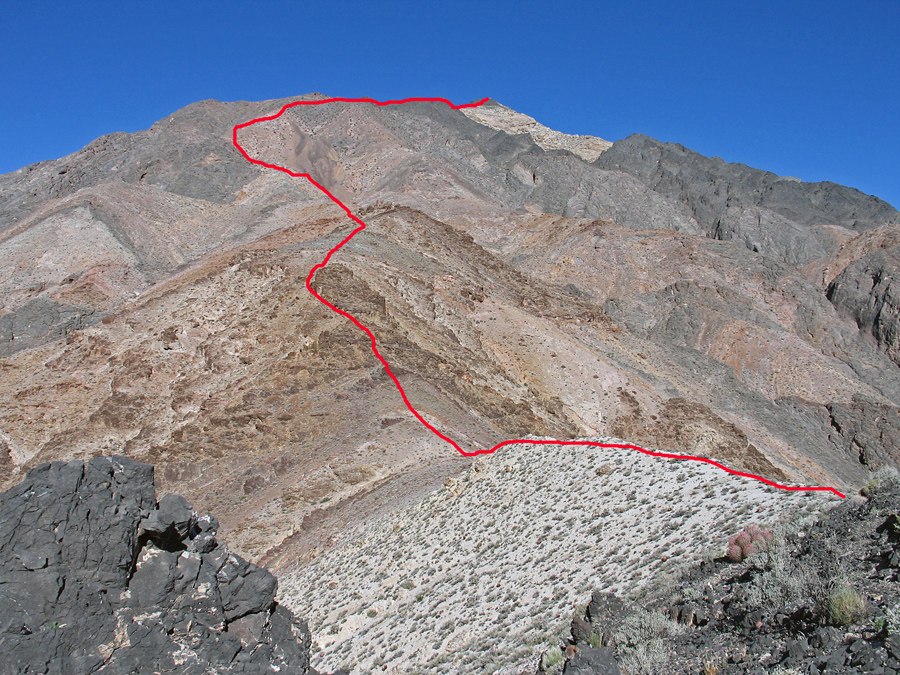
| A view looking west from point 034 shown on the topo. The approximate route is shown. This is one of the harder climbs in the Park. Our group took 4 hours 15 minutes for the ascent and 2 hours 50 minutes to descend. | |||||||||||
|
|||||||||||
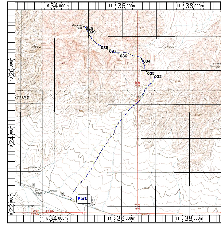
| The route shown on the topo is about 11.2 miles round-trip with a gain of 3800 feet. The UTM grid is shown using NAD27. Park just past the 3000 foot sign on highway 190. | |||||||||||
|
|||||||||||
| The primary benchmark at the summit which was placed in 1949. Datasheet GS0899. | |||||||||||
| In Death Valley National Park. No permit is required for day hikes in the park. Information on back country camping and regulations is available from the Park Superintendant, Death Valley, Ca. 92328. (760) 786-2331 | |||||||||||