On BLM land, Elevation = 3840+ ft.
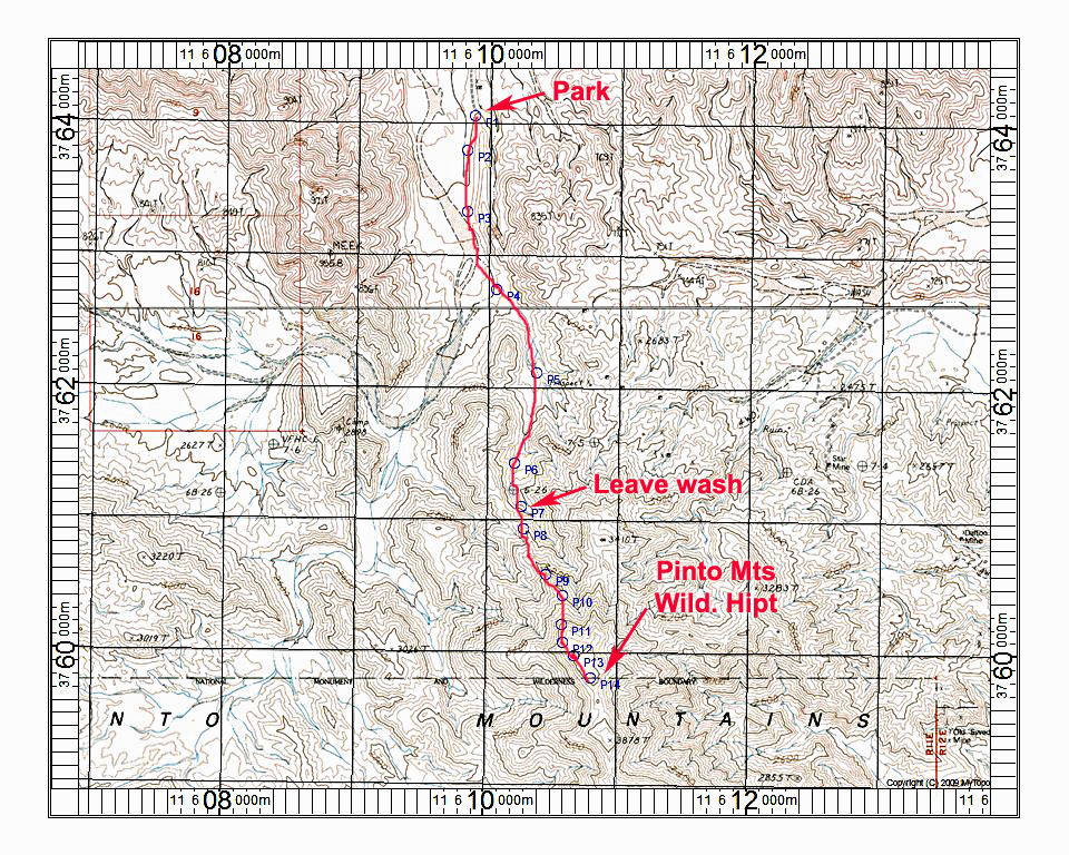
Driving Directions: From Twentynine Palms drive east on route 62 for about 15 miles to milepost 48. On the south side at MP48 is callbox number 62-482. Continue 0.3 miles further east and turn off right (south) onto a wide, cleared area. Go straight south and pick up a dirt track the goes over the west side of a low hill. Follow this track which gets quite sandy and 4wd is needed. After about two niles the road goes up on a rocky plateau for about tow miles. At 3.9 miles you will drop into a wash close to Humbug Mountain. The route follows a sandy wash to join east-west roads south of Imperial Mine at 5.0 miles. Turn left and go a hundred yards of so then turn right (south) and follow the rocky route to the Joel Mine area reached after 7.6 miles. Close to the Joel Mine take a road right and then left passing by a concrete pad that looks like a guzzler. You will be able to drive another 0.9 miles to the road end on a rocky bench which is point P1.
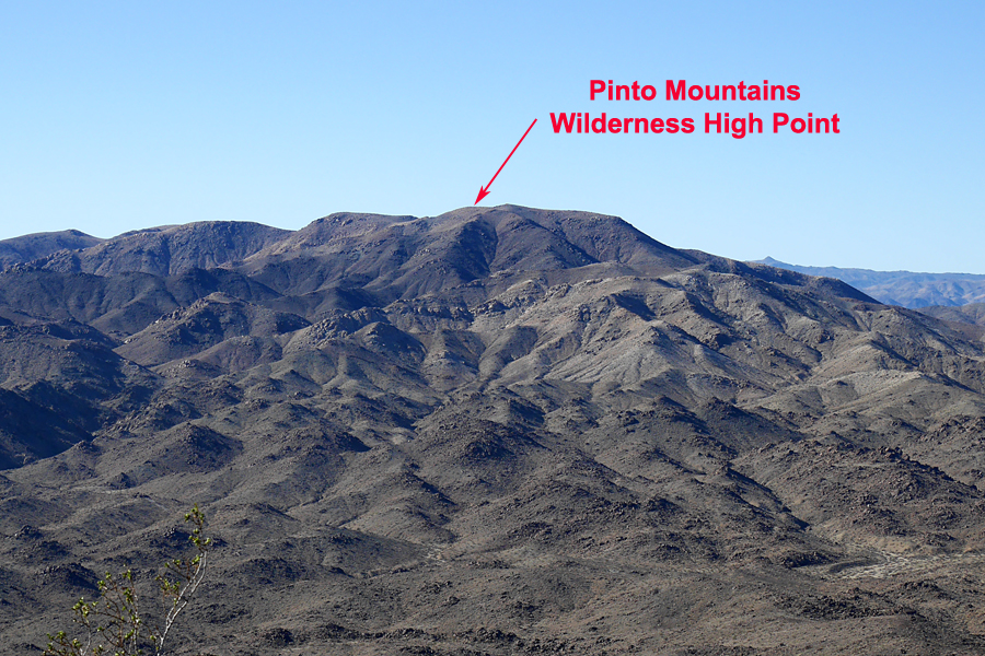
Hiking Directions: Go south along the bench then drop into the wash. At P4 go left where the wash divides into two branches. Continue to point P7 where you want to leave the wash and head up the ridge. The ridge is mostly easy, but does have larger boulders near the top. An antenna for a seismic station will come into view. The wilderness high point is on higher ground further right and south. There is a cairn and register. This route is about 6.4 miles round-trip with a gain of 1500 ft. It took me two hours 20 minutes to the top. 2/16 RLC A GPS waypoint file is available for this route: PintoWldHpt.gpx