Mount Pinchot, Fresno County, California

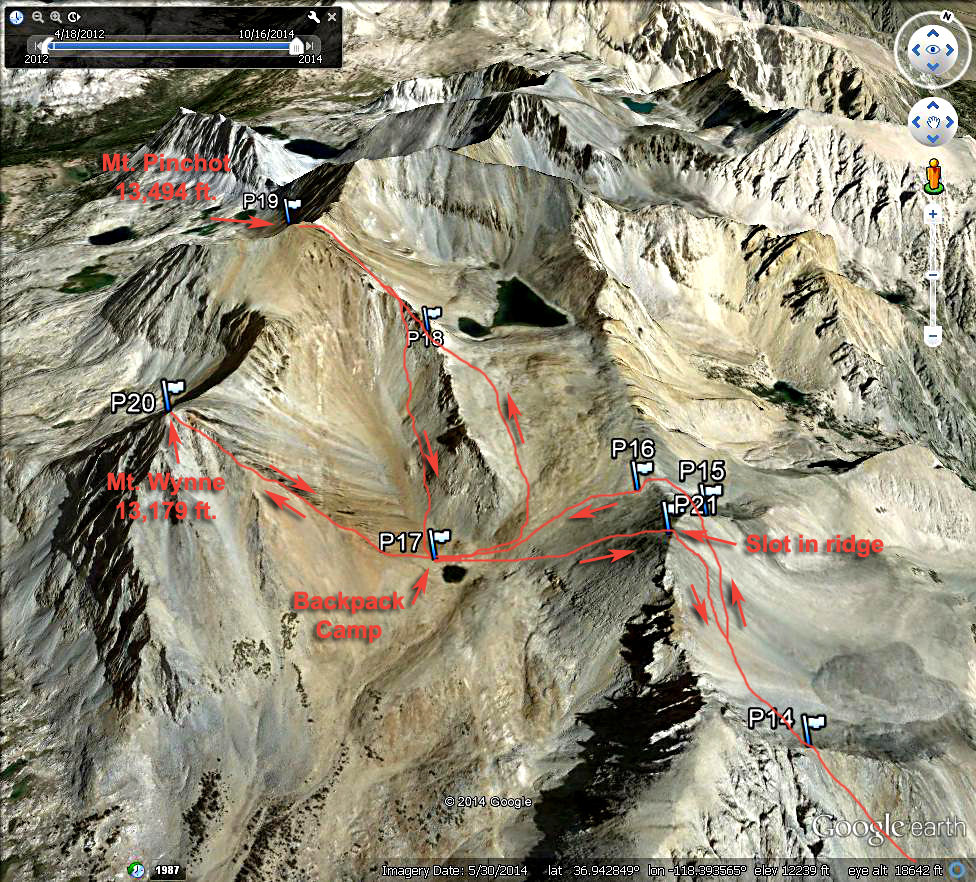
In Kings Canyon National Park, Elevation = 13,494 ft. (4113 meters)

A topo map showing the hiking route up Armstrong Canyon and over the ridge to access Mt. Pinchot and Mt. Wynne. I drove the four-wheel drive route on Forest Road 12S01 to the canyon. I car camped at point P3 shown above. One could drive a bit further to a nice campsite in the trees at P5. There is a narrow section at P4 that may be trouble for full size pickups. The road lower down is a challenge too and I note some tough spots on the Google Earth images below. The map has the UTM grid using NAD27 in Zone 11.

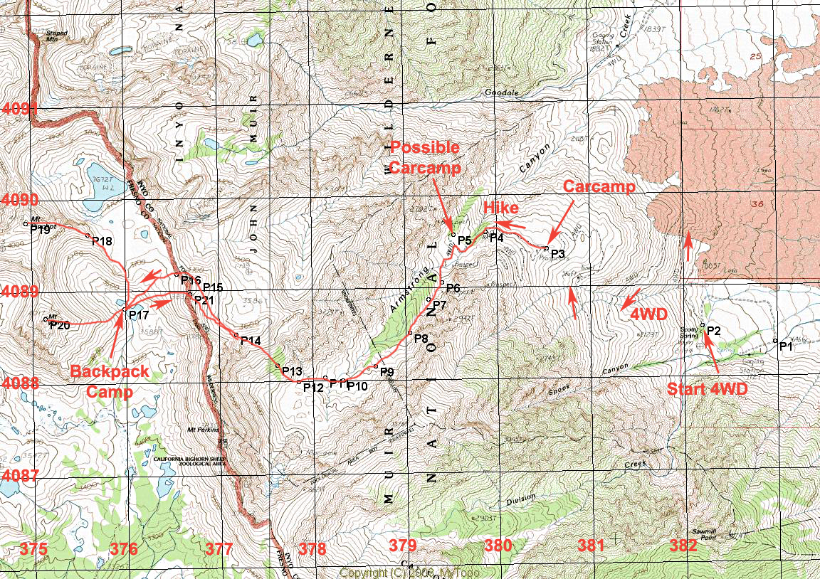
Driving Directions: On route 395, about 8.5 miles north of Independance turn left onto Black Rock Spring Road. Note the following mileages from here:

At 0.8 miles go right on Tinemaha Road
At 2.0 miles go left on Division Creek Road.
At 3.5 miles the road turns to dirt at the powerhouse.
At 4.0 pass the Sawmill Pass trailhead.
At 5.5 turn right onto 12S01. Go straight at 5.7 and left at 5.8.
At 6.1 there is a camp area on the left. The road curves south and makes a switchback at 6.5 miles. Four-wheel drive, high-clearance is needed from here on. There are some narrow spots and I don't advise using a full-size pickup.

At 7.5 there is a sharp switchback left on lava pebbles.
At 8.5 there are some rocks at a right turn.
At 10.0 go right to a plateau to find a good campsite (P3). Take the middle road to continue into the canyon.
At about 10.7 miles there is a junction. Go right to a nice camping area in the trees (P5). The road to the left soon ends.

A Google Earth view of the four-wheel drive section of the road up to Armstrong Canyon.
From the campsite at P3 or alternate spot P5 hike the road until it ends at about point P6. From there it is cross-country up the canyon to its head at about P10. Go up the steep slope to the ridge at P14. This is slow going and hard work with a backpack. See the next image below for the route over the ridge.
From point P14 I was concerned about getting over the ridge so I went north to the end at P16 and then headed down to the small lake. It is rough going around the end with large boulders. While doing the peaks I spotted a slot in the ridge and I used that on the hike out. It worked well and saved some distance and had less rock. One could go up through there on the hike in. From a camp at the lake I did two separate climbs of Mt. Wynne and Mt. Pinchot. The ridge between the two can be traversed, but it looked nasty to me. After doing the two peaks I camped a second night then hiked out the following day. The hike in to the lake is 4.6 miles with a gain of about 4100 ft. and a drop of about 500 ft. to the lake. This took me about 8 hours. The lake is at 11,650 ft. so the gain to Mt. Wynne is about 1500 ft. and to Mt. Pinchot it's 1850 ft. A waypoint file is available with the 21 points in it. Pinchot.gpx

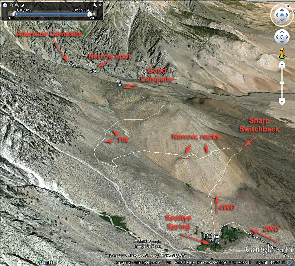
There is a report by Andy Martin on this route. Andy got his Honda Accord up to point P4 and the next day did a dayhike of Mt. Pinchot! Andy Martin Report There is too much rock in the road now to do this.

There is another report on Summitpost. Summitpost Report.