Highest point in the Coso Range, BLM Wilderness Area
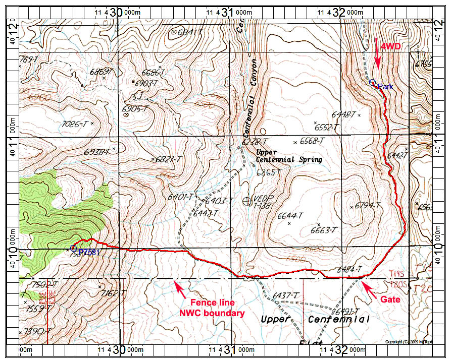
Driving Directions: The dirt road you want is on highway 190 about 28 miles east of Lone Pine or about 25 miles from Olancha. If heading east on 190 turn south (right) just before the Saline Valley Road on your left. Reset your odometer and follow BLM route SE75.
0.0 at highway 190
1.5 go right around a corral.
2.6 go straight at a crossroad and stay on SE75.
4.3 stay right at a Coso Wilderness sign. Four-wheel drive, high-clearance is advised from here.
4.7 go left at a junction onto route SE19.
6.6 Trailhead. Stop here since there is a bad rock-filled section ahead. Motorcycles could continue since the wilderness area is to the right of the road.
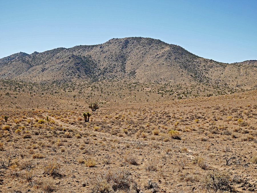
Hiking Route: Go south on the road in the canyon which after about a mile opens into Upper Centennial Flat. Continue west on the road along the fence line and cross a canyon then up to the base of the peak. The slope is steep going up to a plateau with pines and junipers. The highest point is an easily climbed boulder about 10 ft. high. The route is 6 miles round-trip with a gain of about 1700 ft. The hike took about 2 1/4 hours up and 1 3/4 hours for the return. 9/16 RLC A GPX track file for the route shown is available: Peak7581.gpx