Highpoint of the Orocopia Mountains
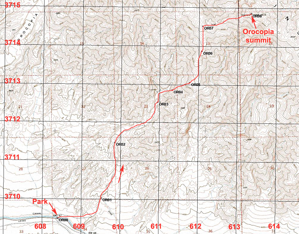
Driving Directions: To reach the start, take Parkside Drive east from highway 111. This road is 0.3 miles south of milepost 8 which is 10.1 miles south of the junction of highways 111 and route 195 in Mecca. On Parkside Drive go east for 1.7 miles and turn left onto Desertaire Road. Go north a half mile to a road going east along the aqueduct. Drive east for 3.5 miles to siphon #28 where you can turn left across the aqueduct. Turn right and go east on the north side of the canal and in a distance of less than 100 yards turn off left onto a poor road. Four-wheel drive will be needed on this road. Follow this road as it climbs in a wash for 0.9 miles to a pullout on the right just before a hill with a gate at the wilderness boundary. (OR01) There is room here for two or three vehicles to camp.
Climbing Directions: The summit is visible from here and is 3.83 miles on a bearing of 39 degrees true. Hike up the old road in the wash for 2.1 miles to a place where there is a canyon on the right and a narrow gravel ridge separating this canyon from the main wash. This is waypoint OR03. Go up this narrow ridge and then head northeast up a major spur ridge. OR04 is on the spur and OR05 is where you join a main north-south ridge. Head north on fairly easy terrain with a fair use trail. At OR07 turn east up a steep hill past P3297 shown on the map and follow the ridge over a few minor bumps to the summit. This route is 9.2 miles round-trip with a gain of 3600 ft. The ascent takes about 3 1/4 hours and allow 3 hours to return. 2/06 RLC
The map below shows the route and has a UTM grid using NAD27 in Zone 11. A GPS waypoint file is available for this route: Orocopia.gpx