Monache Mountain, Tulare County, California, Elev. = 9418 ft.
Located in Sequoia National Forest
|
Monache Mountain, Tulare County, California, Elev. = 9418 ft.
Located in Sequoia National Forest |
||||||
|
||||||
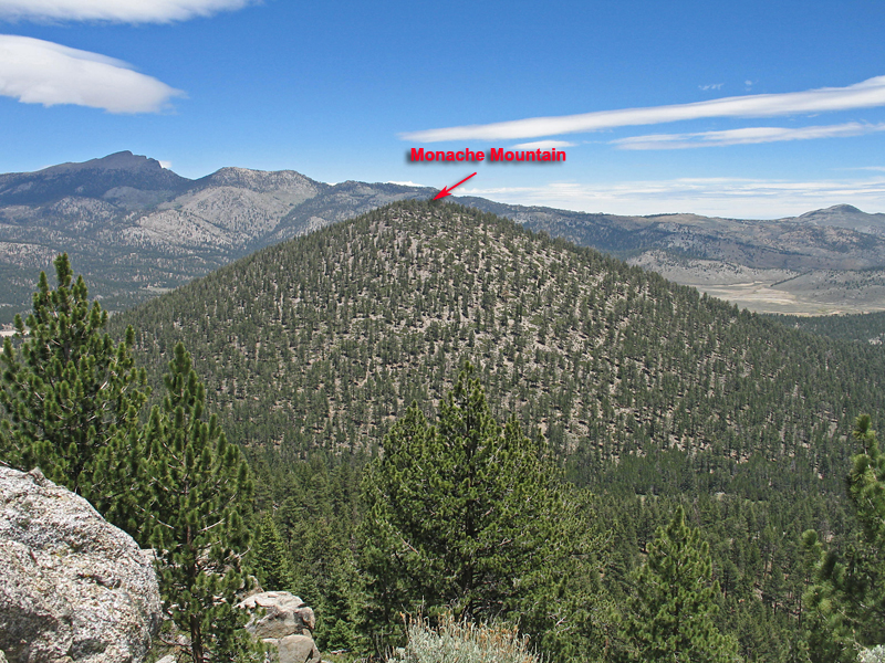
| A view looking northeast at Monache Mountain which is a very symmetrical volcanic cone. At the upper left is Olancha Peak. The prominence for the mountain is 1118 feet. Photo taken June 24, 2013. | ||||||
| Driving and Hiking Directions: Drive the Kennedy Meadows Road for 37 miles from route 395 to the Blackrock Junction near the Ranger Station. Alternatively you can come up the grade on the Sherman Pass Road from the Kern River. From the Blackrock Junction drive north 4.1 miles and turn right on the signed Monache Road. Go another 3.8 miles curving around Powell Meadow to a junction on the left. This is the start of the Monache Jeep Road, 34E38, which is closed in winter months. A four-wheel drive vehicle is needed and low-range is helpful on the sharp turns and several steep sections. A normal small pickup with four-wheel drive is OK. The road has a lot of motorcycle and Jeep traffic on weekends. Drive this for 3.5 miles descending to a bridge at Snake Creek. The driving is easier now as the road crosses a meadow and goes north over Summers Ridge. You can park after about 6.0 miles along the meadow on your left. The hike from there goes northwest up the easy slopes to the top. Most any route will work and some brushy areas with Manzanita will be encountered, but mostly it is open through the pines. The gain is about 1500 feet and allow about two hours to the top. 6/13 RLC | ||||||