Granite Knob, Tulare County, California, Elev. = 9060 ft.
Located in Sequoia National Forest
|
Granite Knob, Tulare County, California, Elev. = 9060 ft.
Located in Sequoia National Forest |
||||||
|
||||||
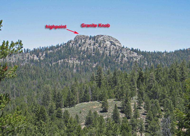
| A view looking northeast at Granite Knob. The prominence for the peak is 400 feet. The climbing route goes around the right to the east side which has a good route to the top.. Photo taken June 25, 2013. | ||||||
|
||||||
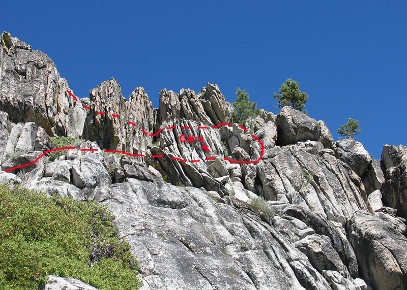
| The upper rock of the Knob on the east side. Climb up the rock toward the north end and look for the cairn. Then go another ten feet and climb up past the small pine and go back left over a small drop then up to the top. | ||||||
| Driving and Hiking Directions: Drive the Kennedy Meadows Road for 37 miles from route 395 to the Blackrock Junction near the Ranger Station. Alternatively you can come up the grade on the Sherman Pass Road from the Kern River. From the Blackrock Junction drive north 4.1 miles and turn right on the signed Monache Road. Go another 3.8 miles curving around Powell Meadow to a junction on the left. This is the start of the Monache Jeep Road, 34E38. Keep going straight until you reach the end of the pavement and a junction at 5.5 miles. Park here. Hike northeast around the east side of the Knob until you are under the northern end. Climb up boulders dodging burned and live manzanita. Look for the cairn shown in the photo above. The hike is short with a gain of about 600 feet. There is a register and also an ammo box Geocache at the summit. 6/13 RLC | ||||||