Hiked May 28, 2007.
| Photos of Fox BM (Fox Mountain #2), Angeles National Forest | ||||||||||
|
||||||||||
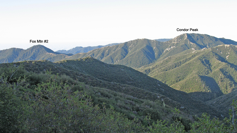
| The route follows along the ridge down from the saddle to the left of Condor Peak. | ||||||||||
|
||||||||||
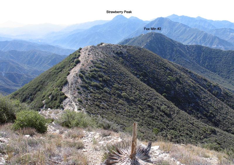
| On the ridge going to Fox Mountain from Condor Peak. The last part up to the summit is steep, otherwise the trail is easy. | ||||||||||
|
||||||||||
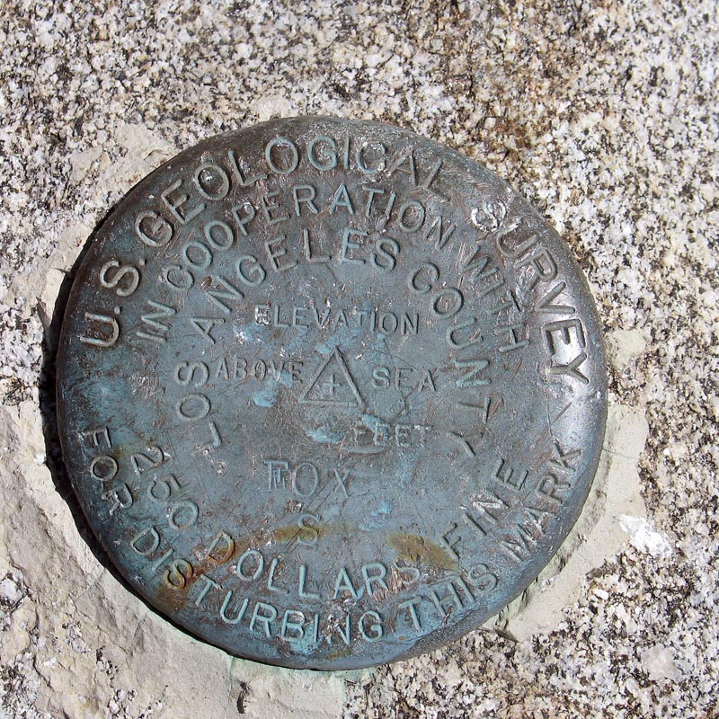
| The benchmark disk on Fox Mountain.
Hiked May 28, 2007. |
||||||||||
|
||||||||||
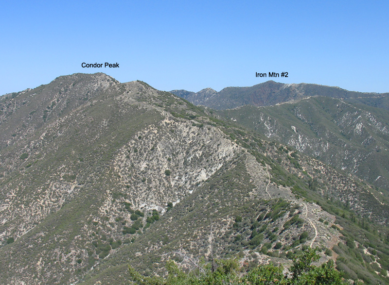
| Looking north from Fox Mountain. The trail follows the ridge going back to Condor Peak then along the ridge to the road by Iron Mountain. | ||||||||||
| Drive-in directions for Condor Peak, Iron Mountain and Fox Mountain: Take highway N3 north toward Palmdale from the Angeles Crest Highway. Turn left on the road to Mt. Gleason (3N17) and note the following mileages: Follow the rough, paved road up to Mt. Gleason and at 6.2 miles go left onto a dirt bypass around a Prison Camp. Climb up to a microwave tower and then go left at a junction on the right with a gate to Mt. Gleason at 8.8 miles. Go down a steep, narrow road and at 9.3 miles go left at a junction onto 3N32. At 9.4 miles at a junction for the Lightning Point Group Camp go right onto a dirt road. This road will end after 1.4 miles (10.8 miles overall) at a locked gate and small parking area. Start from here hiking on the dirt road descending to Indian Ben Saddle. From here you can ascend Iron Mountain or go left on roads and trails to Condor and Fox. Mt. McKinley, on the Lower Peaks List, is also accessible from this area by hiking west on the road past Iron Mountain. | ||||||||||