Domelands Wilderness Highpoint, Tulare County, California, Elev. = 9724 ft.

Located in Sequoia National Forest

Looking east at the Domelands Wilderness which is mostly beyond the high point shown. This view is from Sirretta Peak. The map below shows a good hiking route using the Sirretta Peak trail.
The above topo map has a one-kilometer UTM grid using NAD27. The trailhead can be reached by driving north from Kernville about 20 miles along the Kern River to the Sherman Pass Road. Turn right and drive up the grade about 5.9 miles to Forest Road 22S12 which goes south to Big Meadow. Follow this road which is paved for about 6 miles and then turns into a good dirt road. After about 12 miles there is a junction for 23S07 which is signed to Sirretta Peak trail. Turn left on that road and go for about 0.8 miles to a trailhead area at the end of the road. High-clearance is needed on this last section. There is plenty of parking space here and room to camp although it is not a formal campground.

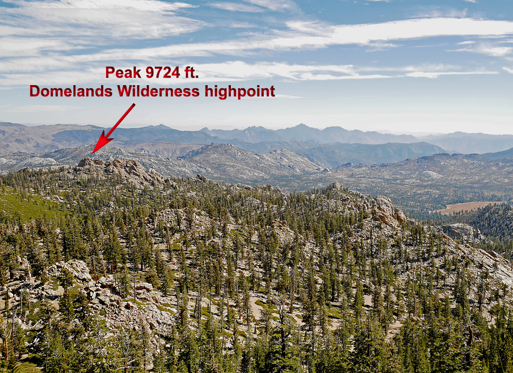
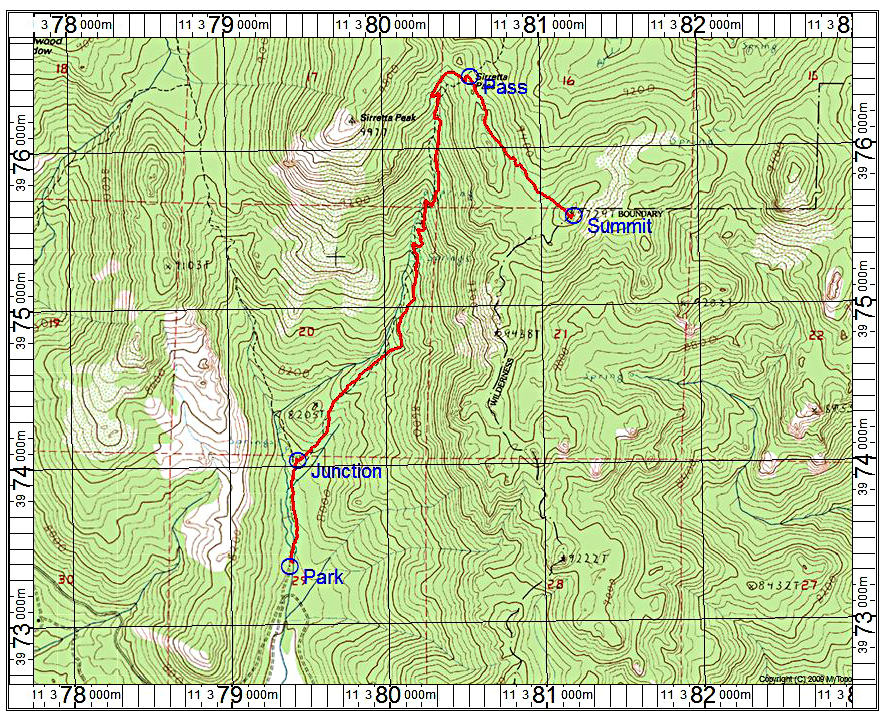
Hiking Route: Follow the trail north to Sirretta Pass. After about a half mile there is a junction and go right at this point. The pass is quite obvious with a sign there on a tree. At this point we went south, off trail, around a boulder pile and stayed on the left side of the ridge. There is some knee-high brush and fallen logs to get past, but it is not difficult. The summit block is obvious and requires a hands-on scramble to get up. The route from the trailhead is 3 miles round-trip with a gain of about 1900 ft. It took us about 2 1/4 hours to the top and 1 3/4 hours down. 10/16 RLC There is a GPX file for this route: DomelandsHpt.gpx