Cox Benchmark, 3035 ft. , Riverside County, California
In the southern Coxcomb Mountains, Prominence = 535 ft.
The UTM grid using NAD27 datum is shown on the above map. GPX file for this route.
|
Cox Benchmark, 3035 ft. , Riverside County, California
In the southern Coxcomb Mountains, Prominence = 535 ft. |
|||||||||||
 |
|||||||||||
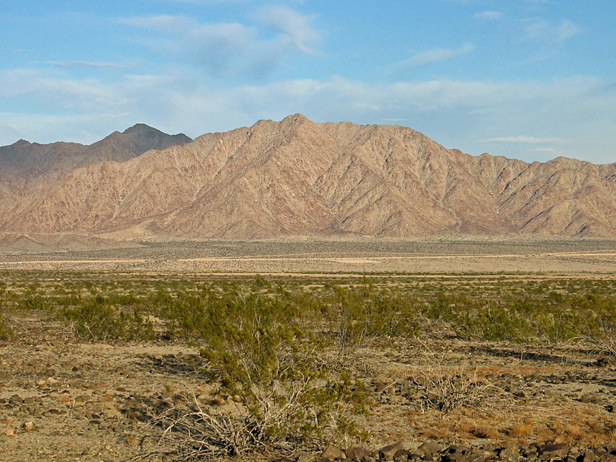
| A view looking north at the peak that has Cox Benchmark in the Coxcomb Mountains in Joshua Tree National Park. The peak was climbed by going north and east around the backside to the ridgetop, then proceeding south along the ridge. Going down we used the prominent canyon to the right of the summit. The Coxcombs are rugged and this peak was more difficult than others in the Eagle Mountains to the west. | |||||||||||
 |
|||||||||||
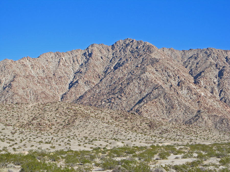
| A closer view of the mountain. The canyon we came down is on the right side. It was steep and slow going with numerous dry waterfalls to work around, none especially difficult, but it took two hours to make the descent. Photo by Mark Adrian on November 28, 2013. | |||||||||||
 |
|||||||||||
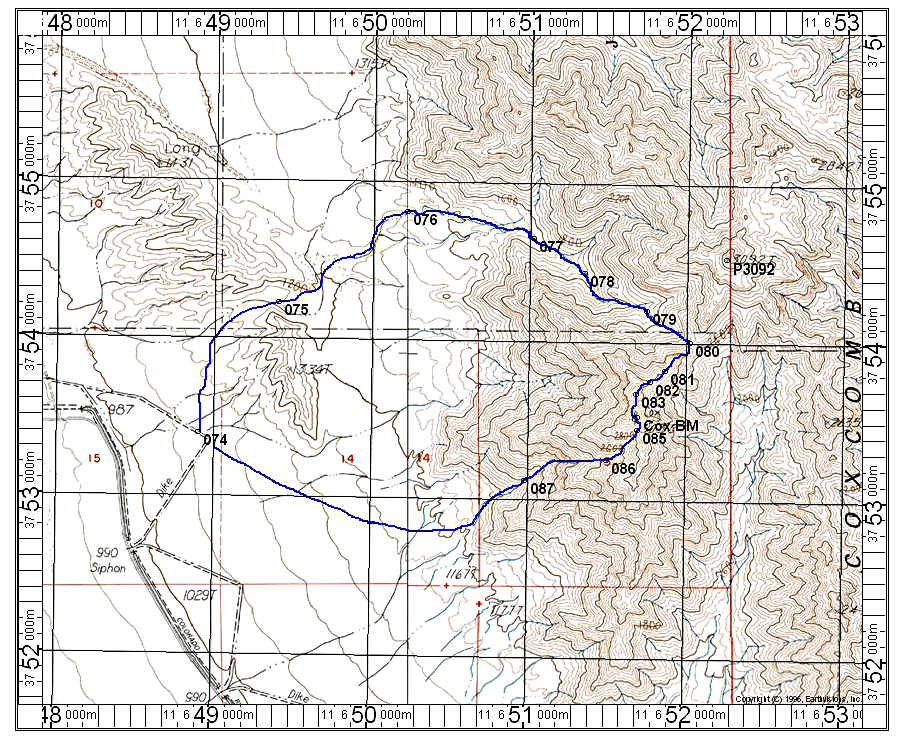
| This topo map shows our ascent and descent routes. The peak is in the wilderness of Joshua Tree National Park. To reach the trailhead take route 177 north from the exit at Desert Center on I-10. Drive north for 10.4 miles and turn left (west) onto a good graded dirt road. Follow this for about 8 miles until you approach the aqueduct area. Continue northwest along the aqueduct for another 3.2 miles to the 990 siphon shown on the above map. At the siphon there is an opening where you can turn right and cross to the other side. Look for a ramp on the left going up onto the dike. Drive this for about 0.7 mile and turn left and park at point 074. The route we took goes clockwise via the large canyon on the northwest side of the summit. The canyon from point 077 to a saddle at 080 has numerous boulders. From 080 the ridge has several pinnacles to work around. Some hands-on scrambling is needed on this route which is class 2 to moderate class 3. We went down the canyon south of the summit after deciding we didn't want to go back on the ridge. The route up took 3 hours 10 minutes and the descent took 2 hours. The complete loop is about 6 miles long with a gain of 2200 feet. 11/13 RLC
The UTM grid using NAD27 datum is shown on the above map. GPX file for this route. |
|||||||||||
 |
|||||||||||
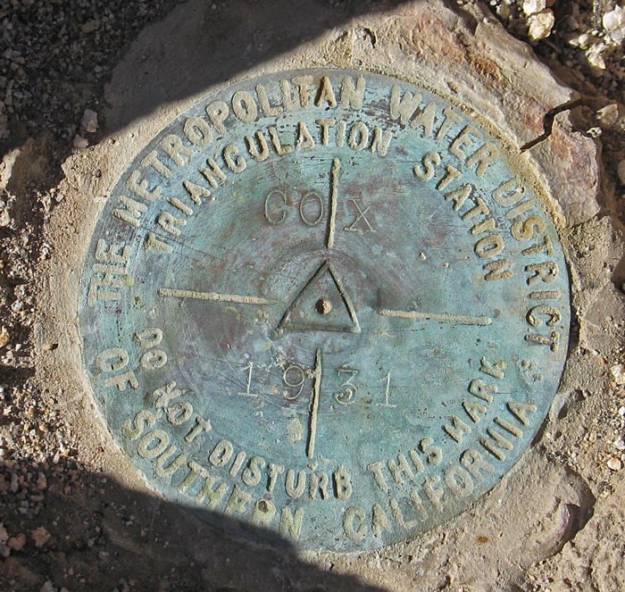
| Benchmark at the summit placed in 1931. Datasheet | |||||||||||
 |
|||||||||||
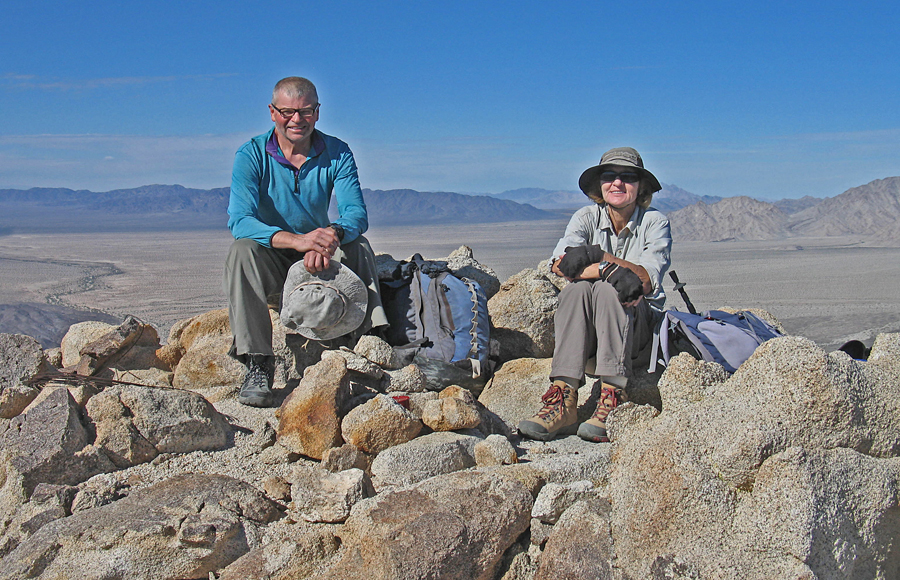
| Mark Adrian and Shelley Rogers looking quite happy after reaching the summit of Cox Benchmark. The register contained entries back to 1971. | |||||||||||