Berryessa Peak, on Napa and Yolo County lines, California
Elevation = 3062 ft. (933 meters)

|
Berryessa Peak, on Napa and Yolo County lines, California
Elevation = 3062 ft. (933 meters) |
|||||||||||
|
|||||||||||
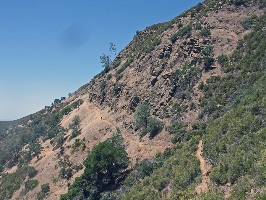
| Looking north at the long trail to Berryessa Peak where it runs under the ridge top for 1.6 miles. There is a very good report on hiking this peak at the Yolohiker website. Through a lot of work over many years a public easement has been established through some areas of private land. Below are pictures and map of the route I did on June 6, 2014. It was warm that day and I suggest waiting until cooler weather with temperatures below 70. Peakbagger.com page. | |||||||||||
|
|||||||||||
| Gail Hanna crossing the fence at the top of a steep section on the trail. This is at point 199 shown on the topo map below. Note the post with BPT marking the route. | |||||||||||
|
|||||||||||
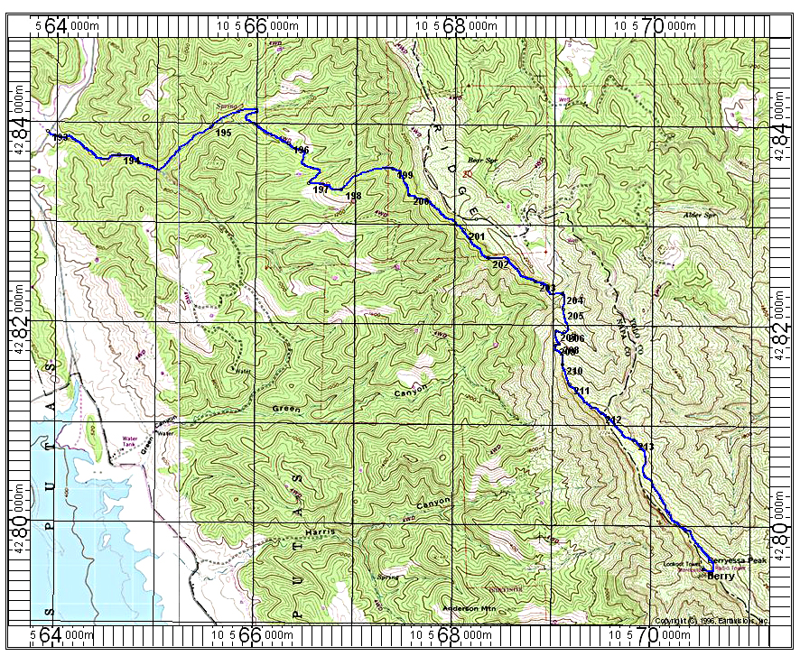
| The above map has a UTM grid using NAD 27. I have a GPS file available for the above route. Berryessa.gpx The starting point is at waypoint 193 which is very close to Milepost 20.0 on the Knoxville Road. A small sign indicates no motorized vehicles are allowed, but it doesn't say it is the trail to Berryessa Peak. The route follows an old road which turns into a trail at about point 198 where is goes steeply up a hill. At 199 is the stile crossing a fence. The trail runs under the ridge top and drops into a canyon at point 204 at 1890 feet elevation. From there you have a gain of 800 feet up to the ridge top then a slight drop of about 80 feet to the road at point 213. Then another 1.25 miles to the top on a good road with a gain of 450 feet. I measure the route to be 15 miles round-trip with a gain of about 2900 feet on the ascent. There is a gain of about 300 feet on the return. This is a hard hike if it is warm so take plenty of water, at least four quarts. In my case the ascent took 5 hours and then 3 1/2 hours to return. 6/14 RLC | |||||||||||
|
|||||||||||
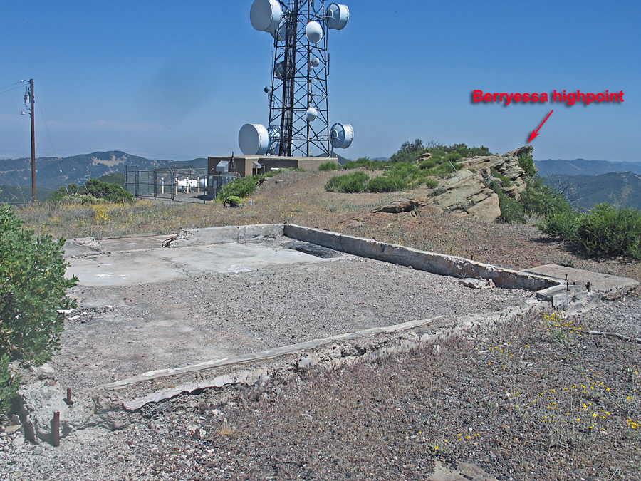
| The summit used to have a fire lookout which was built on this foundation in 1948. The building was destroyed in the 39,000 acre Rumsey Fire in October 2004. | |||||||||||
|
|||||||||||
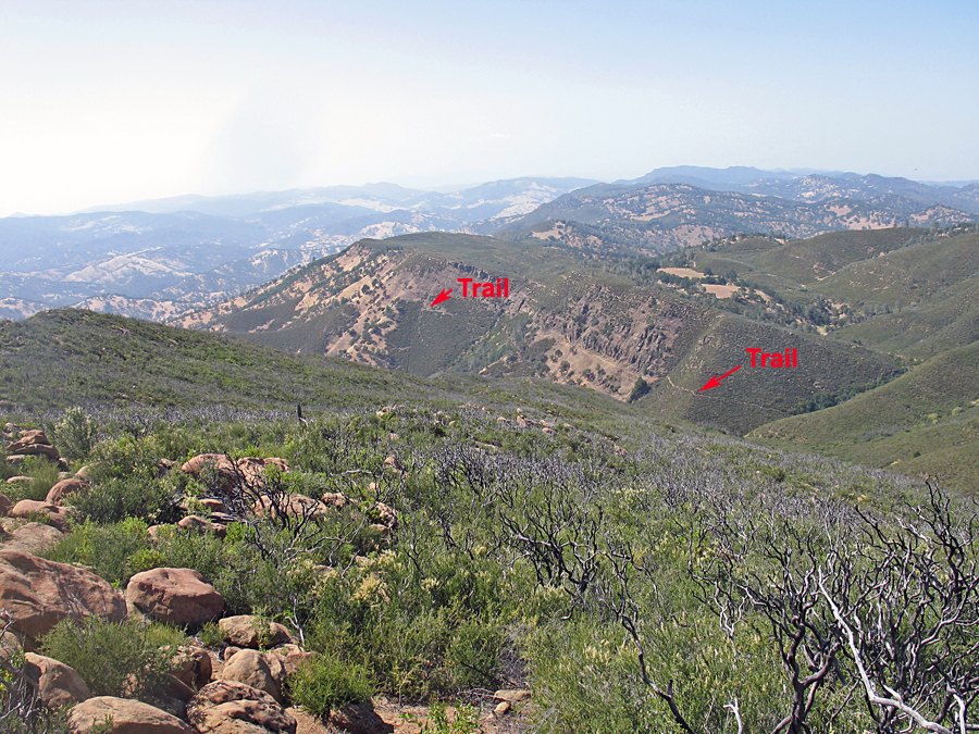
| This is looking north from the upper ridge at about waypoint 211. You can see parts of the trail running along under the ridge top. It's a long way back to the trailhead from here. If it's warm you will be thinking about your water supply! | |||||||||||
|
|||||||||||
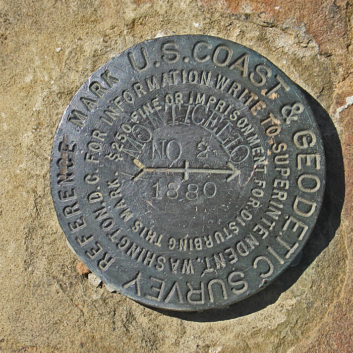
| Reference Mark #2 named Monticello is south of the lookout. The peak was first surveyed in 1880. Datasheet. | |||||||||||