Mitchell Peak, Lookout Site, Tulare County, California, Elevation = 10369 ft.
Located on the boundary of Sequoia National Forest and Kings Canyon National Park
|
Mitchell Peak, Lookout Site, Tulare County, California, Elevation = 10369 ft.
Located on the boundary of Sequoia National Forest and Kings Canyon National Park |
||||||||
|
||||||||
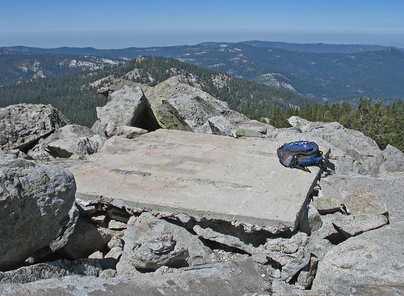
| This slab and other debris is all that remains of the lookout building which was removed possibly in the late 1970's. The peak has terrific views in all directions and is the highpoint of the Jennie Lakes Wilderness. The peak is reached by hiking good trails from the Marvin Pass trailhead off road 14S11. Photos taken August 12, 2008. | ||||||||
|
||||||||
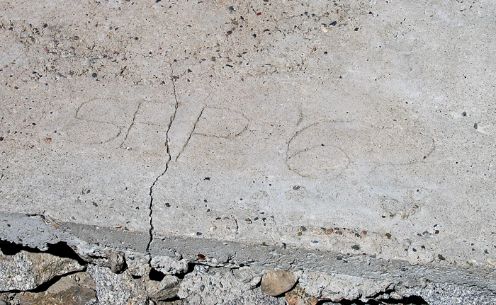
| Markings in the slab indicated it was poured in September, 1962. This is consistent with the survey datasheet which indicates no lookout in 1950 and one existing in 1966. | ||||||||
|
||||||||
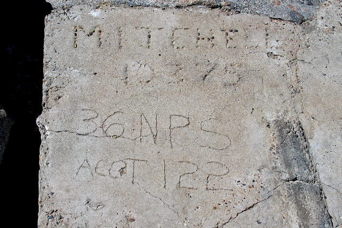
| The markings indicated Mitchell with 10375, probably the elevation. The latest data has 10,369 ft. I am not sure what "36 NPS" and "ACCT 122" means. | ||||||||
|
||||||||
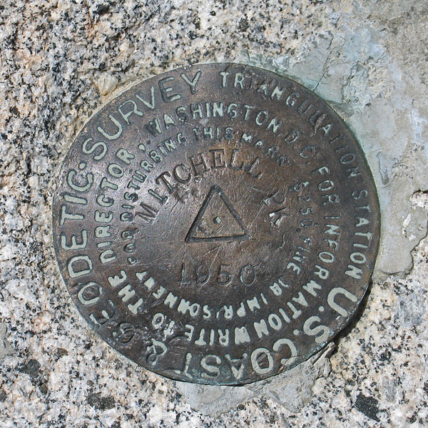
| Mitchell Peak benchmark is in good condition near the slab for the building. Placed in 1950. The datasheet does not mention a lookout in 1950, but in a 1966 survey it says a lookout was constructed. | ||||||||